
I’m in a Salt Lake county public library thinking about Alaska. About a week ago I told myself that there’s nothing worth going south of the border (Canadian) for again. Nothing in the Lower 48 is as inspiring as the northlands of Alberta, British Columbia, Yukon Territory, and Alaska.
A day or two ago I spent a bit of time thinking of what it is about AK that I love and miss so much. It may be driving down billboard and development free highways for hundreds of miles immersed in a void of wilderness. Staring across the Great Salt Lake today I thought it may be the verdant lushness (that sometimes, admittedly, pisses me off due to the nasty weather that makes it possible). Preparing photos for this trip report, I thought it might be the mountainous contrast of rock, ice, snow, and thick vegetation that only the far north provides.
There are other reasons. I originally moved to Alaska, in part, to get as far away from “America” as possible without having to deal with an immigration epic. Alaska definitely delivered. While it has become more “American” (due to “development” and “progress” in the form of box stores, chains, and cookie-cutter housing) over my 14 years of residence, Alaska is uniquely un-American. “Alaskan exceptionalism” is a concept on par with “American exceptionalism.”
The Deltas, a sub-range in the Eastern Alaska Range, are an exceptional place. They offer great road-accessible adventures for the low budget and carbon-conscious. Minya Peak is a wondrous daytrip for the fit and competent mountain traveler.
Late summer to early autumn is a favorite time of year in Alaska. I do hate the autumn shoulder season when it’s wet, muddy, cold, nothing dries, and there’s snow on the mountains (but not enough to ski). But, before the first permanent snowfall sticks to the mountains for good and makes the rock slick, there’s a magical window for glaciated peakbagging. The rock is dry, the tundra and forest colors are outrageous, and the glaciers are great for travel as crevasses are either open or bridged with relatively reliable neve.
Thus, on sunny August 30, 2019, I completed a solo summit daytrip of Minya Peak. In addition to the standard daypack with appropriate food and layers, I brought an axe and crampons. Three season mountain boots were the footwear of choice.
Not being able to find much beta on Minya routes, I first climbed to the saddle between Minya and Institute thinking I’d go for the north ridge. This turned out to be a no-go given the choss and exposure factor (also considering an annoying section requiring a short transition in and out of pons). Not being discouraged given the beautiful day, despite not having identified any other obvious route, I figured I’d poke around in hopes of finding reasonable passage to the summit.
Rough sketch of route: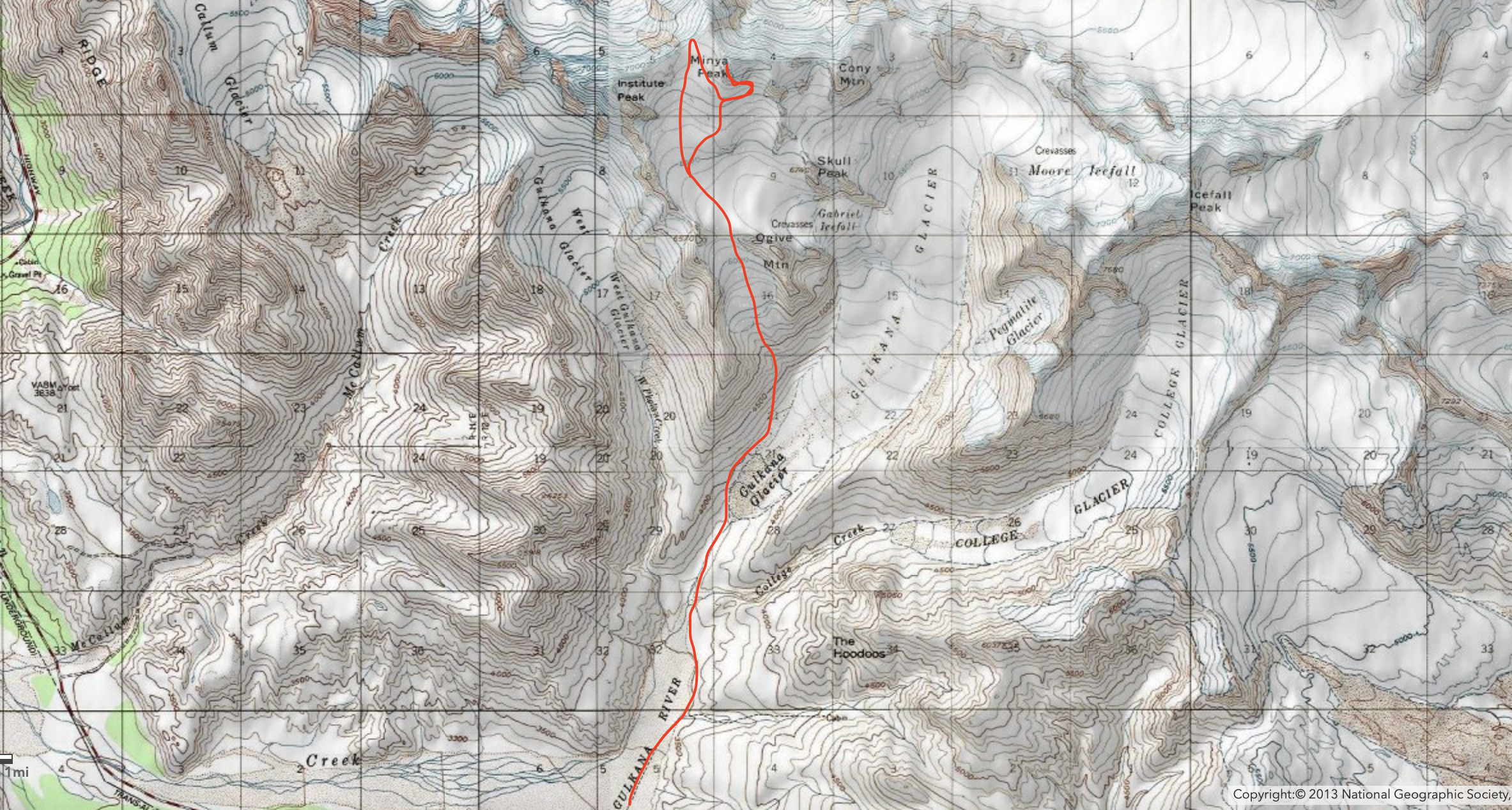
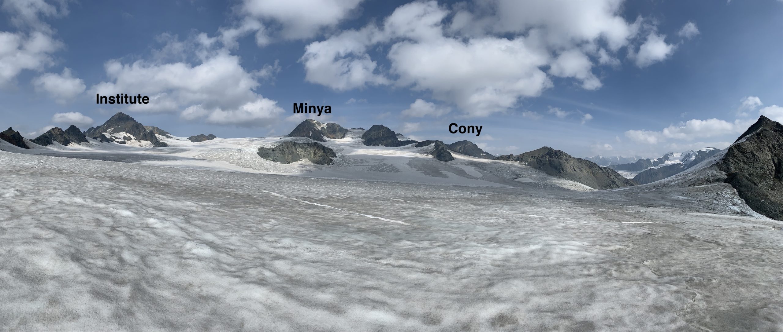
Looking north across the Canwell glacier from the saddle between Minya and Institute: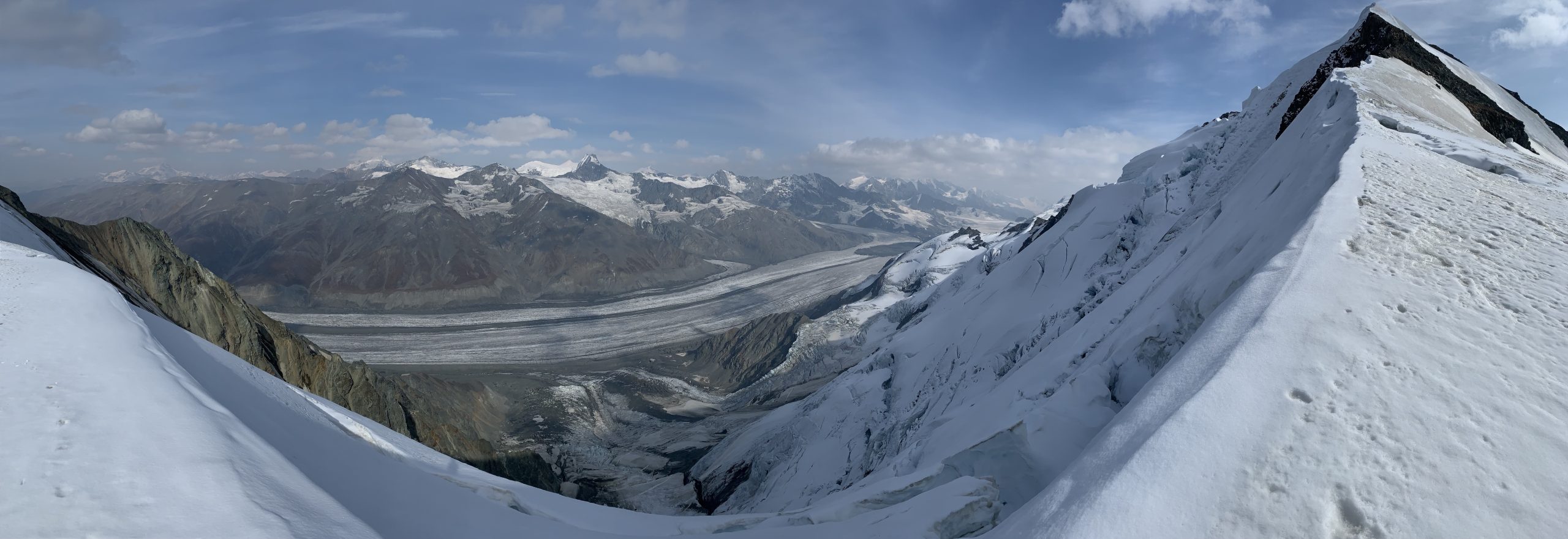
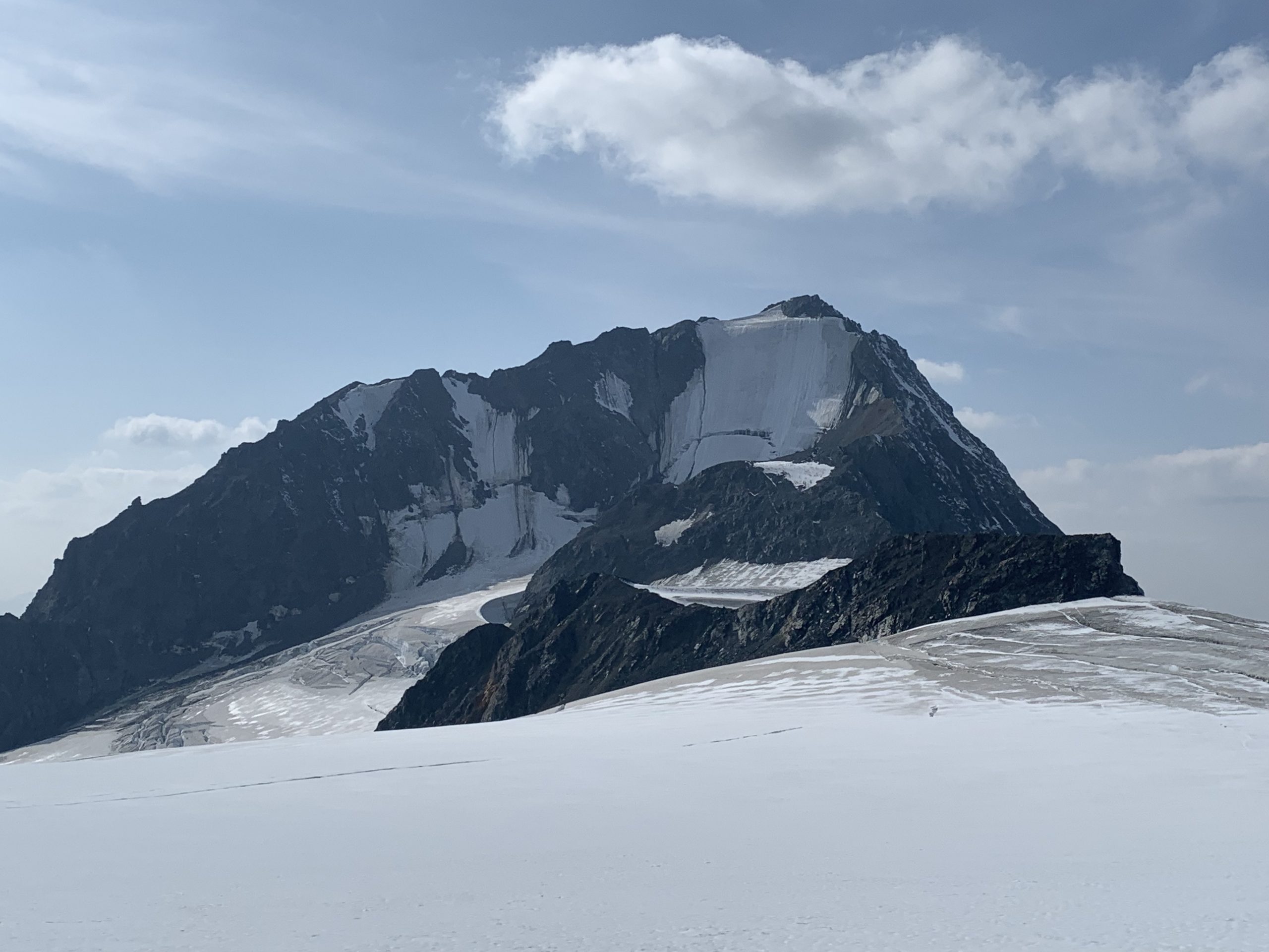
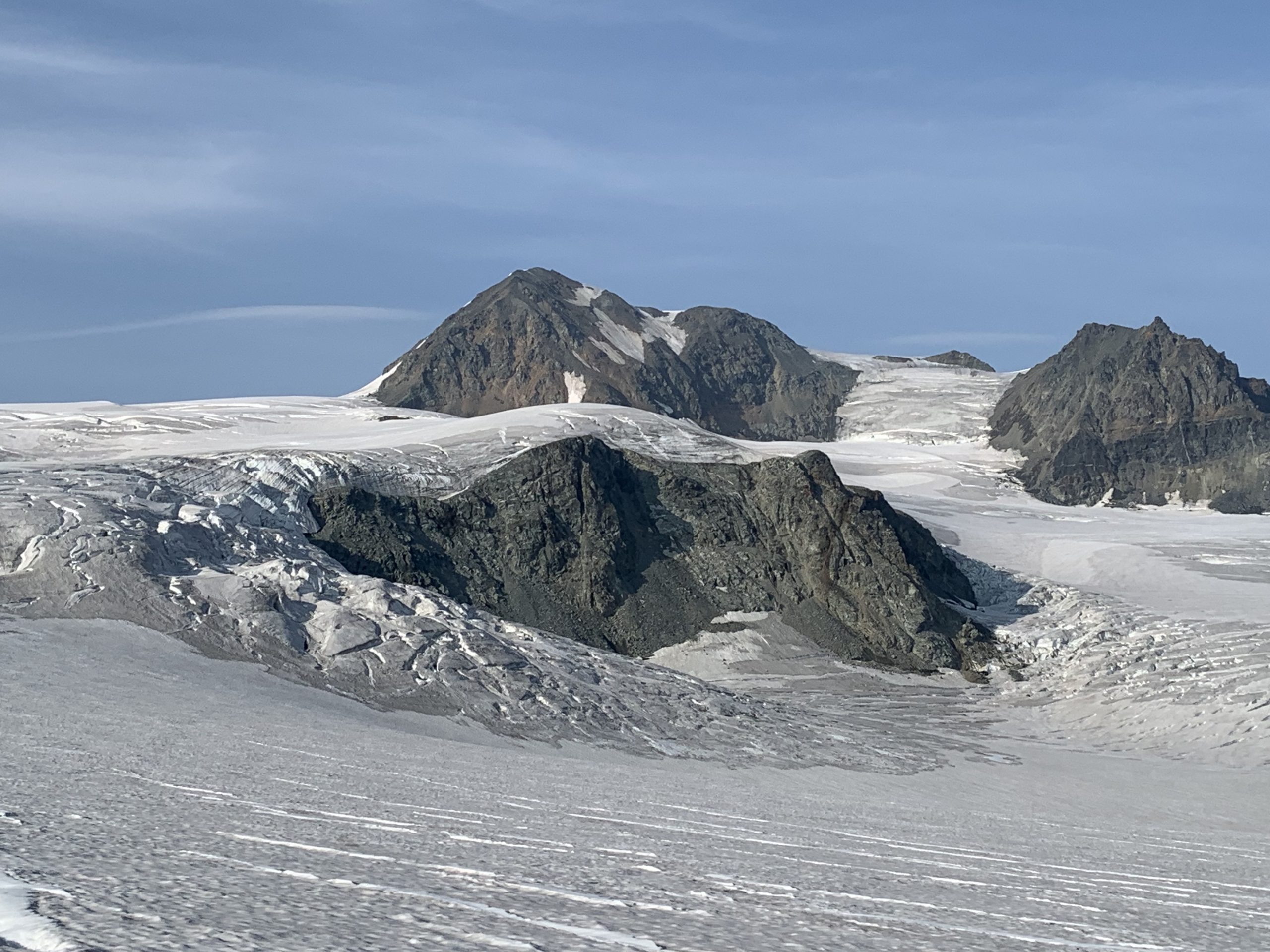
Institute’s incredibly aesthetic west face: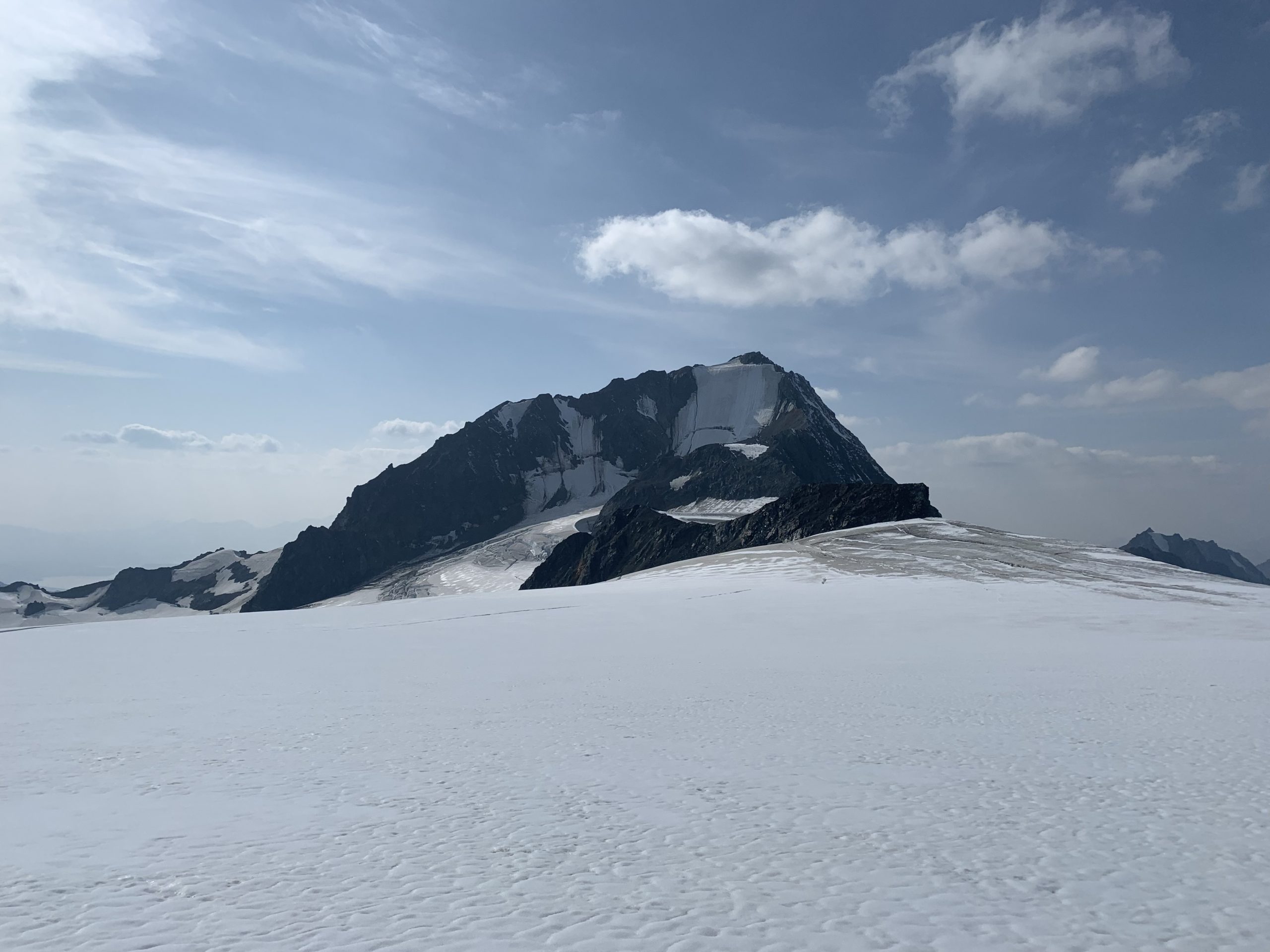
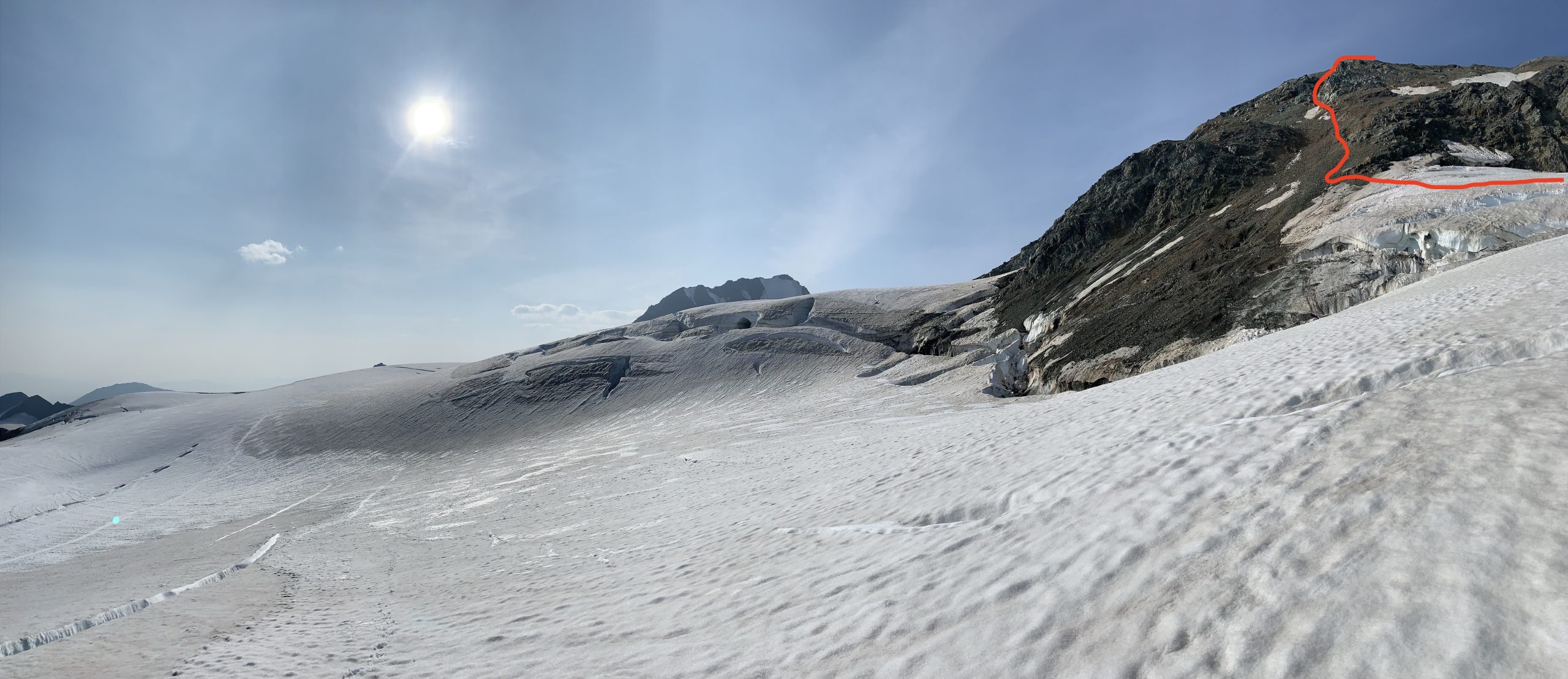
I traversed south and then east to see if I could gain the east ridge via the glaciated south-facing slope that leads to it. Getting to the base of the south side of Minya required solving a crevasse maze. After weaving through crevasses and arriving at the base of the glaciated south-facing slope that leads to the base of the east ridge, it became clear that the steepness and exposure of this route would require two ice tools.
Again not deterred, I looked closer and found a potential route from the glacier onto the south ridge. Linking long sections of 30º degree titled glacier-ice sidewalks between BIG crevasses, I was pleased to find there was not a gaping moat and I could easily hop off the glacier onto scree at the base of the south ridge’s east side.
First glimpse of the potential south ridge access and route: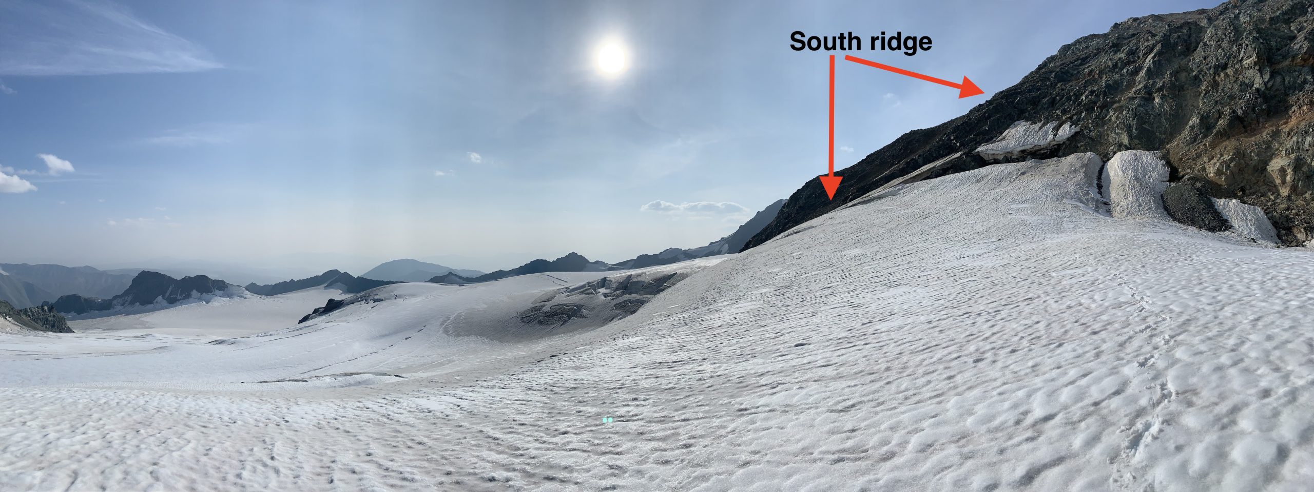 The tilted glacier sidewalks:
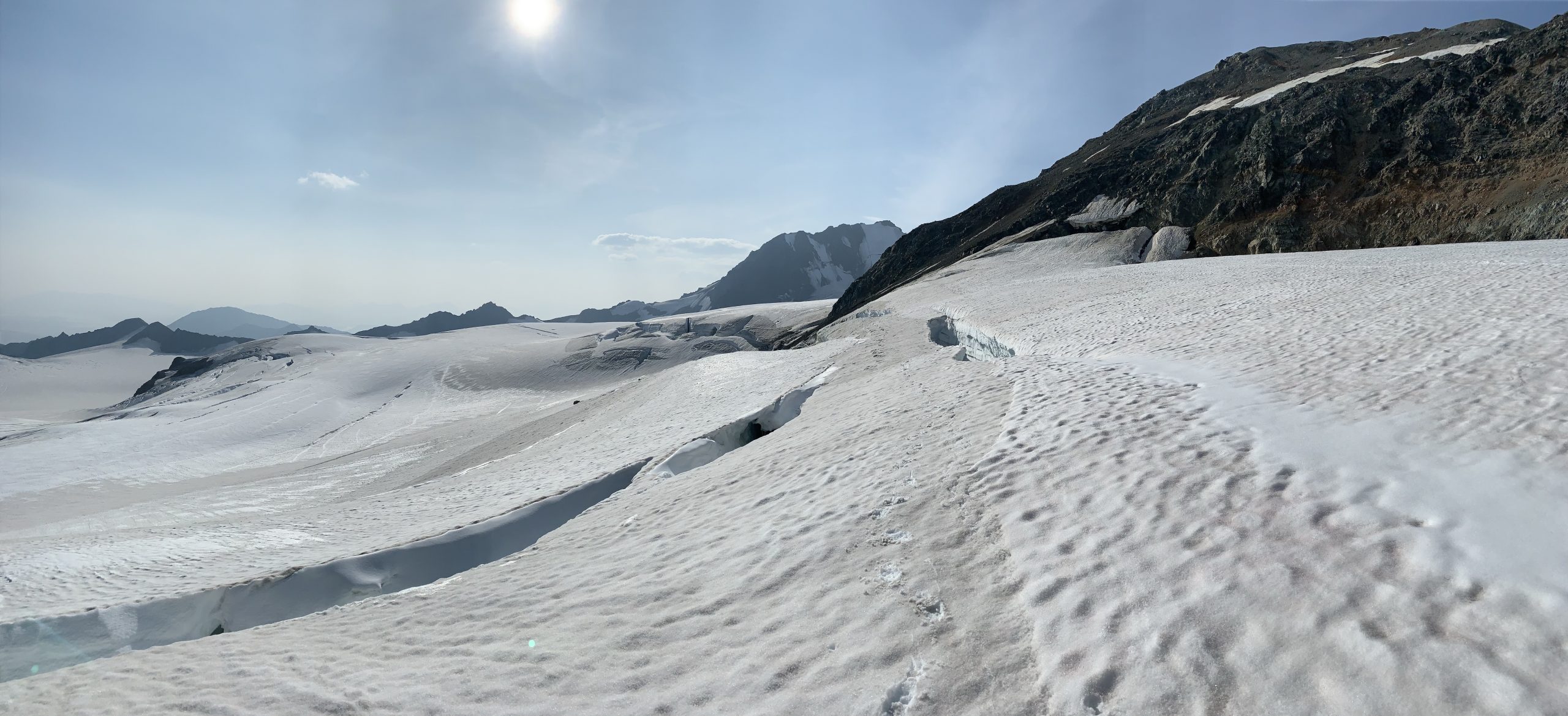
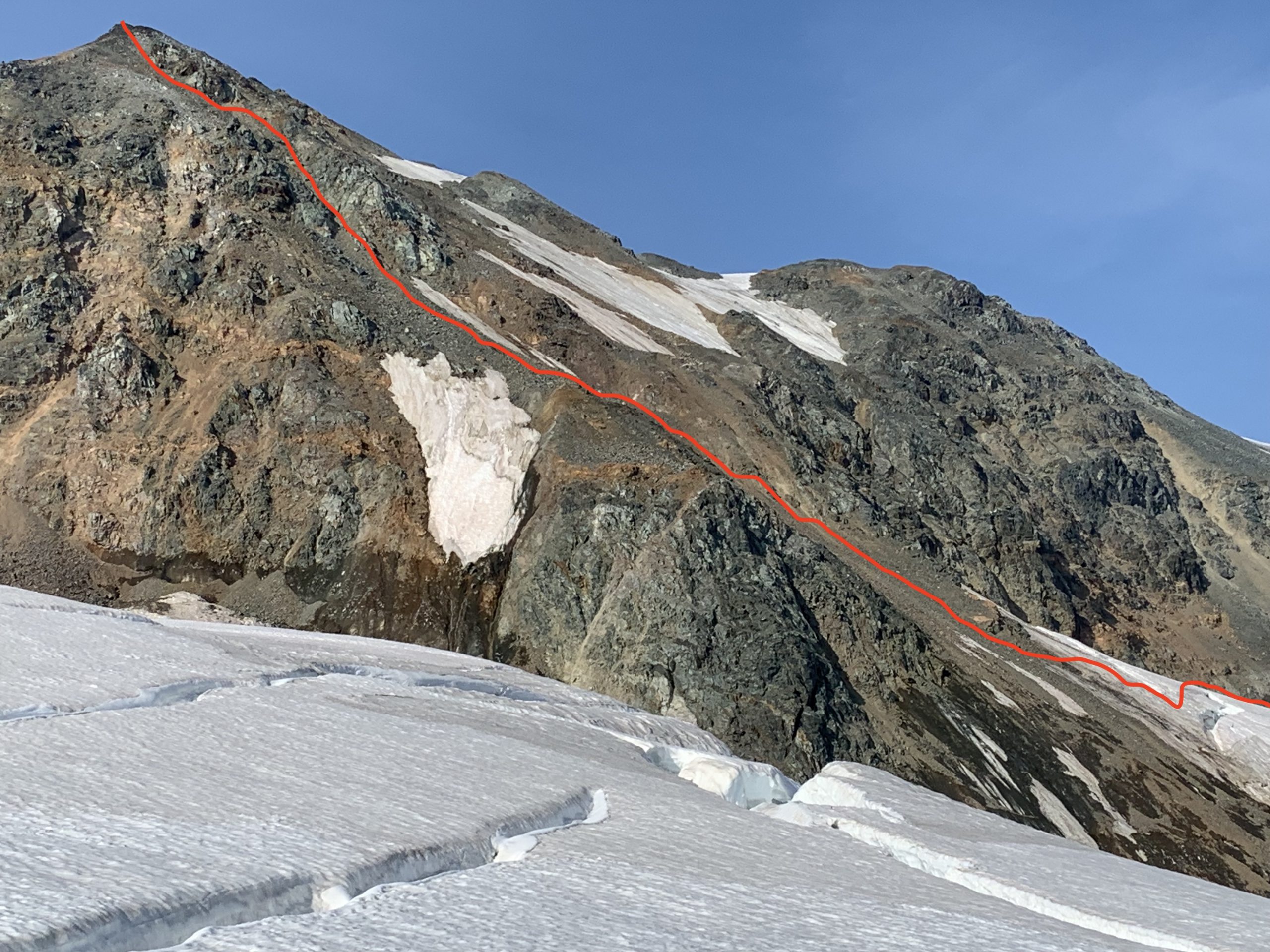
From here, the precarious nature of the footwork changed from tiptoeing around on crampons to scrambling incredibly loose choss. About halfway up the south ridge, the nature of the footing again changed: from treadmill choss with trekking pole assist to hands-required scrambling. However, the hands weren’t reliable as there’s a serious risk of dislodging dangerously large chunks of rock. After this sketchy section of loose crud scrambling, the ridge mellows out to relatively flat scree before a final (also relatively flat) glaciated section to the summit proper.
Summit view east: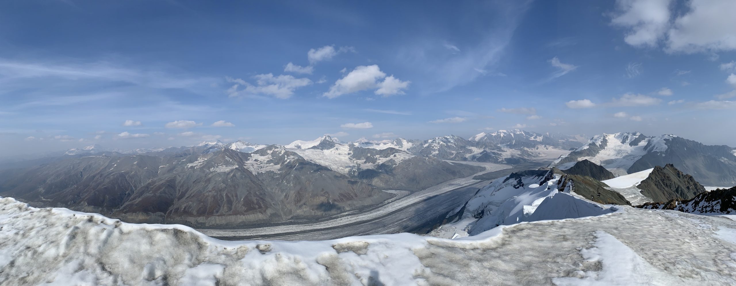
Summit view west: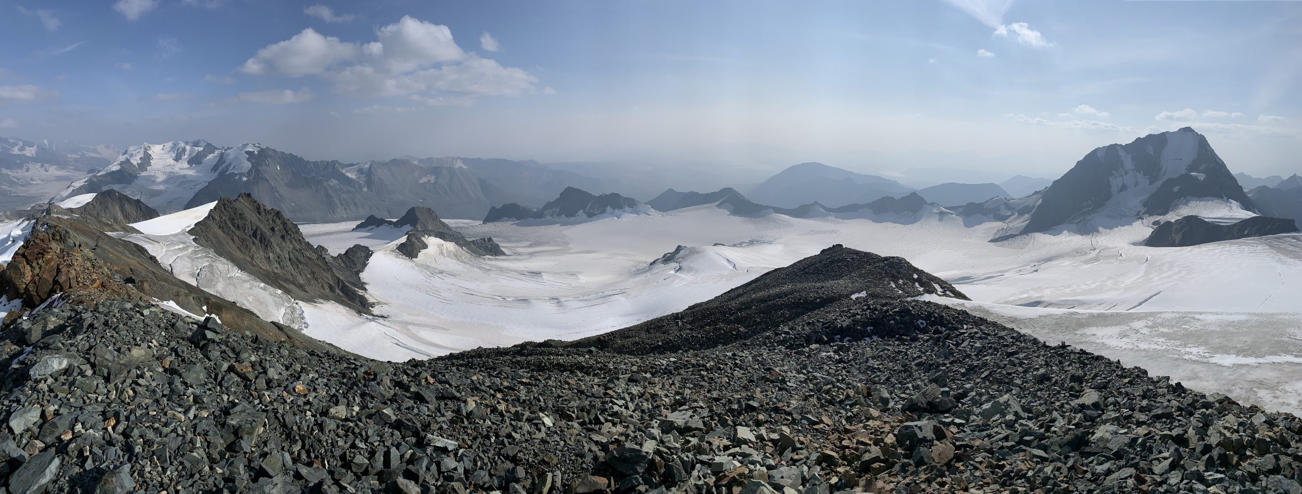
After taking in the summit views (which were incredible, even though obscured by the unprecedented statewide wildfire smoke of summer 2019), I retraced my steps down the south ridge and along the traversing glacier sidewalks before charting a new route south back towards my approach via the glaciated valley between Ogive Mountain and Peak 6570. A downhill scree boogie, stream crossing, and interesting cable bridge brought me back to the Gulkana glacier trail. Shortly thereafter I was having dinner in the back of the Cache Camper in the beautiful Gulkana River valley (an absolutely amazing place for car camping).
Looking down the south ridge: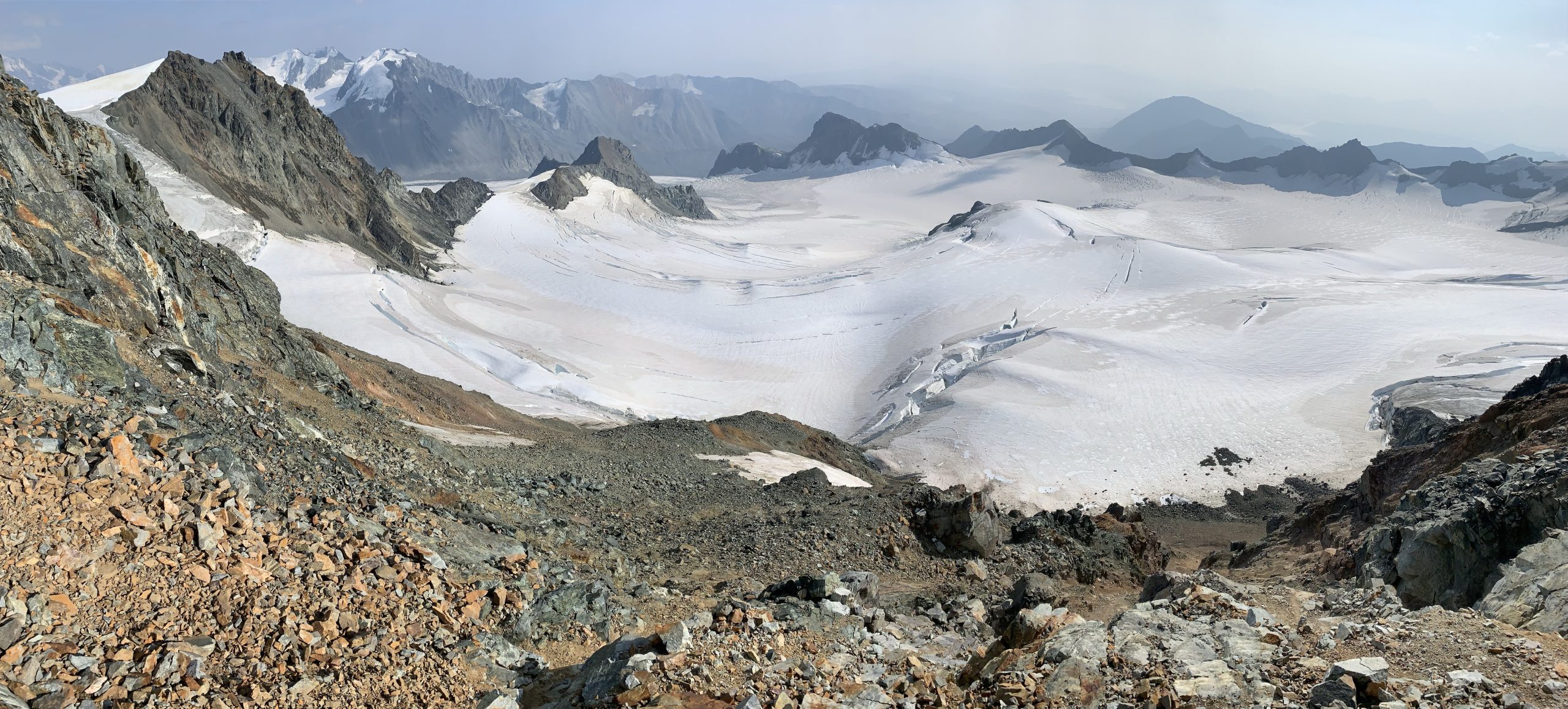
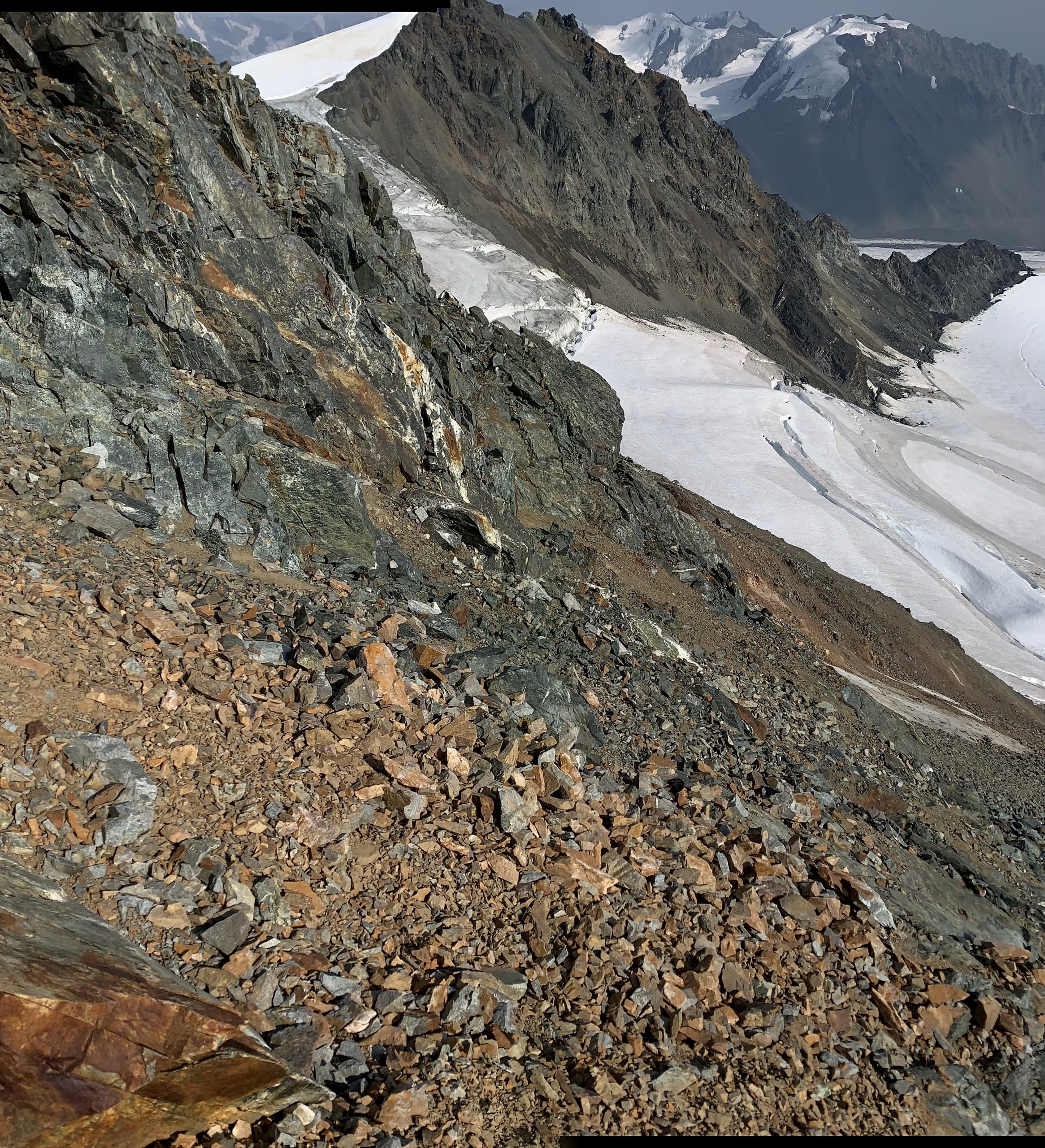
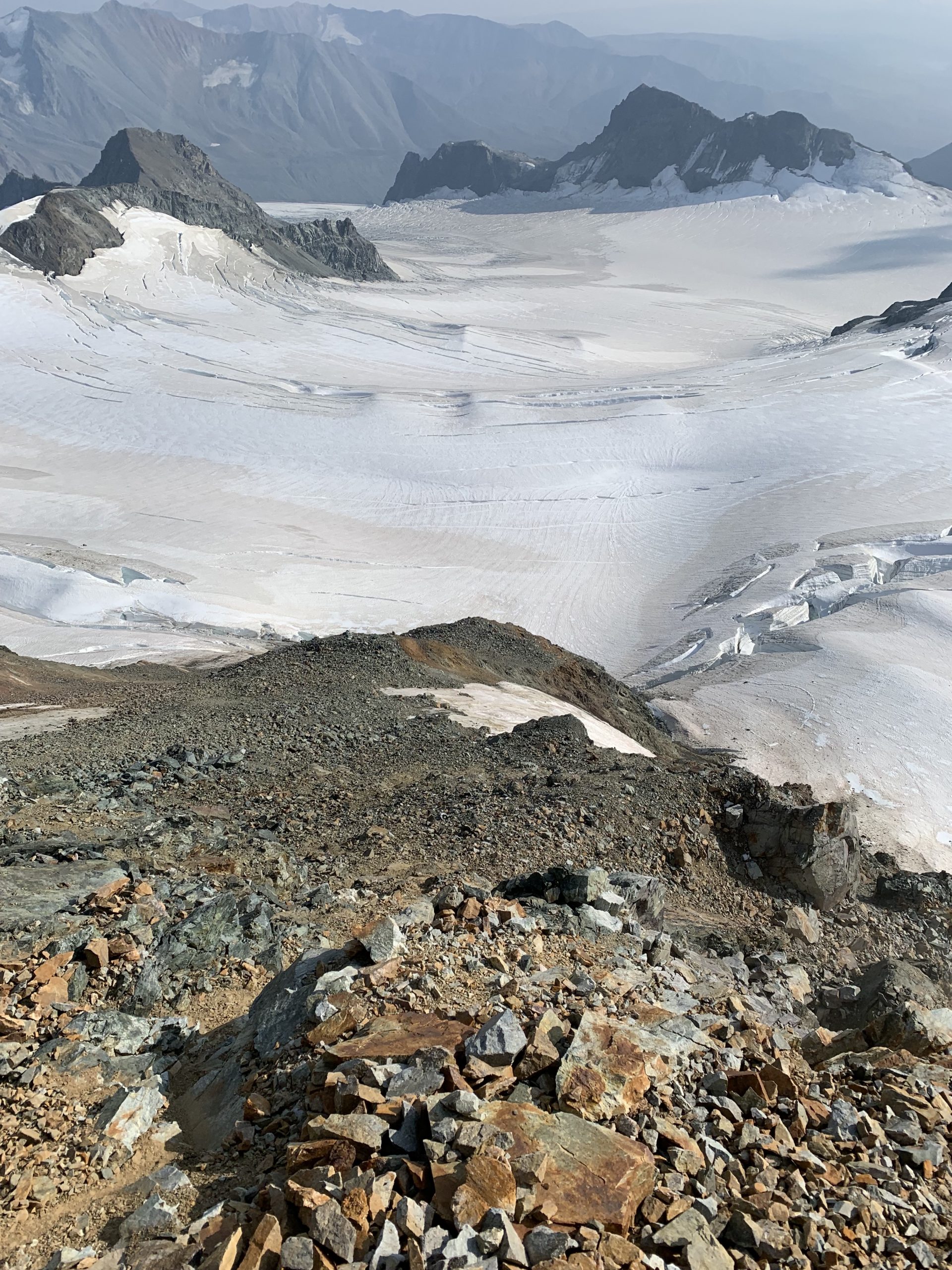
Looking back at the line up the south ridge on the exit: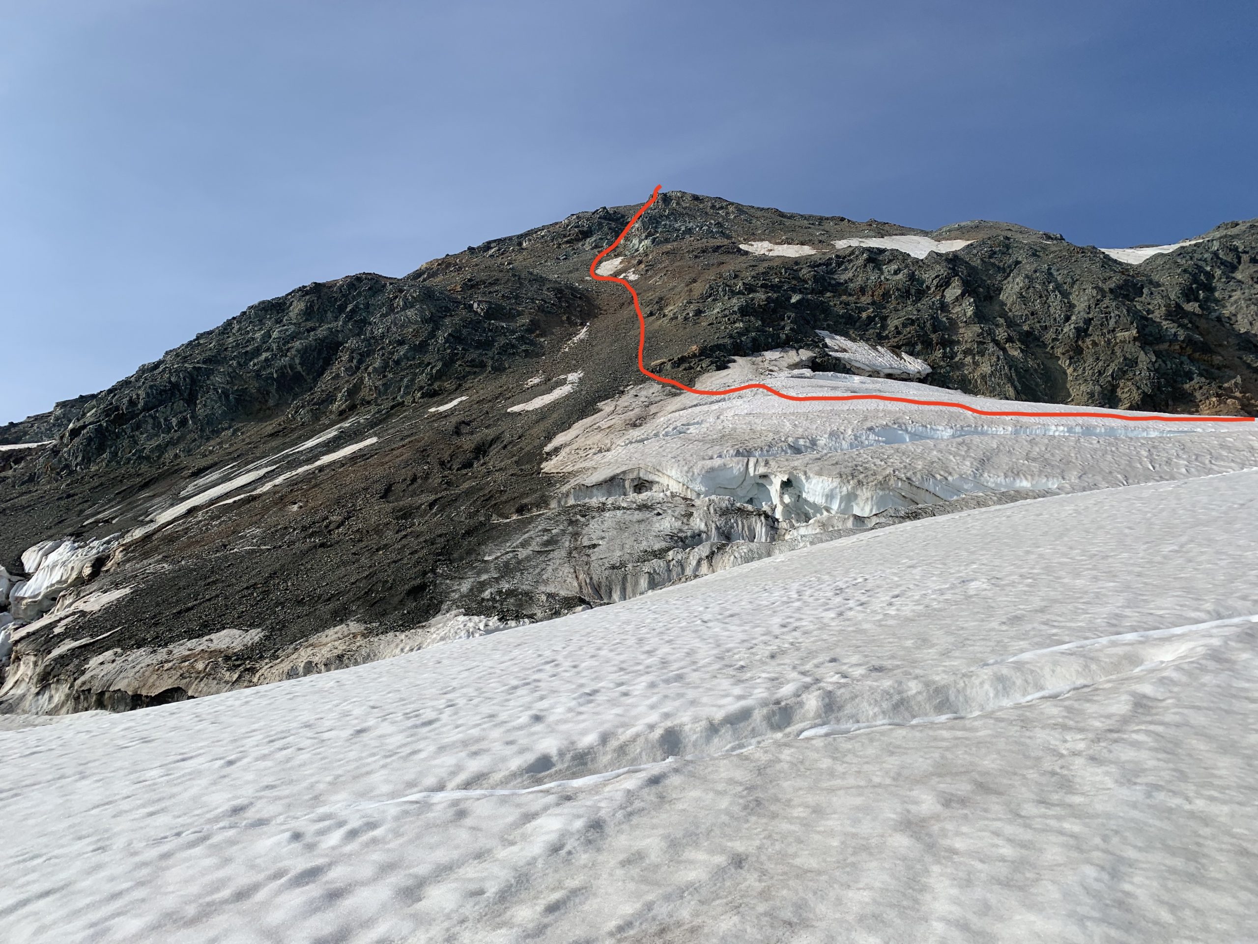
South ridge route as seen from the SW on the exit: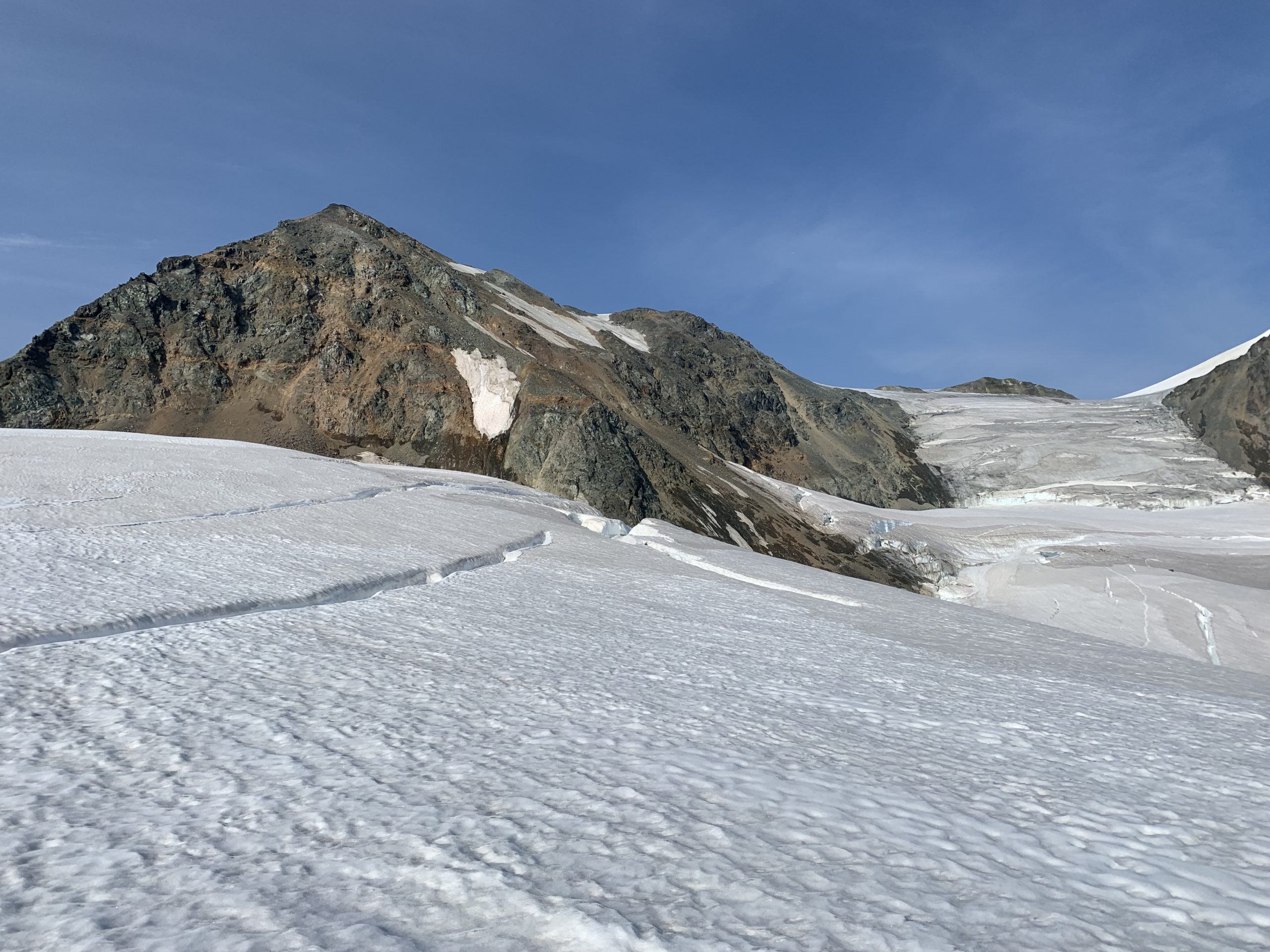
Minya as seen from the SW further down on the exit: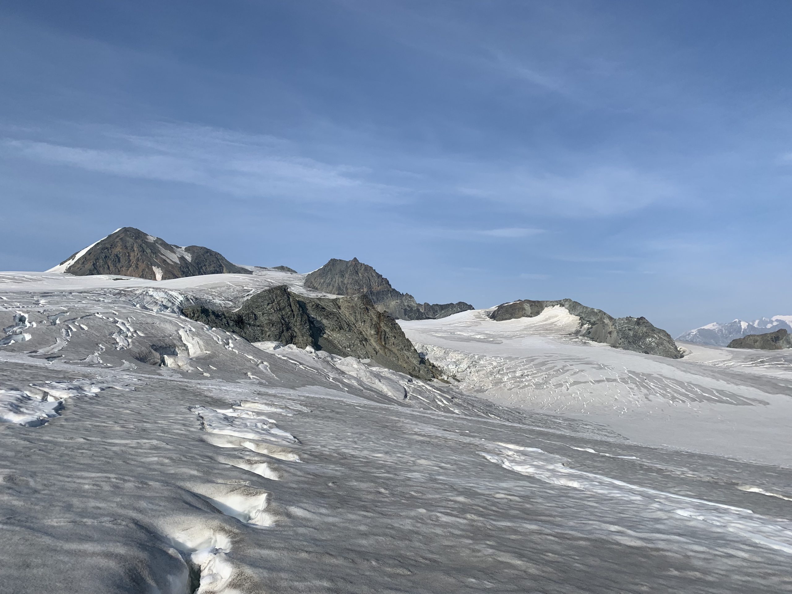
Video: