Wednesday, December 25, 2013 Observations
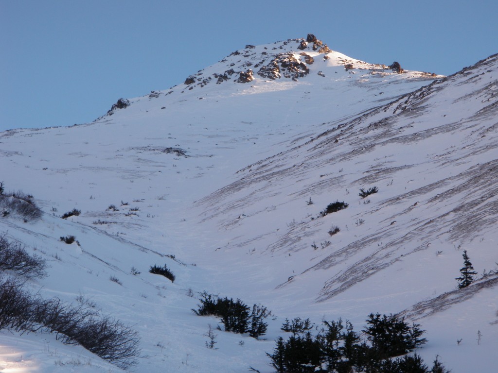
Canyon Road – Flattop and Peak 3
Signs of instability:
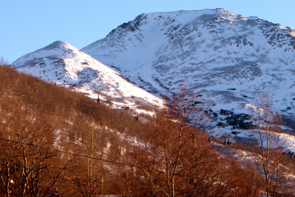
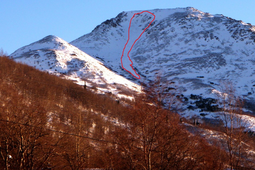
- Relatively recent avalanche on west face of Flattop (the main face visible from town) that propagated widely across the upper slope that is popular with skiers and snowboarders – just below the top and to the climber’s right of the trail
Weather:
- Sunny skies with mostly calm winds (intermittent light breeze) and upper elevations temps in the 20s
Surface conditions:
- Widespread wind affect of varying degrees; supportable and breakable wind board 2″+ thick in most places with coverage
- Wind, for the most part, has kept surface hoar at bay above the upper parking area
Snowpack discussion:
The most noteworthy observation of the day struck the eye on the drive to the trailhead; a wind slab that occurred near the top of Flattop, west facing, and just to the climber’s right of the trail (presumably naturally triggered). It appears to have occurred at the rollover where the slope steepens just below the top. It propagated widely across the upper slope that is popular with skiers and snowboarders and is estimated to have run about 800′.
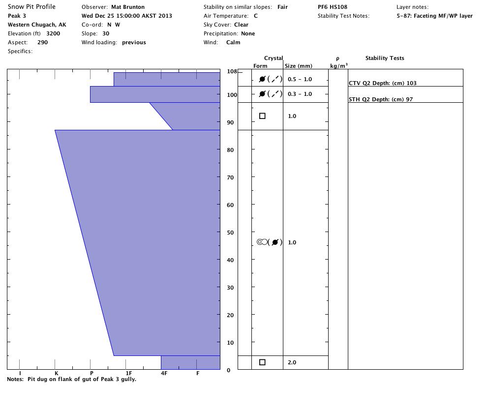
HS-U-D2.5-R3:
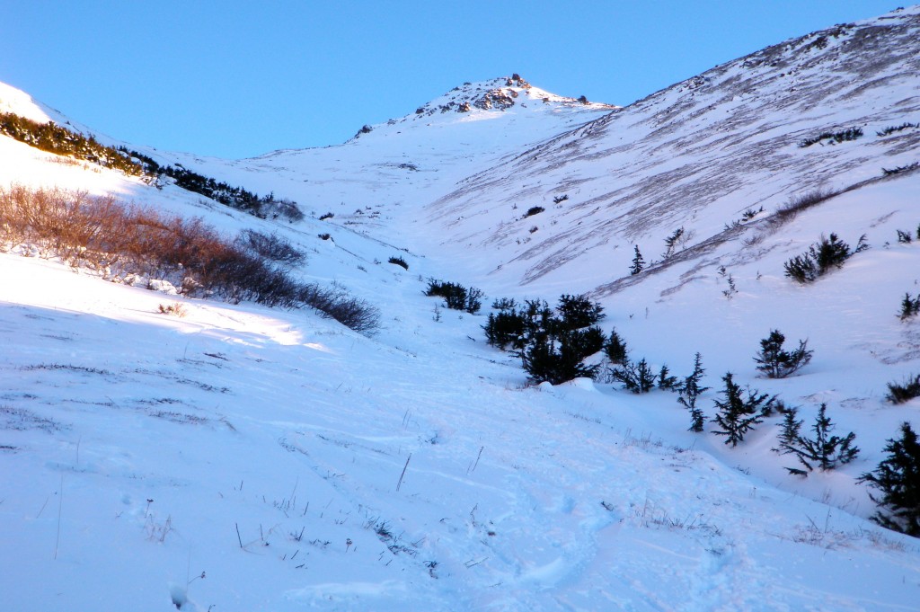
The first snowpit was dug just to the side of the gut of the Peak 3 gully where there is what could be considered “average” snow depth, at least for the areas that actually have coverage. The thick, old wind-packed layer from 87-5cm that has experienced at least one melt-freeze cycle is more complex than can be portrayed by the snowpit graphing program. It is comprised of faceting melt forms of varied, uneven hardnesses.
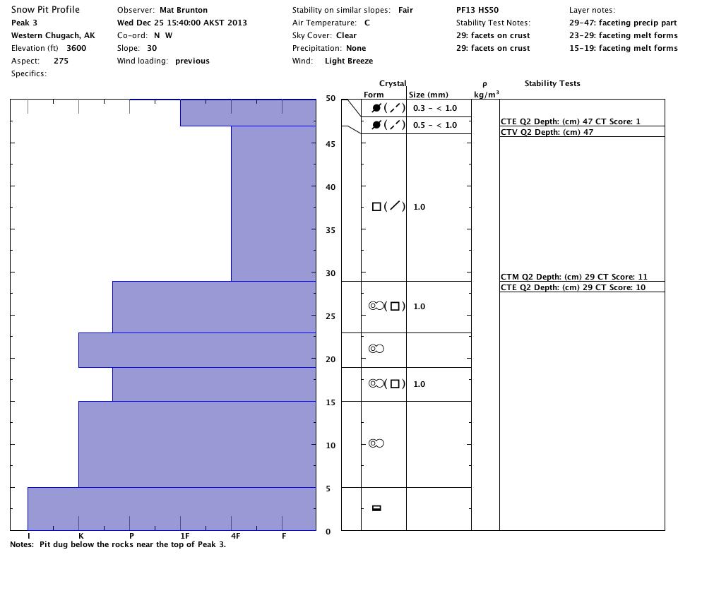
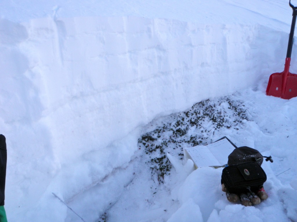
The second snowpit was dug just below the rocks near the top of Peak 3, before the slope funnels into the gully. It also portrayed complex morphology within melt-freeze layers of the snowpack.
The above pit was also dug in an area of “average” depth, but the photos show small-scale snowpack variability within just one snowpit; the climber’s left side is much deeper than the climber’s right side: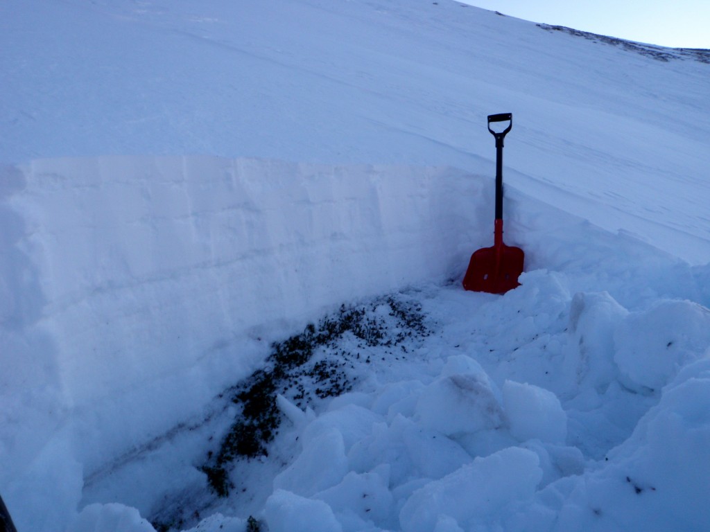
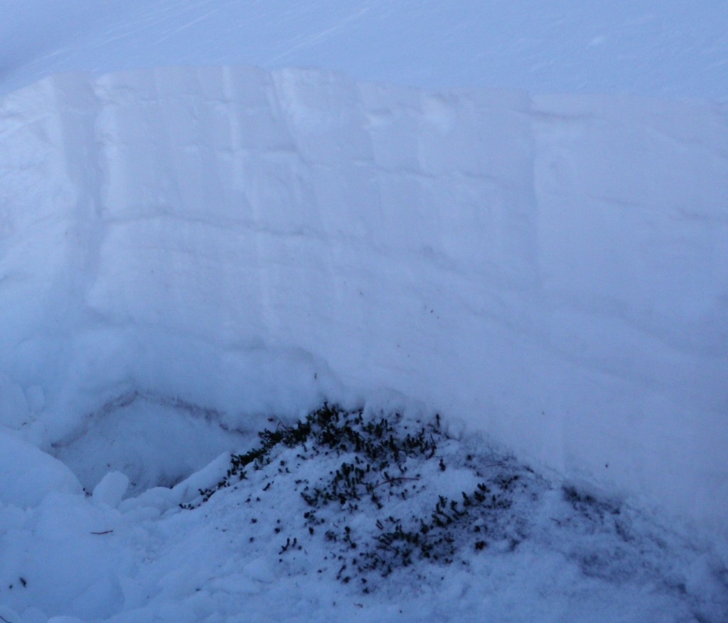
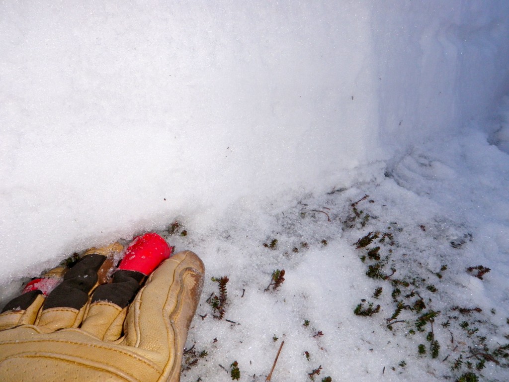
In this photo the gloved hand is at the point where the snowpack gets deeper (due to the gully terrain depression to the left) and the basal ice documented in the above snowpit turns into a faceting crust with deeper layers of melt-freeze crusts with varied hardnesses below it:
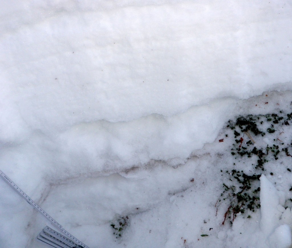
This is what those deeper layers to the left of the gloved hand pictured above looks like after being carved out a bit. Hard Q3 compression test failures, not documented in the above snowpit (as it documents the shallower right side of the pit), occurred near the ground on the deeper left side of the pit at density changes in the melt-freeze layers:
As evidenced by stability tests in the second snowpit, loose and faceted grains (weak layer) on top of hard and relatively slick melt-freeze crusts (bed surface) will be a primary concern and something to keep tabs on as the snowpack builds, although it is not currently an imminent threat. Such a setup resulted in the partial burial above Hunter Pass last Thursday (wind loading causing failure in weak faceted grains above the early December melt-freeze/drizzle crust) and was responsible for several other hard slabs triggered by wind loading in the South Fork area last week.
Peak 3 coverage:
Avalanche Outlook for Thursday, December 26, 2013 & Friday, December 27, 2013
Issued Wednesday, December 25, 2013 at 9:00pm (information provided below expires in 24 hours):
Click here to see the complete danger scale
Primary concerns:
As evidenced by the recent Flattop avalanche, slabs on the brink of failure lurk and may be quite large in some places.
Click here to learn more about persistent slabs and management of this type of danger
Weak and loose faceted grains (weak layer) on top of old melt-freeze layers (bed surface) – in some places shallowly buried and in other places deeply buried – with cohesive layer (slab) above, is a widespread snowpack setup that can currently be found throughout the Front Range and Eagle River area Chugach Mountains. While the larger avalanches that could result from this setup are much less likely to be triggered than wind slabs formed earlier this week, this setup has the potential to create the most inherently dangerous avalanches.
Click here to learn more about wind slabs and management of this type of danger
With winds having recently relaxed and being forecast to stay light, this problem should be on the decline as these slabs have time to bond and stabilize. However, wind slabs ranging from small to large in size are still possible and even a small one that isn’t inherently dangerous could do serious damage depending on the circumstances.
Please contribute your observations and share them with the AAC if you get out in Chugach State Park!


