
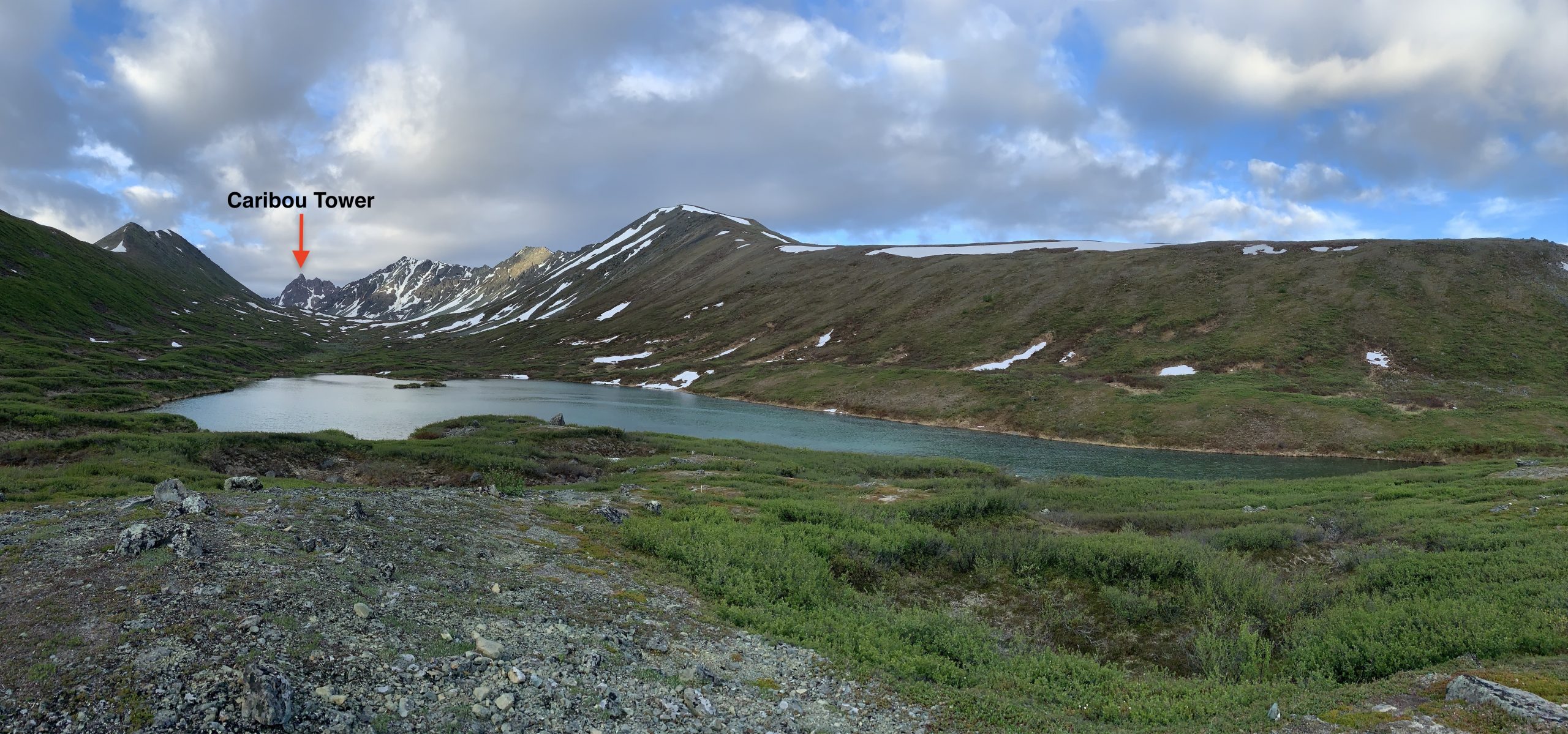
This peak, which I’ve dubbed “Caribou Tower,” is the highest and most prominent in the southern Clearwater Mountains of the Hayes Range (a subrange of the Alaska Range). I noticed its striking towers, and seemingly good stone, caribou hunting from the Denali Highway a couple years ago. Since then, it’s been on my peakbagging to-do list.
Mid-June 2020, with an unfavorable weather forecast for alpine activity in most areas, the Clearwater Mountains offered a couple days with good probability of favorable alpine climbing conditions. I decided it was time to go for Caribou Tower, and left Anchorage in the late evening driving to the west end of the Denali Highway.
Regrettably, we Cache Camper-ed, in the same pullout as I’d camped on the caribou hunt a couple years prior. I say regrettably because I hadn’t processed that when I’d stayed at this pullout in mid-August on the caribou hunt it was post-mosquito season. It was a fitful night with basically no sleep as the swarms of mosquitos managed to stream into the camper through tiny holes I’d neglected to bug-proof.
Given the 2am bedtime and lack of sleep, I probably could have slept in the next day and not been motivated to go climbing. But, the hum of a mosquito swarm that had worked its way inside the camper by 7am forced me to get up and take action. By the time the interior walls of the camper were covered with slaughtered mosquitos there was no going back to bed, I quickly made breakfast and coffee, and Jess and I were off hiking (quickly through the lower elevation morning mosquito swarms) up Alpine Creek.
Caribou Tower from the first lake up the Alpine Creek valley: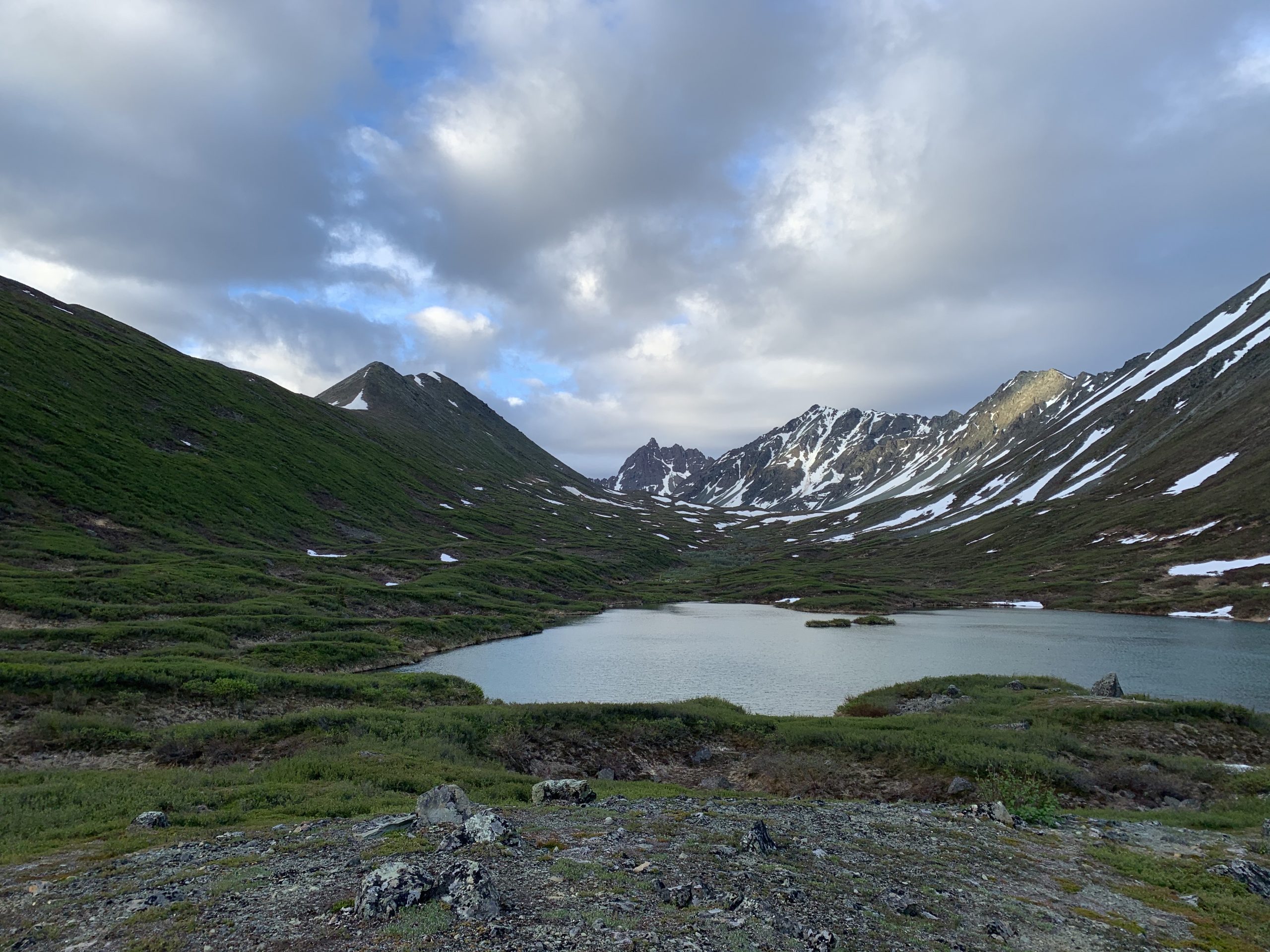
As Caribou Tower came into view from several miles away once we reached treeline elevation of Alpine Creek, I immediately thought to myself “damn, that looks burlier than I remember.” The seemingly sheer upper walls of the south face had me hoping that there was indeed a manageable route up the north side, which I hadn’t seen firsthand before. With overcast weather and the threat of showers, we hiked with haste up valley to the Alpine Creek pass.
Caribou Tower from Alpine Creek pass:
At the pass, I got out my monocular to have a closer look at the south face. While it still looked steep, with several hundred feet of fourth and fifth class, it looked more reasonable than from when we were a few miles further away. It seemed there might be a way up the south side rather than making a much longer approach to check out the questionable north side I hadn’t seen before. I found a potential line up the south face and continued to scope it as we got closer.
At the point of decision between the north or south side approach, I made a final examination with the monocular and decided to give the south side a shot. I had scoped a line that seemed like it would go without anything beyond very exposed mid-fifth class. There was one particularly questionable pitch, but it was worth a shot knowing that the steep north side was even more questionable and would be holding a lot more snow and ice.
Our route up Caribou Tower: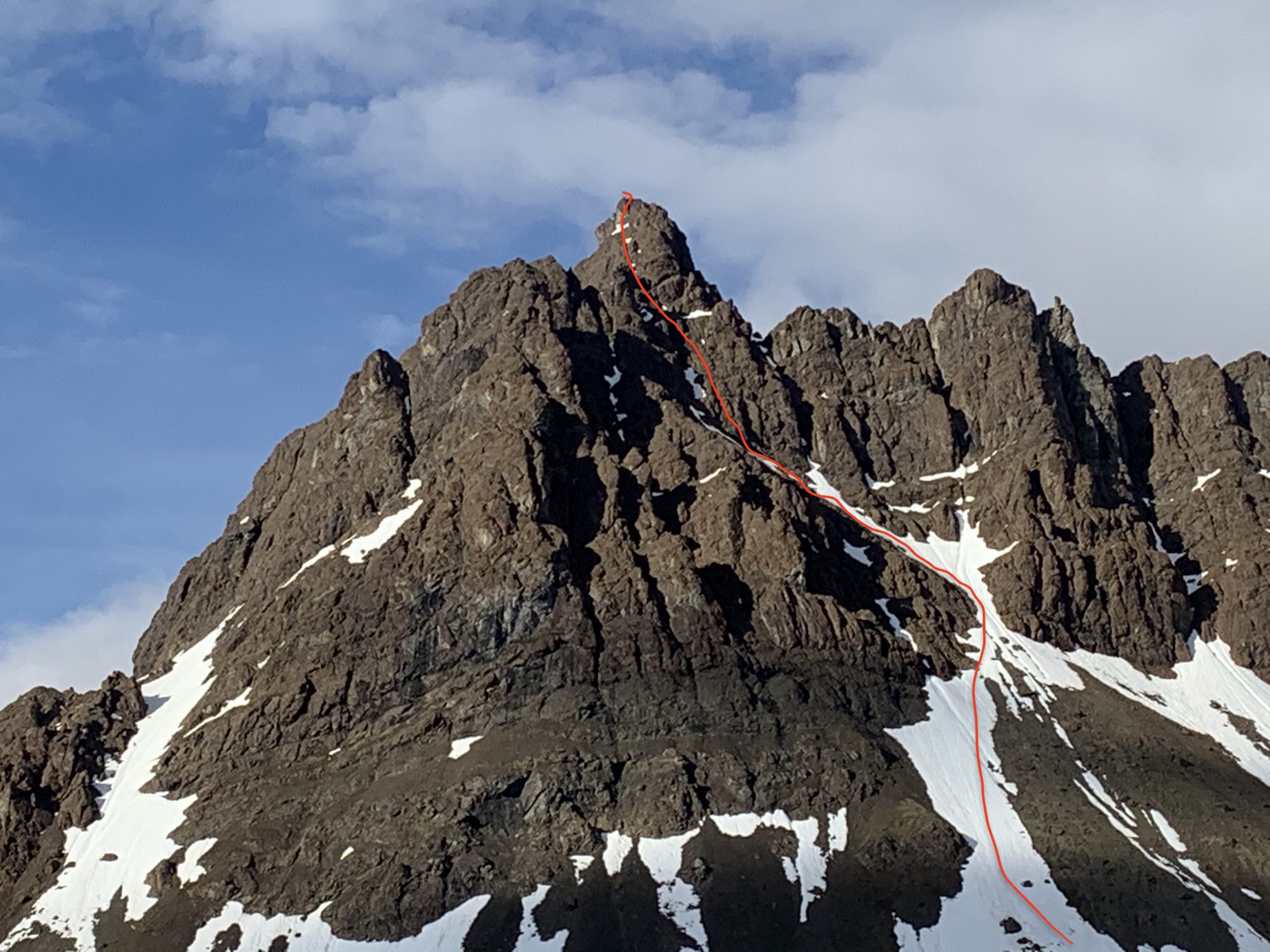
We worked our way straight up ~500′ of steep snow and then followed the filled-in gully another 100-200′ climber’s left before we left this snow (that had provided good booting) for a short stretch of third class scree. From the steep and exposed scree, we followed a relatively solid fourth class rock band up until it became steep and exposed enough as to be unreasonable not to use the rope I was carrying in my pack.
We then pitched-out a 50m rope length of mostly fourth class, with some mid-fifth class moves, directly up the south face. From the lower angle scree ledge where I anchored and belayed Jess up to, the route-finding got more interesting. I eventually decided to quest climber’s left, sticking to the potential route I’d observed from the valley with the monocular. After a pitch of very exposed fourth class from which I followed exposed scree from the south face to a narrow grooved ramp running up the otherwise sheer west face, I anchored on a horn and brought Jess up.
The grooved ramp pitch: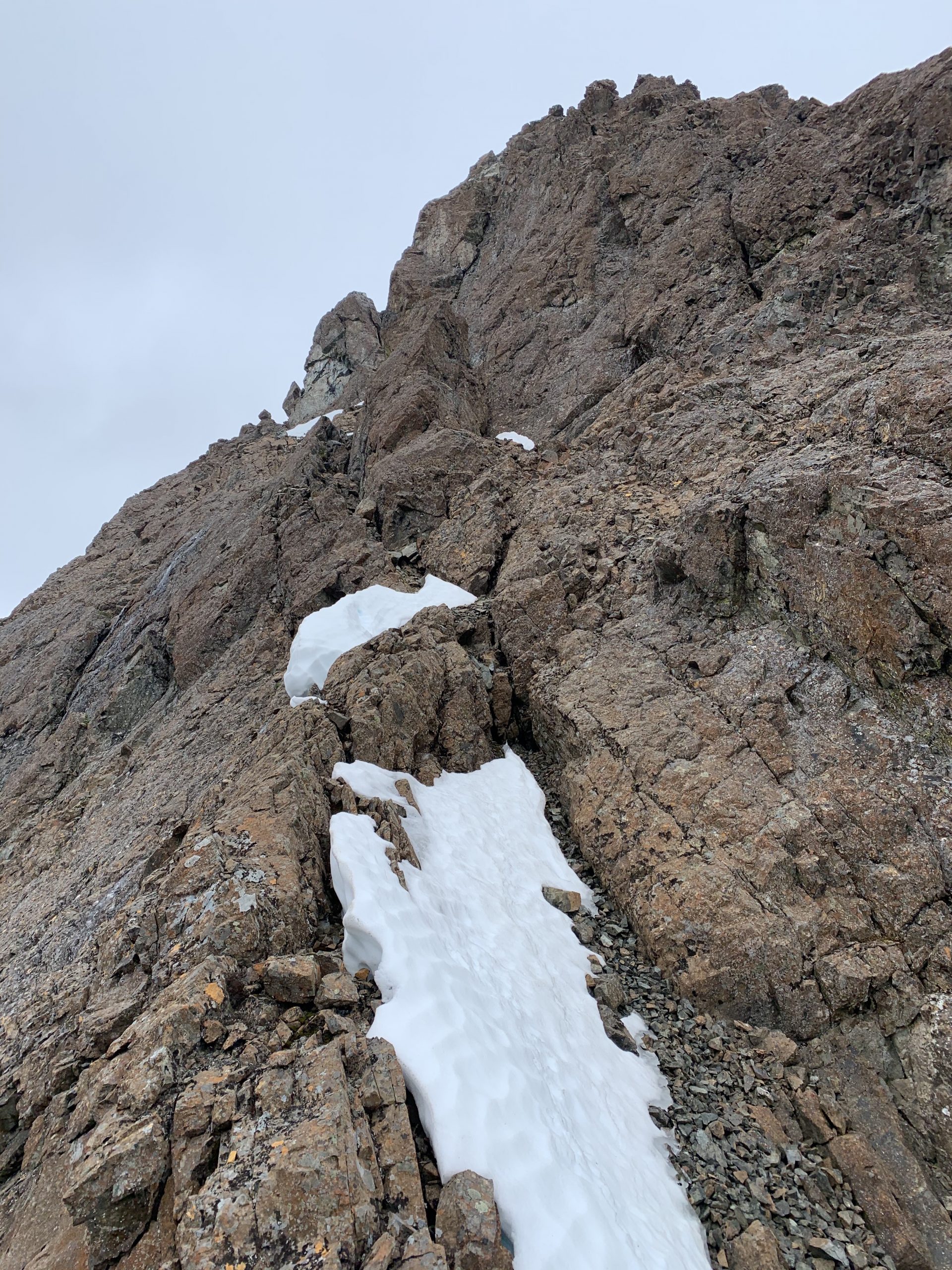
We were at the crux of the route (in terms of climbing consequence but not necessarily difficulty), and the questionable section I’d observed from the valley. About halfway up the narrow and exposed ramp running along the otherwise sheer west face, there was a notch where the grooved ramp we had been climbing disappeared and a sliver of snow and ice ran down the sheer rock wall of the west face several hundred feet to a lower angle (but still steep) and wider snow couloir below. While this gap would be tricky enough to climb over, what I was really worried about was safely rappelling back over it to the reliable anchor we were at.
Given that we only had a 50m rope, limited accessory cord for slinging anchors, and I’d neglected to bring disposable pins or nuts I was willing to leave behind (instead opting for just a light rack of cams); I didn’t know if I could find a reliable anchor at a distance that would allow us to safely descend this very high consequence section. After hemming and hawing and being belayed back down the ramp looking for an alternative, less exposed option; it became clear that the route over the gaping gap was our best bet. Plus, once passed this crux, the route to the summit seemed obvious and reasonable.
I got down on my ass, feet dangling into the gap, kicked away loose and unsupportable snow, found solid handholds, and stepped across. I shimmied my way up the narrowing and steepening grooved ramp on the other side of the sheer drop over small chockstones wedged in it on to looser choss, and began the desperate search for a suitable anchor within 25m of the anchor Jess was at. As the ramp feature we’d been climbing up ran into an impassable patch of steep snow, I noticed what seemed to be a suitable anchor horn just above its moat. I got out my ice axe and climbed to it, hollering to Jess to see if I’d passed the halfway mark of the rope.
She replied that I had, but only by ~2”. With the couple of cams I’d placed removed, and a more direct line for the rope on the rappel, I felt confident we could rap this crux safely. I brought Jess up to the horn anchor, in which we stood a few feet down in the moat where the steep snow patch met more fourth to low fifth-class rock.
I climbed up this short but steep pitch, that turned out to be the loosest of the route, careful to not dislodge any choss that would fall on Jess. From the top of this pitch, the summit was an easy fourth class scramble up relatively solid blocks. As mentioned, considering limited anchor building material, we belayed each other up and down the two upper pitches so as to not have to leave any material behind.
Mat on the summit: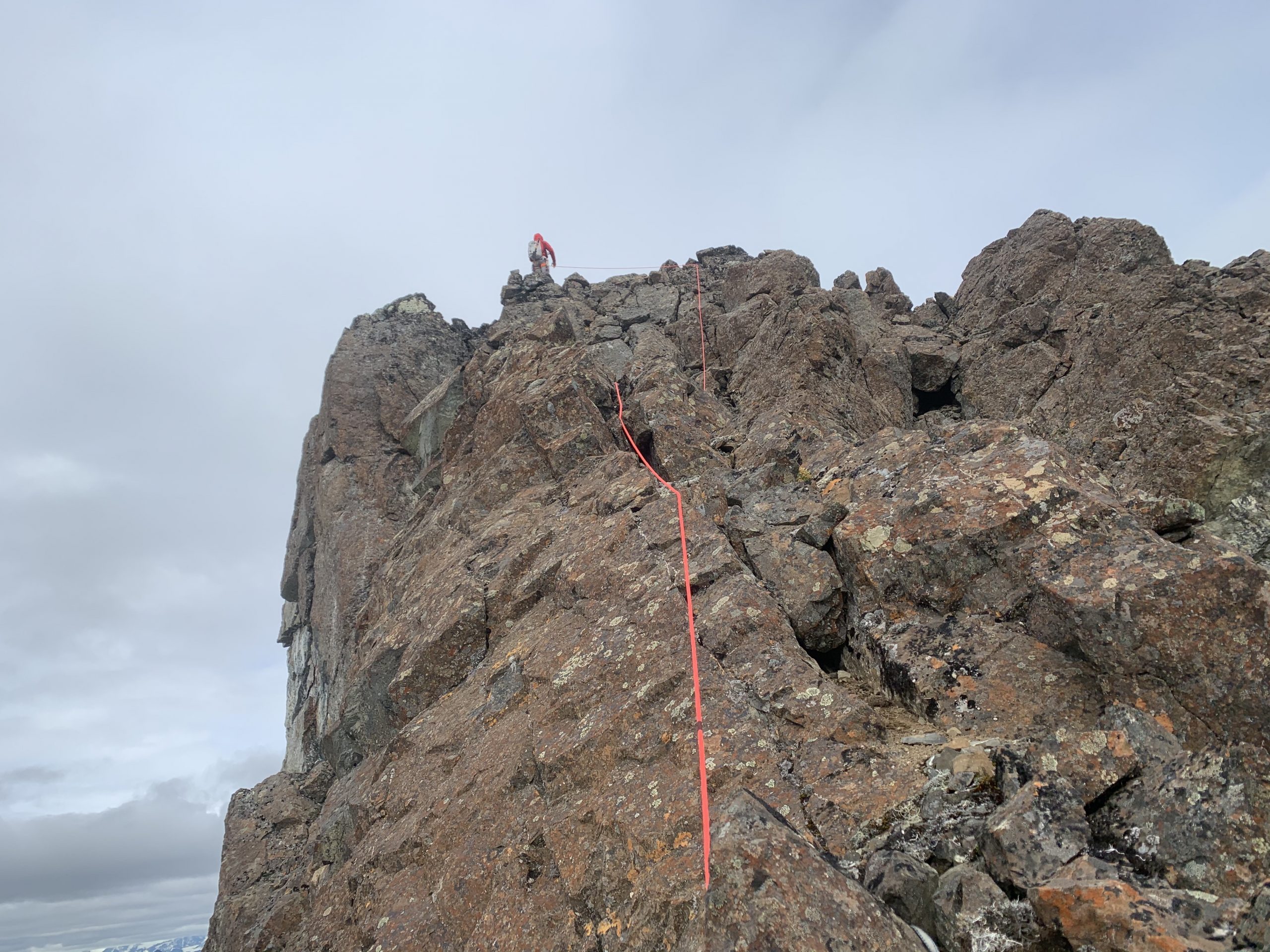
Jess at the final belay with a view of the crux gap: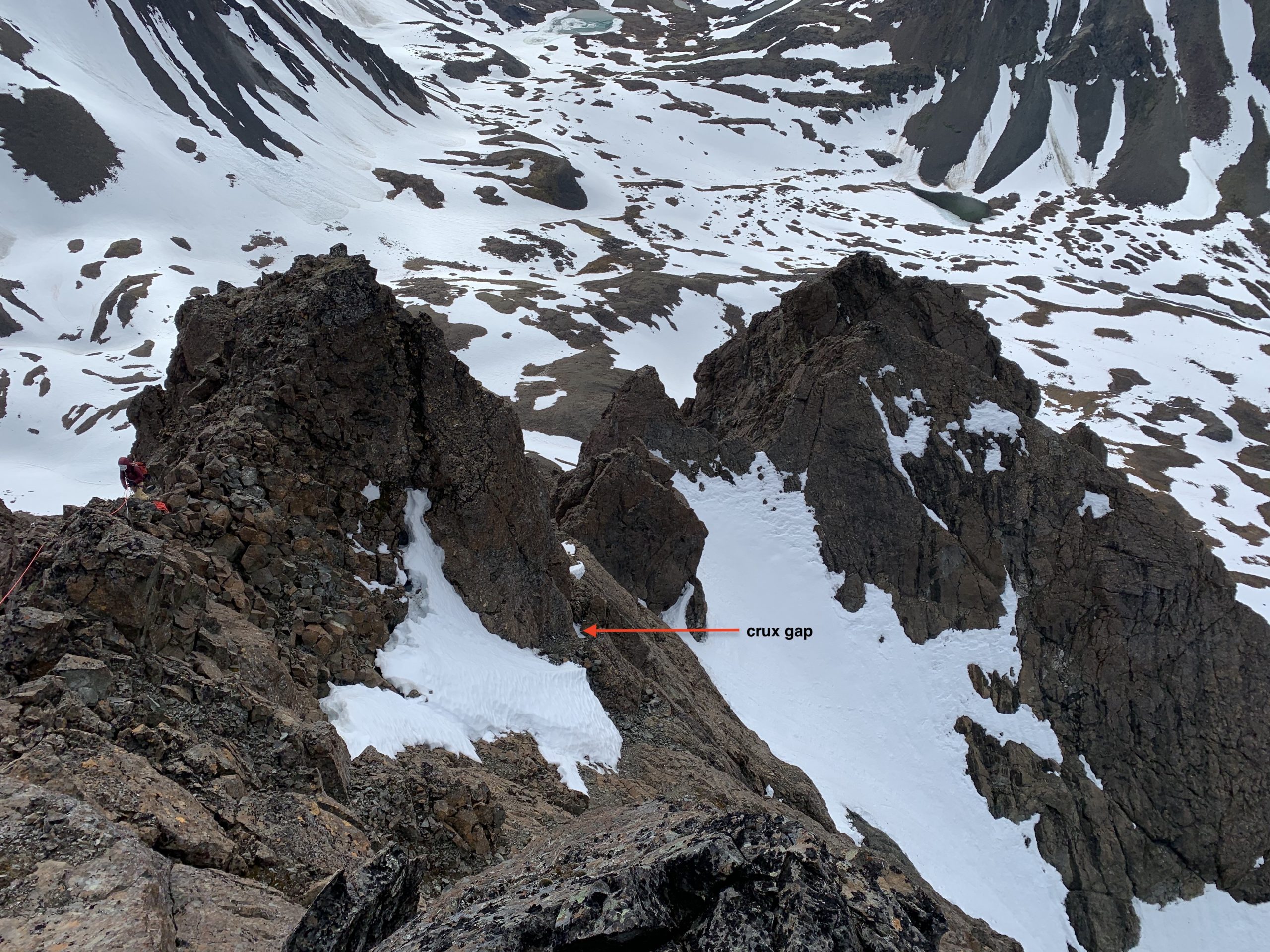
Summit view south: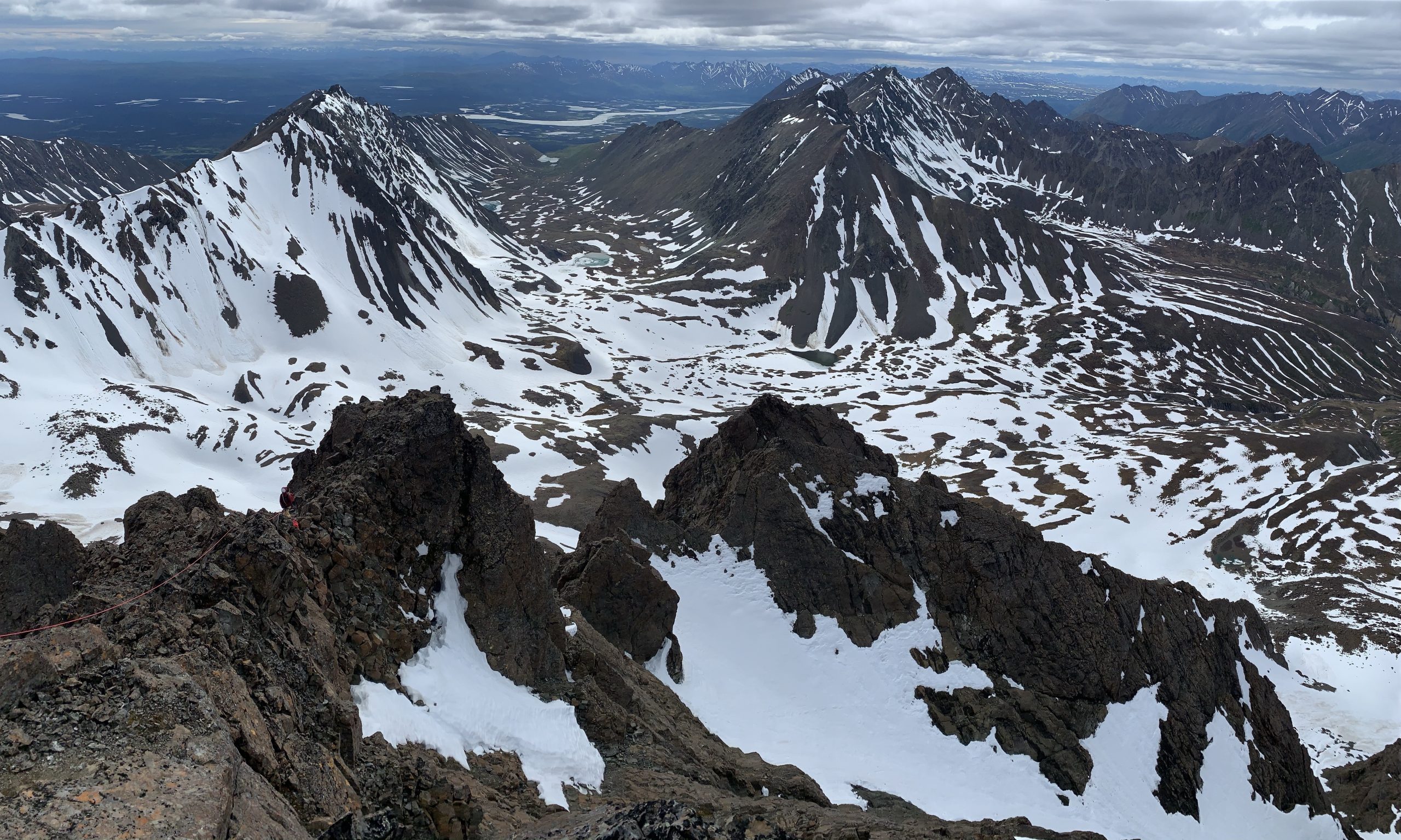
Summit view east: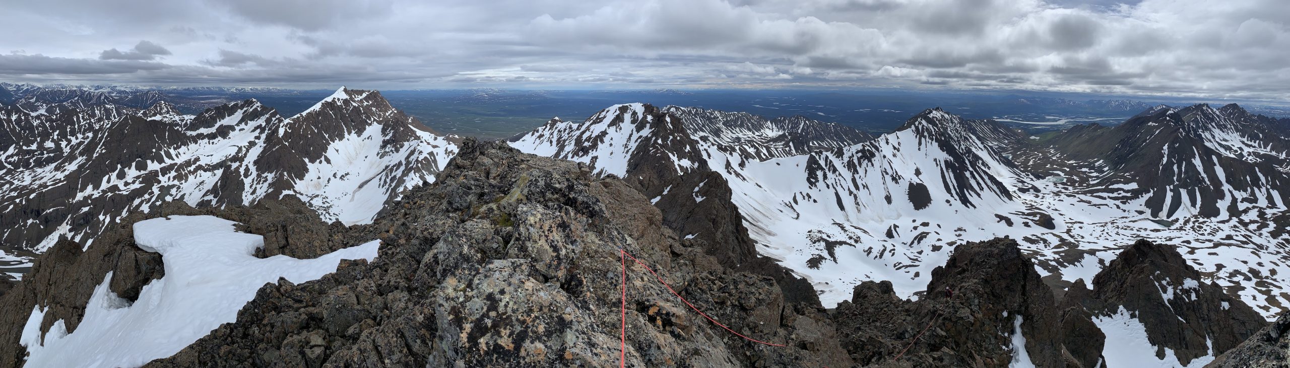
Summit view west: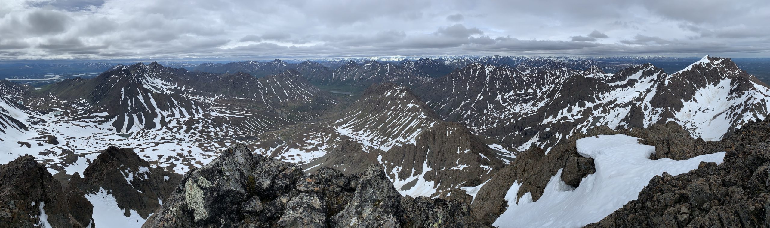
The rappel over the gap crux went smoothly, with about a foot of rope to spare. We then began the less anxiety-provoking, but still somewhat nerve-wracking, descent. This consisted of exposed fourth class down-climbing and two more rappels down the steepest sections. As we’d climbed four pitches on the way up, but made the descent with only two down climbs and two rappels, we descended in a less direct fashion than the ascent in order to down-climb as much as possible to make sure we had enough anchor material for the steeper and sketchier sections that required a rappel.
Jess at the crux rappel over the gap in the grooved ramp of the west face: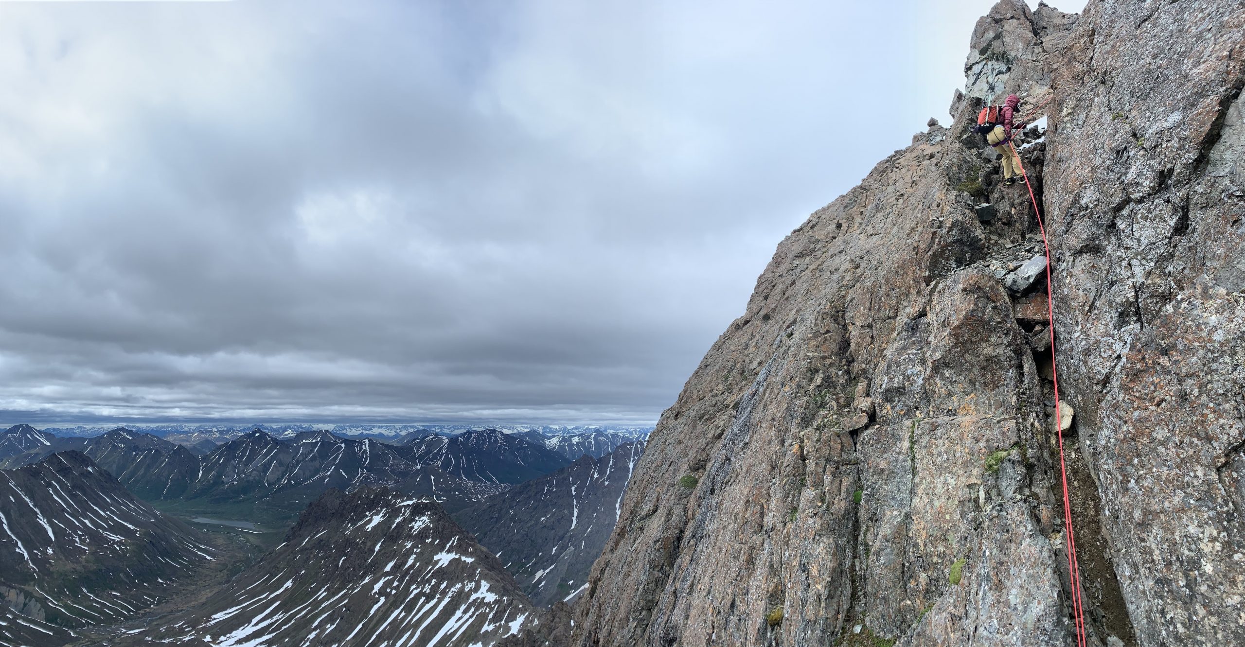
Back down to where we first roped-up for the ascent we opted to descend third class rock and scree, instead of down-climbing the steep snow, in order to avoid making a transition to crampons and axe. Once the steep snow mellowed and was no longer exposed, we moved on to it for a nice slide down to the valley. We had a relaxing and uneventful hike out after a fine day of adventure climbing that provided a good test of mountain craft.
Mat and Caribou Tower: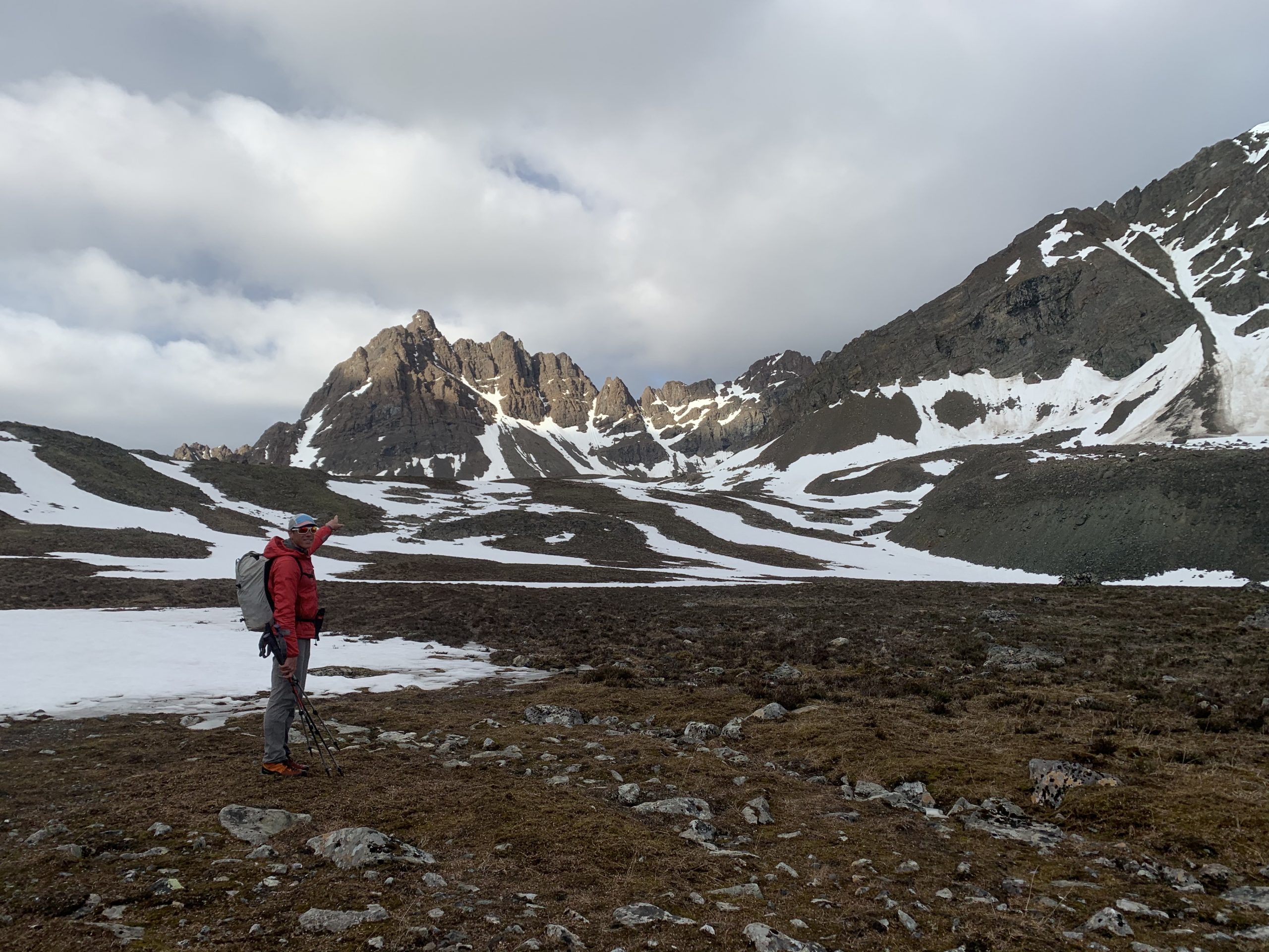
Before we left the alpine we prepared and planned for the last crux of the trip: getting back to the truck without being eaten alive by mosquitoes. As soon as we were back to the Alpine Creek Lodge‘s parking lot the biting began, but we were able to make it into the truck without much damage. We quickly drove east to higher elevation and more wind-exposed terrain, finding a high and dry pullout between Alpine Creek and the Maclaren River.
As we opened the Cache Camper, the swarm trapped inside that we’d transported from the Alpine Creek area escaped. After killing off this swarm, we were pleased to find only a few native mosquitoes in the area. Another culinary mac and cheese masterpiece from Mac Master Mat, a fire under the beautiful purple-pink sky and midnight sun, and fine herbs ended a magical Alaskan summer day.
While we found no obvious sign of prior human ascent of Caribou Tower (such as anchor material, cairns, or summit register) and have inquired without any positive history of ascent, it’s unclear if this fine Clearwater Mountain summit had ever been attained before. Regardless if this was a first ascent or one of very few ascents, Caribou Tower is a superb adventure climbing destination deep in the wilderness of interior Alaska. It can definitely be done as a daytrip from the Denali Highway, or as a more leisurely climb from camp in the spectacular upper Alpine Creek valley. This area is a fantastic alpine playground with tons of opportunity for exploration and bagging less prominent but easier peaks.
Just beware the spooky droning of military planes and their ground-shaking bombing of the nearby landscape: a vibe that makes this area all the more uniquely and eerily Alaskan. When hearing these sounds, be reminded that our nation’s absurd investment in technologies of death and destruction for the sake of vain attempts at global hegemony could someday be re-invested in technologies that promote global social and ecological wellbeing. As-salamu alaykum.