
Weekend Avalanche Outlook
This is a regional backcountry avalanche forecast for the Western Chugach Mountains of Chugach State Park. It is provided pro bono by a local avalanche professional, is based on limited field data for a large area, and is meant to be used only as a general baseline for recreationists’ personal and specific assessment in the field. The Anchorage Avalanche Center and associates assume no responsibility or liability for the use of this information. Anyone using this information needs to be formally educated in regard to avalanches and backcountry travel. Please encourage statewide investment in high quality outdoor and environmental education via K-12 public schools, as this is the best way to ensure all Alaskans are “avy savvy.”
Click the hyperlinks and icons for further learning.
Get outside and enjoy The Greatland! This is your weekend avalanche outlook for March 27-29, 2020.
The avalanche danger this weekend is expected to be moderate. Be sure to practice safe travel protocols and effective terrain management to minimize exposure to potentially dangerous avalanche terrain and reduce the consequences if an avalanche is triggered.
Remember that terrain traps can make even a small avalanche deadly. Be mindful of the consequences if you were to fall or lose control due to triggering just a small avalanche. Beware of exposure where a fall or slip could cause trauma, as well as channeled terrain features that might cause even a small amount of debris to pile up deeply.
So far this season we’ve had particularly tricky and dangerous avalanche conditions, especially in areas of Chugach State Park north of the Front Range (i.e. Arctic Valley north to the Knik River). This is due to a relatively high volume snowpack, combined with heavily faceted snow from the very cold and dry month of January. In some areas, a rain/melt-freeze crust (observed up to 3500′ in the South Fork Eagle River area) underlies the heavily faceted January snow and has enhanced instability-producing metamorphism. It’s also providing a very low friction bed surface causing avalanches to run much further than they would without this very slick bed surface.
The heavily faceted January snow has been a very persistent weak layer, but a melt-freeze cycle this week has done a lot to improve stability.
While it will be relatively cold this weekend, spring has arrived and with it diurnally increasing avalanche danger. Avalanche danger will increase throughout each day, especially on solar aspects, due to warming temperatures and solar radiation.
As springtime temperatures and solar radiation continue to increase in the coming weeks, large and destructive avalanches are expected to occur due to a loss in snowpack strength causing failures on the mid-snowpack January facet layer and basal facets and depth hoar near the ground.
Problem 1 – Persistent Slab

Human triggered persistent slab avalanches up to D3 (large, deadly, and destructive) in size are possible above 2500′ on terrain steeper than 35º across all aspects. The persistent slab danger is higher in northern areas of Chugach State Park (i.e. from Arctic Valley north to the Knik River), and lower in southern areas of the park (i.e. Front Range and Turnagain Arm).
While persistent slabs remain possible, the danger this weekend is the lowest it’s been since we began forecasting this season in early February. Warm temperatures midweek followed by colder temperatures to end the week have significantly reduced the persistent slab danger via melt-freeze cycles.
In the Front Range and Turnagain Arm areas Thursday, a melt-freeze crust was found up to 4000′ even on northerly aspects. On solar aspects, melt-freeze and sun crusts were found up to 4500′ and may exist even higher. Similar crusts are expected to exist across the park, although they aren’t expected to have developed to such high elevations in northern areas (i.e. Arctic Valley to Knik River).
The melt-freeze cycle and resulting crusts have done a lot to improve stability and heal avalanche problems resulting from the VERY persistent weak layer of January facets. That said, persistent slabs problems remain in some areas. Steep northerly terrain above 4000′ is still likely to harbor potentially dangerous persistent slabs. When temperatures warm and solar radiation increases, persistent slabs on solar aspects will destabilize and be more prone to human triggering.
A human triggered persistent slab may be very difficult to escape, as a person may be able to get into the middle of the slab before it releases from above with hard slab characteristics. The hard slab nature of the debris also makes trauma more likely.
The best way to manage the tricky persistent slab avalanche problem is to simply avoid terrain capable of producing a large slab. The most likely terrain to produce such a dangerous avalanche is a big and steep slope that’s convex, unsupported, and/or has thinner areas where the persistent weak layer is closer to the surface and more likely to be impacted by a human trigger.
Assessment this problem in the specific area in which you’re traveling will require thorough snowpack investigation: digging a snowpit, analyzing the stratigraphy, and conducting stability tests like the ECT. As always, be mindful of red flags (especially recent avalanches, collapsing or “whumphing,” shooting cracks, active loading, etc.) and be very diligent about safe travel protocols.
Problem 2 – Wind Slab

Small human triggered wind slabs will be possible on steep (35º+) leeward terrain. As there is not much loose snow available for transport, wind slab danger will mainly be confined to the uppermost elevations and depend on how much fresh snow we get Friday night into Saturday.
The most significant wind-loading this weekend is expected Saturday night into Sunday, as clearing skies are again accompanied by moderate to strong outflow northerly winds.
Dangerously wind-loaded snow may feel hollow and punchy, indicating a denser slab overlying looser and weaker snow. It may look pillowy, bulbous, and/or have a smooth, lens-like appearance.
Pole probing and quick hand pits are a way to assess wind slab danger near the surface. Expert skiers and backcountry travelers may be able to use prudent ski cuts to assess and manage the wind slab problem.
Problem 3 – Wet Avalanches
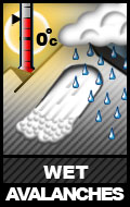
Wet avalanche danger is expected to increase throughout the day on steep solar aspects (primarily east clockwise to west aspects) if temperatures warm and solar radiation increases.
Natural and human-triggered loose wet avalanches are possible in the afternoon and evening. With a bit of fresh snow forecast Friday night into Saturday, warming rocks will readily shed snow onto the slopes below them when the sun comes out and temperatures rise.
Loose wet avalanches have the potential to trigger more dangerous slab avalanches as they descend. Warming temperatures and solar radiation may also de-stabilize persistent slabs, as discussed above.
It’s now the time of year when route planning needs to take aspect relative to the sun into consideration. Make sure your route does not expose you to terrain that has been de-stabilized by warm temperatures and solar radiation later in the day. This includes being mindful of overhead hazard, even if you’re on relatively flat terrain.
South and west-facing avalanche terrain and paths in the Turnagain Arm area are prime examples of overhead hazards and terrain traps. Potentially dangerous, sun-exposed avalanche terrain and paths exist in the vicinity of popular hiking trails and nordic ski routes: Penguin Ridge, Bird Ridge, Indian Creek (i.e. Arctic to Indian), and Falls Creek. Make sure you know how to identify and avoid potentially dangerous sun-affected avalanche terrain!
Problem 4 – Cornice Fall
![]()
Cornices (especially over typically leeward slopes: primarily west clockwise through north aspects above 2500′) are large in many areas of Chugach State Park. Cornices may become more prone to failure and falling (especially Sunday and Monday) if temperatures warm and solar radiation intensifies. Beware of overhead cornice fall hazard, as well as naturally triggered avalanches that may result from cornice falls.
Give corniced ridges a wide berth; cornices may break off further back than expected. Do not approach the edge of a snow-covered ridge, unless you’re sure it’s not corniced. A cornice fall itself is dangerous, especially if the human trigger falls onto exposed terrain. Cornice falls may also trigger slab avalanches as they “bomb” the slope they fall onto.
Danger Trend
Avalanche danger will increase from a modest amount of fresh snow Friday night into Saturday followed by increasing winds Saturday night into Sunday. Sunday and Monday, the danger will increase throughout the day on solar aspects due to warming temperatures and solar radiation.
Mountain Weather
A few inches of mountain snowfall with generally light wind is possible Friday night into Saturday. Later Saturday into Sunday northerly outflow winds increase. Sunday and Monday are forecast to be sunny with moderate north winds that eventually decrease. Expect daytime alpine temperatures in teens to mid-twenties (colder higher).
Best wishes for your weekend!
Please let us know what you’re seeing by tagging us on Instagram @anchorage_avalanche_center, submitting an observation, sending an email to info@anchorageavalanchecenter.org, or via FaceBook message. All observations help us provide the public with a better forecast product – no matter how basic. We are more than willing to keep observations confidential, and only use the information to inform forecast products.
Funding and resources for this forecast generously provided by the Post-Capitalists and Libertarian Socialists of Alaska who encourage you to #FeelTheBern, #DumpTrump, #RecallDunleavy, and tell Murkowski, Young, and Sullivan that this is their last term! Our democracy and planet are at stake, stand up and fight the power!