
Squeegee the 3rd Eye: Deep Wilderness Ski Alpinism in the Eastern Wrangell Mountains
Our mind-blowingly vast Alaska wilderness and public lands provide unique experiences for exploring human potential and the further reaches of human experience. Getting inserted deep into a wilderness larger than the nation of Switzerland (i.e.Wrangell-St. Elias National Park & Preserve) is, as Alaskan big mountain guru and Valdez local Taylor Brown would say, a squeegee for the third eye. The heady experience of undertaking serious and technical skiing and climbing missions in one of the most wild, remote, and unknown nooks of our wondrous planet and being completely dependent on self, partner, and pilot can impart deep revelations into the nature of self, other, and reality (if one opens the mind and listens).
In early winter of the 17-18 season, Taylor and I set aside two weeks in late May to fly into the Wrangell Mountains or University Range for ski alpinism. As spring approached and parties throughout Alaska were getting spanked by weather in the mountains or weren’t even able to fly in, we hoped our two week allotment would align with an overdue high pressure system. After extensive weather obsessing in the short term leading up to our trip, it looked promising. But, as the short term shortened, it again became questionable.
We pushed back our earliest planned departure almost a week, hoping for improvement in the forecast, and finally pulled the trigger and drove to Tok (with a Glenallen rendezvous given our different origins) on Monday, May 14 despite a mixed bag of a forecast. We spent the night with our pilot, and the most gracious and hospitable of Alaskan hosts, Zack Knaebel of Tok Air Service in his beautiful cabin in a serenely quiet Tok birch forest. He fed us tasty caribou steaks and a flavorful salad.
The next day started casual as the forecast remained questionable. A lazy morning began with coffee and a tropical fruit breakfast provided by Zack. Tentatively, we decided we’d get our stuff sorted out for flying and make our way to Tok Air Service headquarters hoping more hemming and hawing over various weather resources would give us the confidence we needed to commit to an attempted insertion via Zack’s 185 Sky Wagon.
By mid-afternoon, the forecast remained uncertain. After all, there are no webcams in close proximity to the range, no realtime weather data, and not much action in the park prior to summer. Although some corners of the giant Wrangell-St.Elias National Park and Preserve see a bit of humanity in winter and spring, most of it remains an unknown void. Zack wasn’t feeling confident about a reliable window until Friday, but Taylor and I didn’t want to spend days hanging out in Tok. As Taylor has spent years guiding and doing personal trips in Wrangell-St.Elias, and Zack has decades of experience as a pilot for outdoor folk of various persuasions venturing into the range from the north side, I left it up to them. I don’t know how the final decision came to be made, but by 2ish in the afternoon Taylor must have convinced Zack it was good enough to go, and felt confident enough to risk our money on the attempt, and Zack was loading our gear into the Sky Wagon.
We flew over the Mentasta Mountains and up the Nabesna glacier as Taylor had options in mind. The BIG mountain lines of objectives one and two were quickly nixed due to conditions, level of commitment, lack of mellower alternatives in the area, and the questionable weather forecast. Soon we were heading east towards the University Range, but Taylor had an obscure and potentially user-friendly zone in the eastern Wrangells in mind: the upper Chisana glacier.
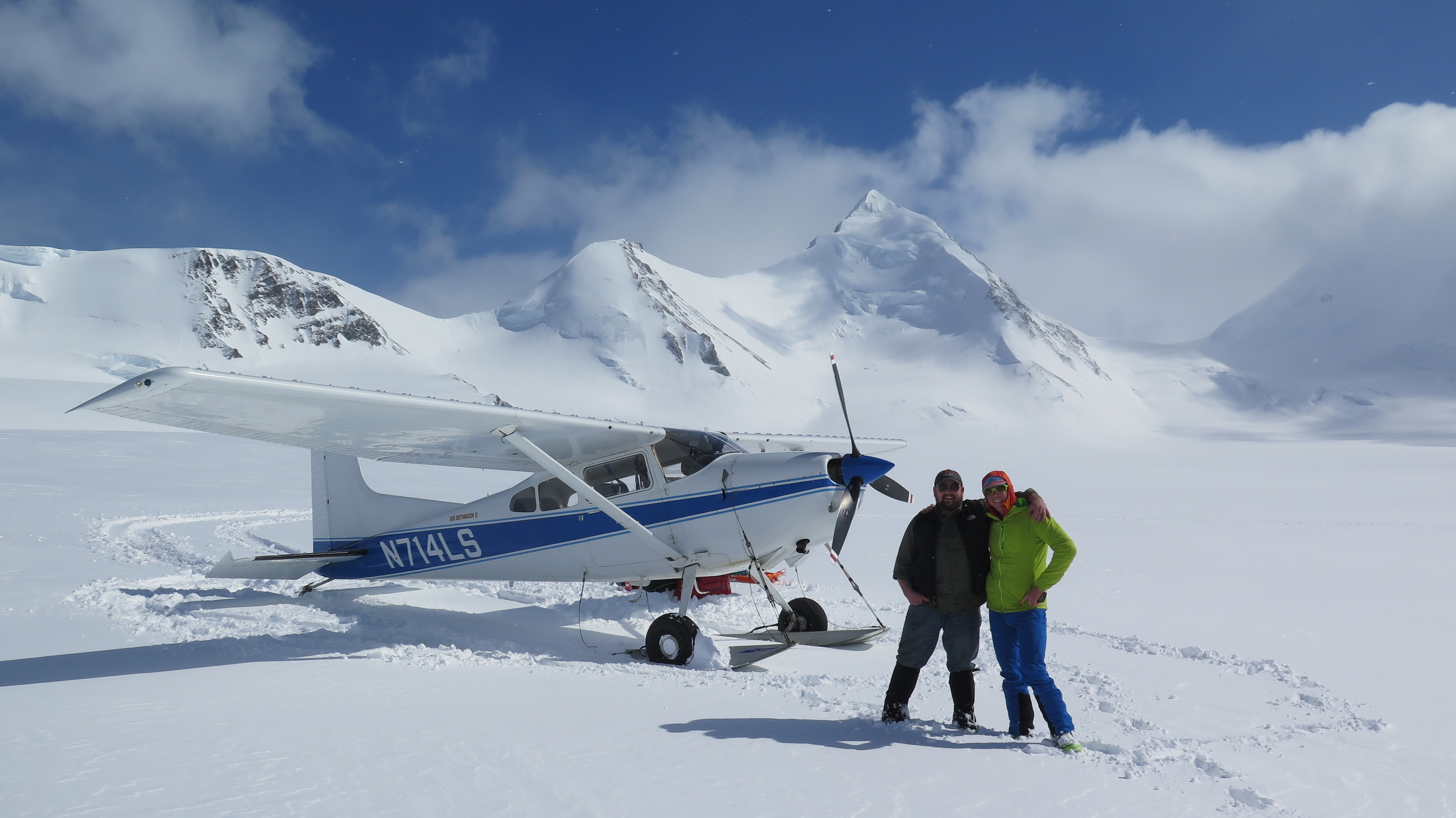
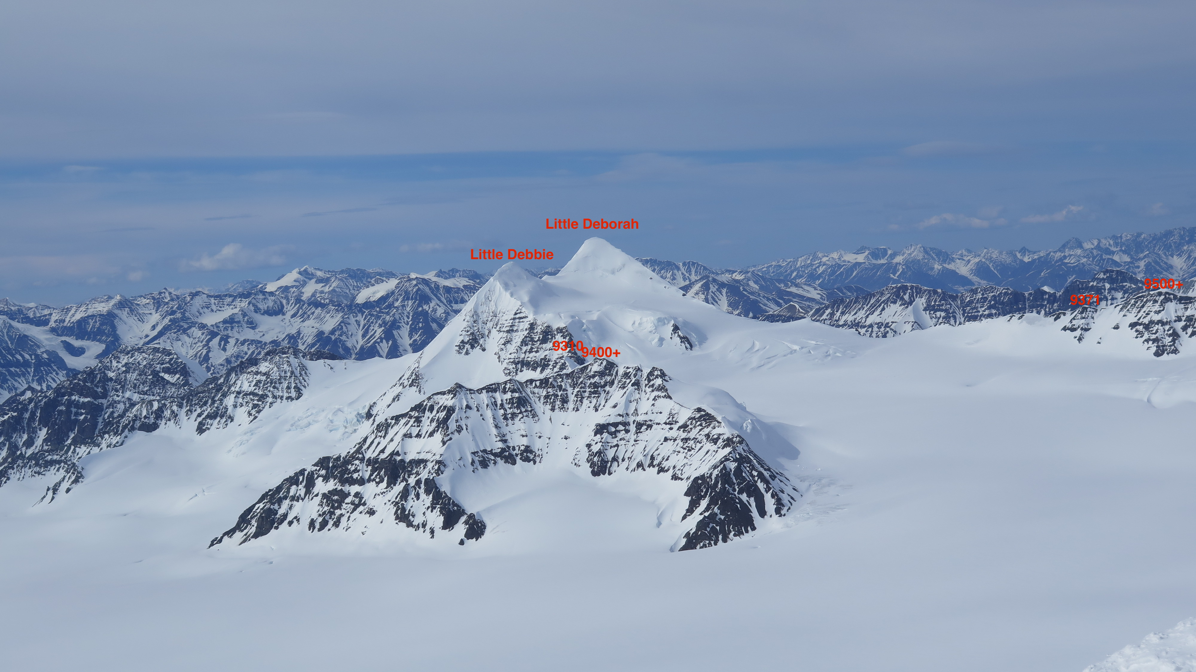
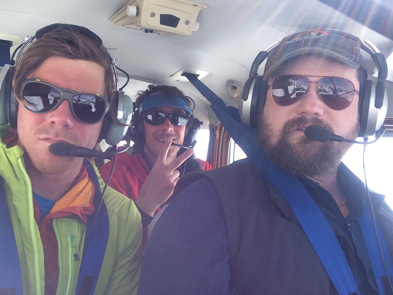
R-L: Mat, Zack, and the 185 Sky Wagon on the upper Chisana glacier (pc Taylor Brown)
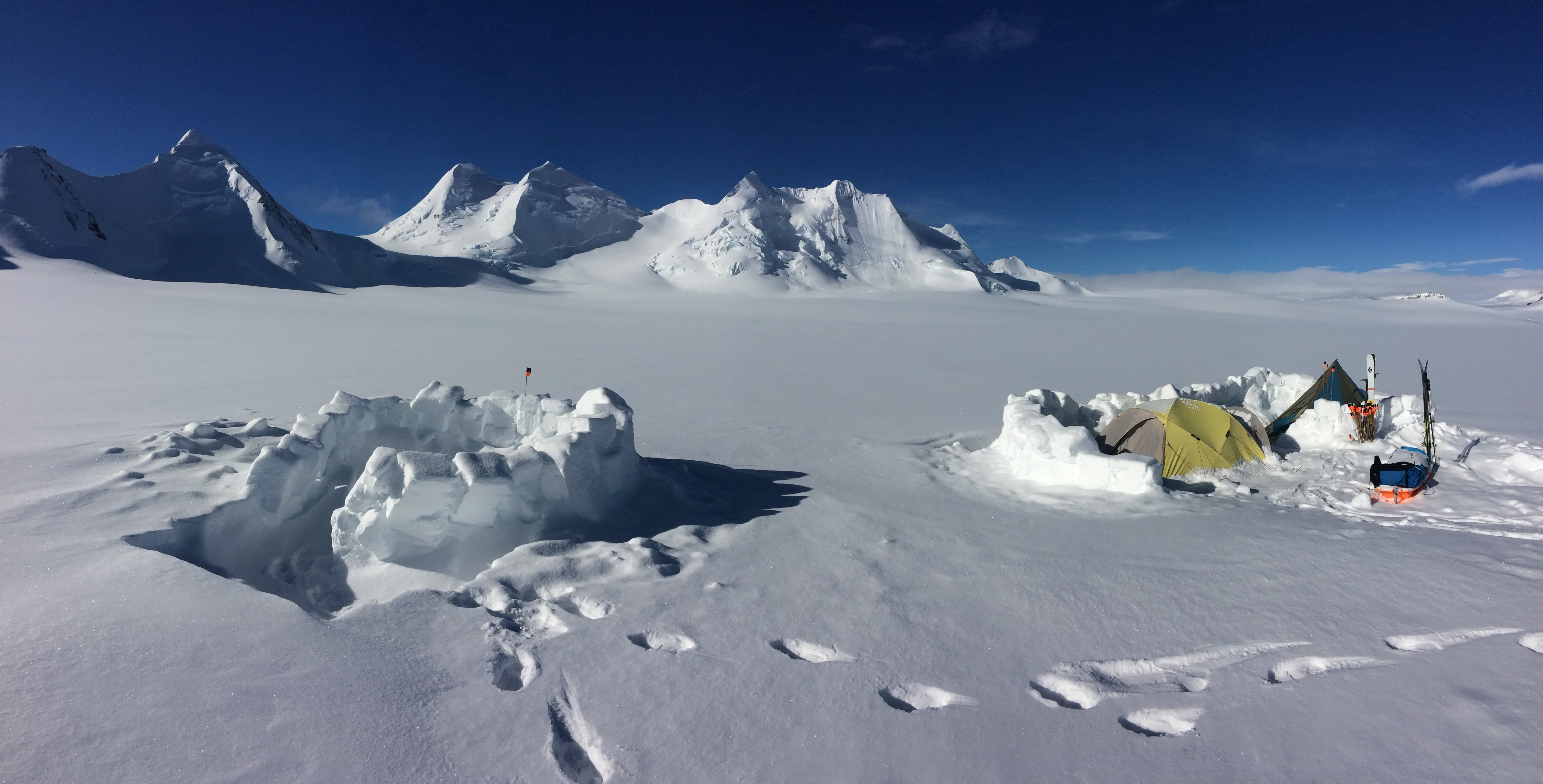
After an extensive fly over of the Chisana glacier region, Zack put us down in an ideal location for a ski-peakbagging binge at 8250′ ~3 miles SSE of one of higher peaks in the area named Little Deborah (according to its larger likeness in the Eastern Alaska Range). We took some time for a photo opp with Zack and his plane, but he quickly boogied out considering the encroaching cloud bank from the south. Taylor and I set up the Bomb Shelter and Megamid and settled in for our first night – stoked on the successful insertion, ideal surface conditions, and 320+ cm snowpack on the glacier at ~8250′.
Chisana glacier camp at ~8250′ (pc Taylor Brown)
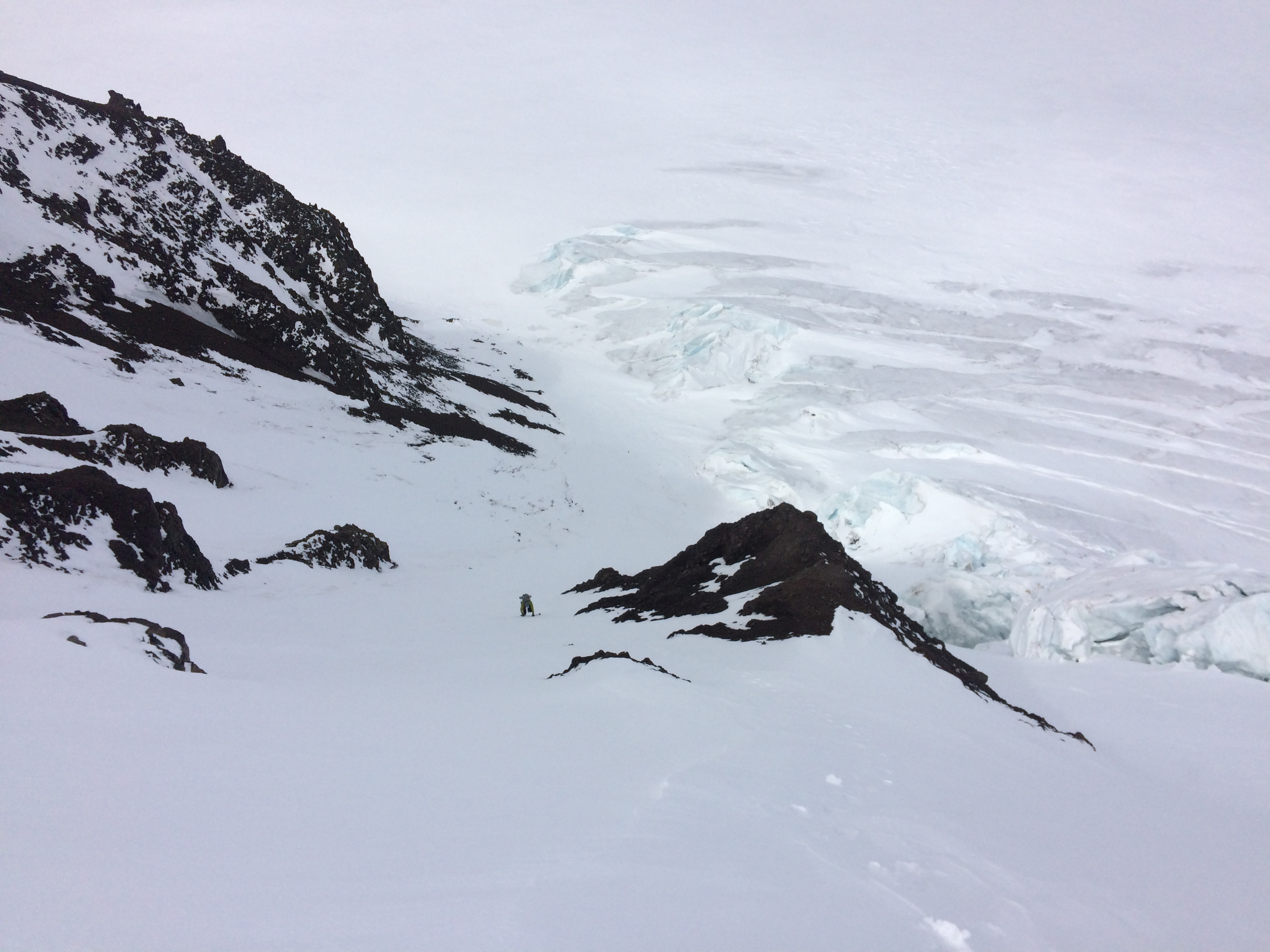
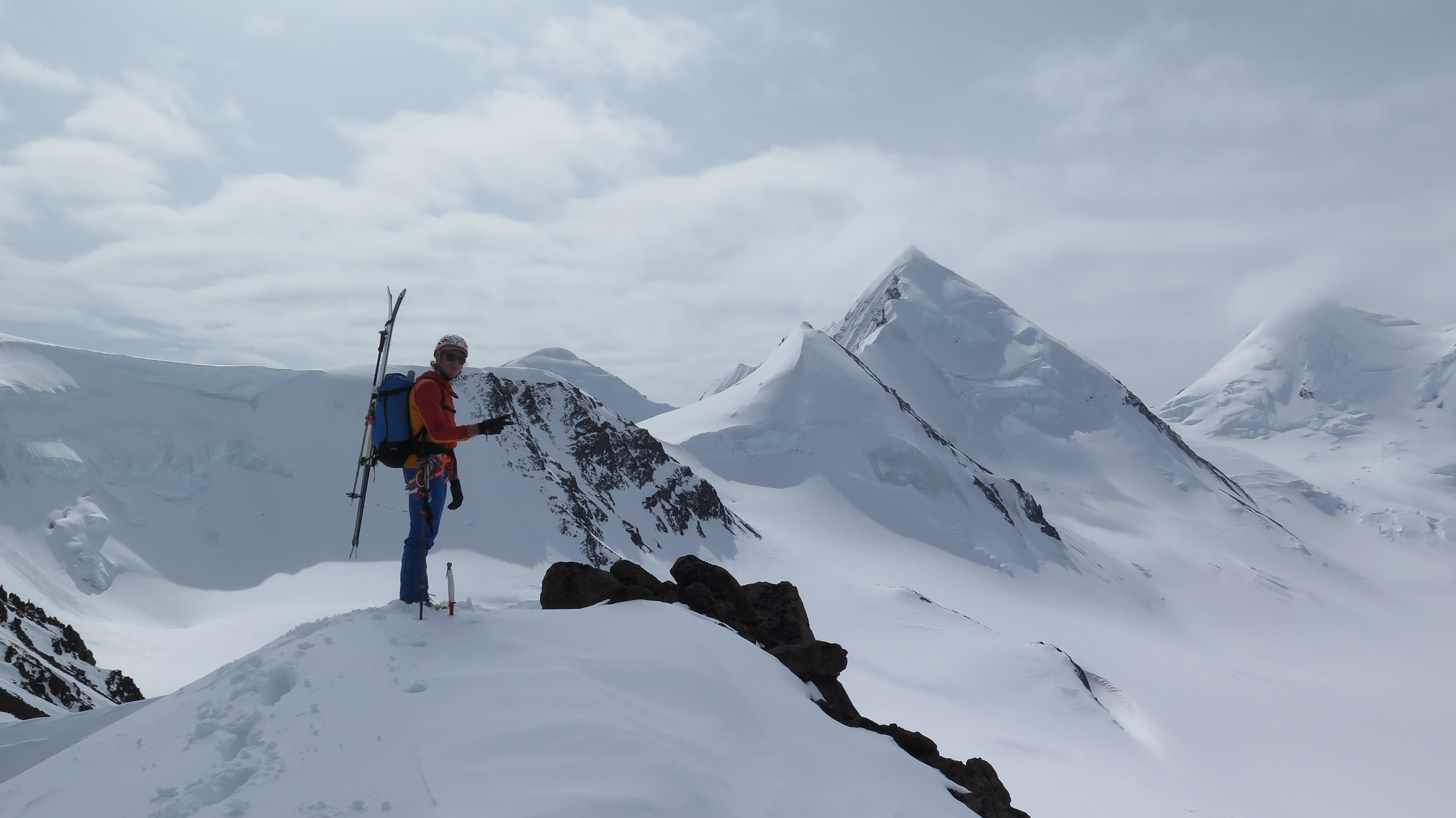
Wednesday, May 16 we awoke to what ended up being our best weather and snow conditions day of the trip. It was quickly decided that the basin to our north, formed by the south face of Little Deborah and surrounding peaks, was to be our first venue. We beelined to the south ridge of Little Deborah finding easy passage west of the crevasse field between ~9000-9500′. We climbed steep, wind-blasted, and icy snow up the south ridge from the col to the summit with ice tools. We negotiated a few crevasses on the ridge that had thin, rotten coverage – which became a theme of the trip: crevassed, icy ridges rife with body-width cracks that had superficial, faceted bridges that could be hard to see (especially in flatter light) and were completely unsupportable. The Wrangells are such an icy range; it’s hard to tell how much of the mountains are actually rock given how covered they are in ice – and that ice is very cracked up!
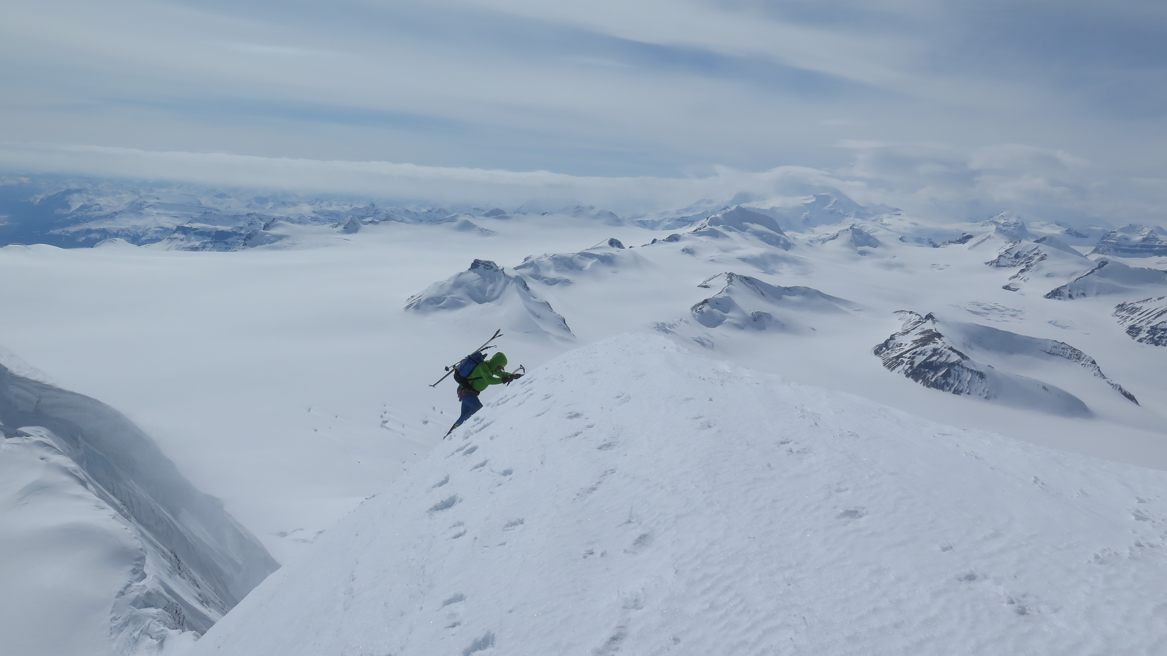
Mat nearing the summit of Little Deborah (pc Taylor Brown)
The summit of Little Deborah was in classic, big mountain alpine conditions with an already stiff wind exacerbated by it being the highest peak within miles. The 50+ degree iciness, wind, exposure, and cracks spanning from the south ridge through the south face had us down climbing a bit from the summit before stepping into our skis. After re-negotiating the most prominent ridge crevasse we were making careful, scratchy jump turns and hopping smaller ridge cracks before getting pitted for a few softer turns above the bergschrund jump.
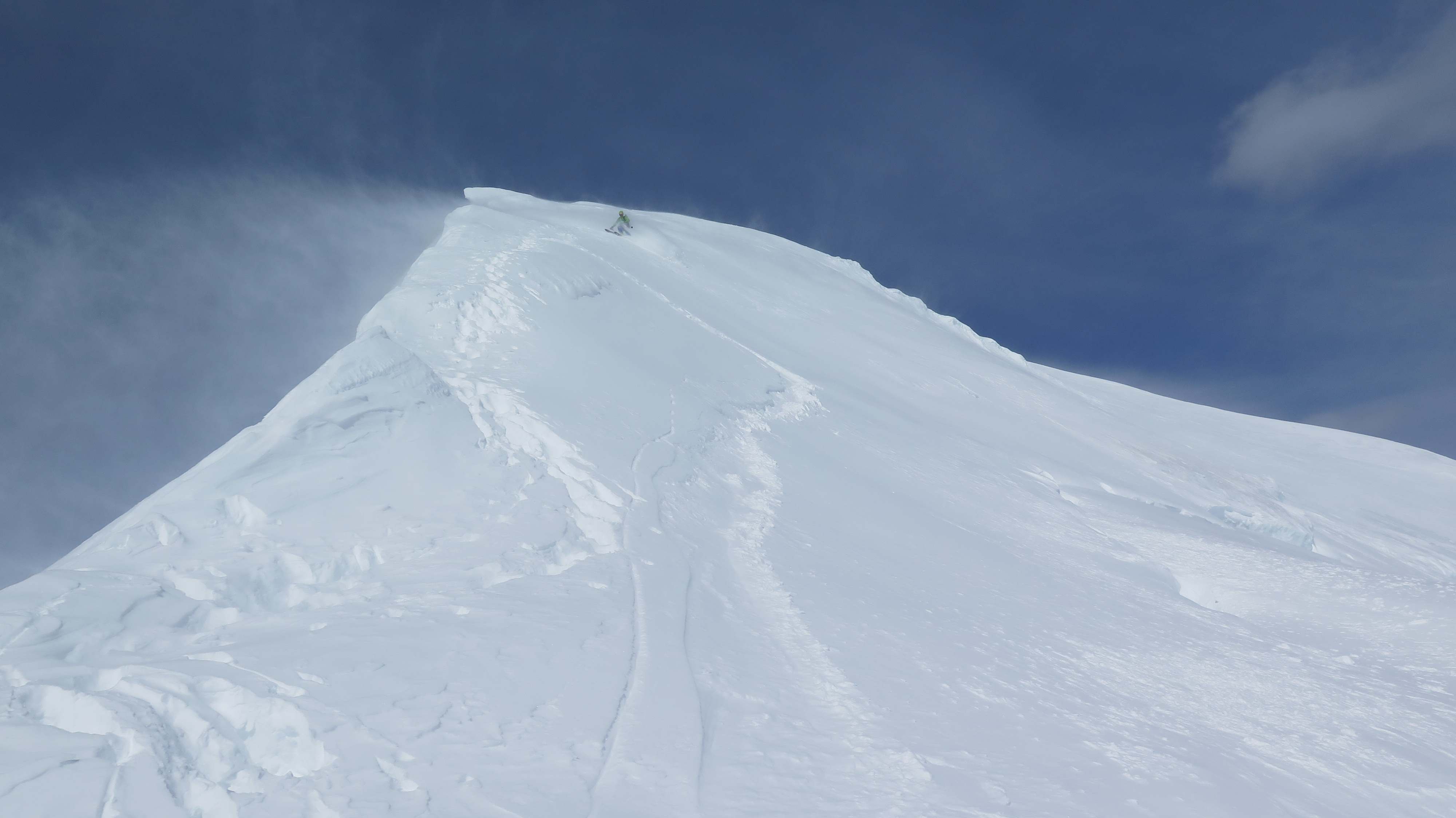
Mat skiing Little Deborah (pc Taylor Brown)
We rendezvoused a couple hundred feet below the col between Little Deborah and the peak to her south, and then headed up this 10200′ peak (which we dubbed “Little Debbie”) via its north ridge. Of note, due to glacier recession and melt-out, the slopes of many of the peaks in the upper Chisana area have more relief than appears on the map. From the summit of Little Debbie we descended an east facing shoulder in flat light and blowing snow via a sidewalk width path of softer, more recent, windblown snow between glacier ice. This made for reasonable turns, but hid crevasses, and one jump turn resulted in my uphill leg punching into a thin crevasse boot-top deep. After this incident, commitment had to be made to linking bigger, smoother, and faster turns to reduce the potential for further crevasse incident.
We continued south from the base of Little Debbie toward peak 9310, and attempted it via its north ridge. This ridge started out with straightforward travel, but a large overhanging cornice forced us onto the west face. After getting around the cornice and back on the knifey north ridge, the last push had extensive exposed, steep glacier ice. Having not gotten a good view of the south ridge and south side of the summit, we thought we might end up on a small and super-exposed summit pinnacle hemmed in by extremely hard glacier ice below the summit snow patch that would be difficult to down climb and hard to anchor into for rappel from the summit. We decided our horizontal front points were not up for the task, and skied the steep east face from just below the summit.
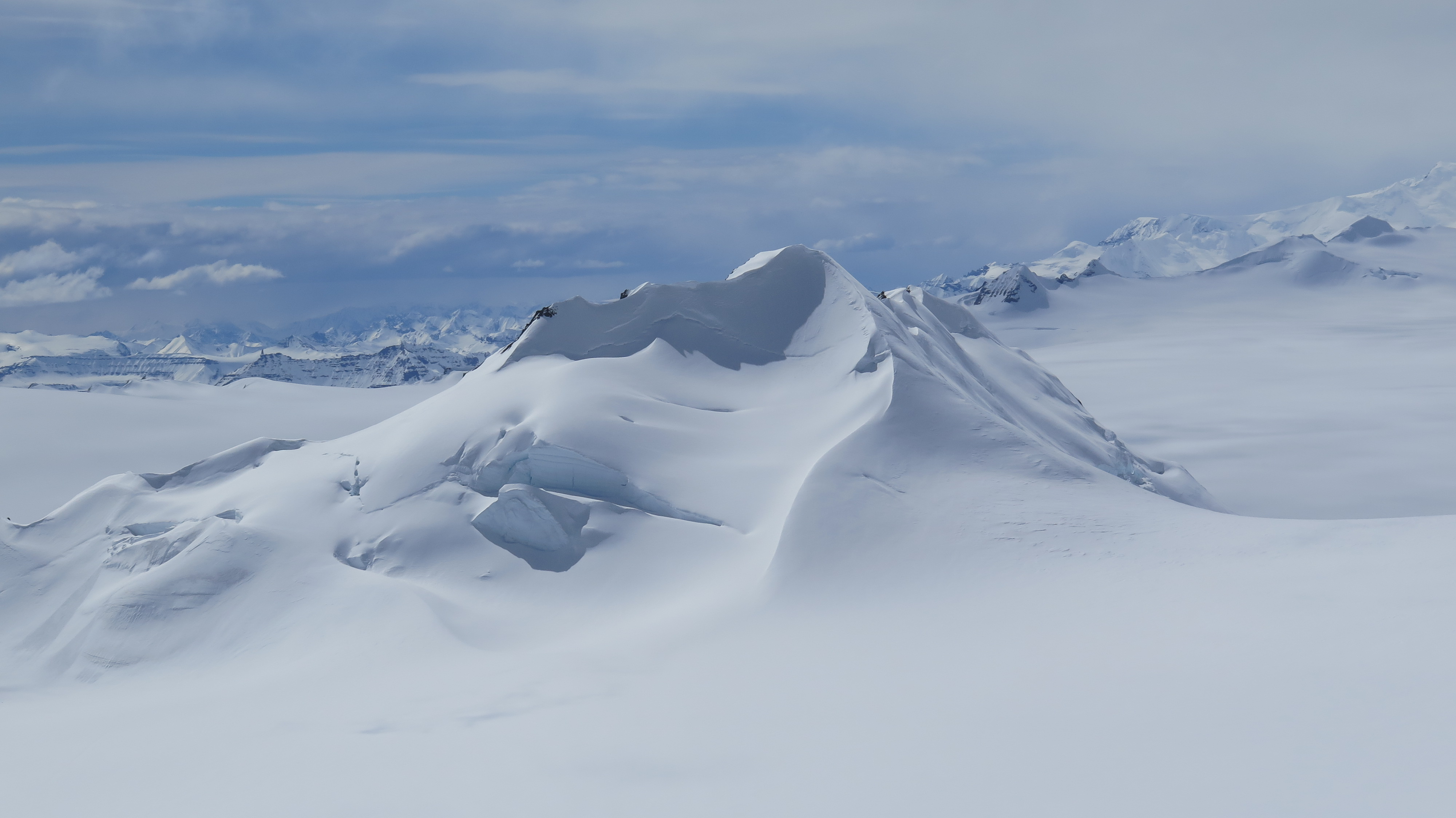
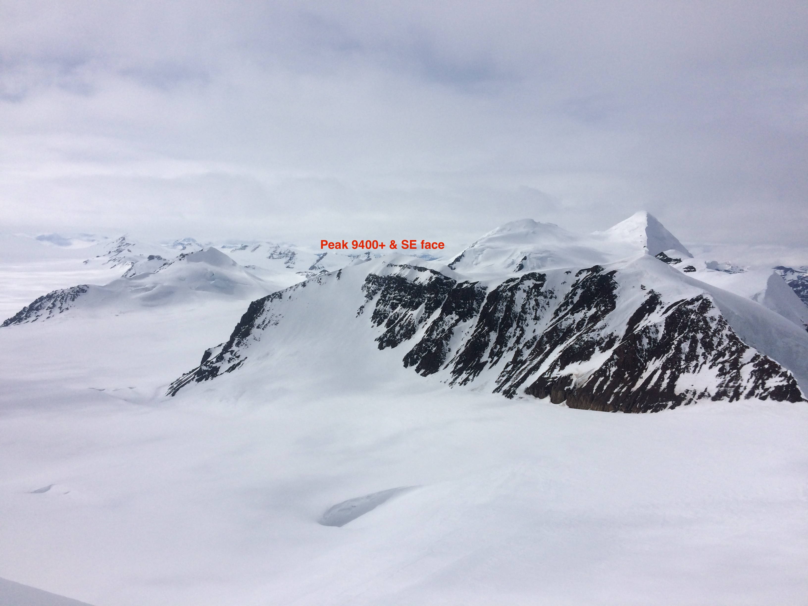
Peak 9400+ with N ridge and NE spine of 5/16/18 ski descent (pc Taylor Brown)
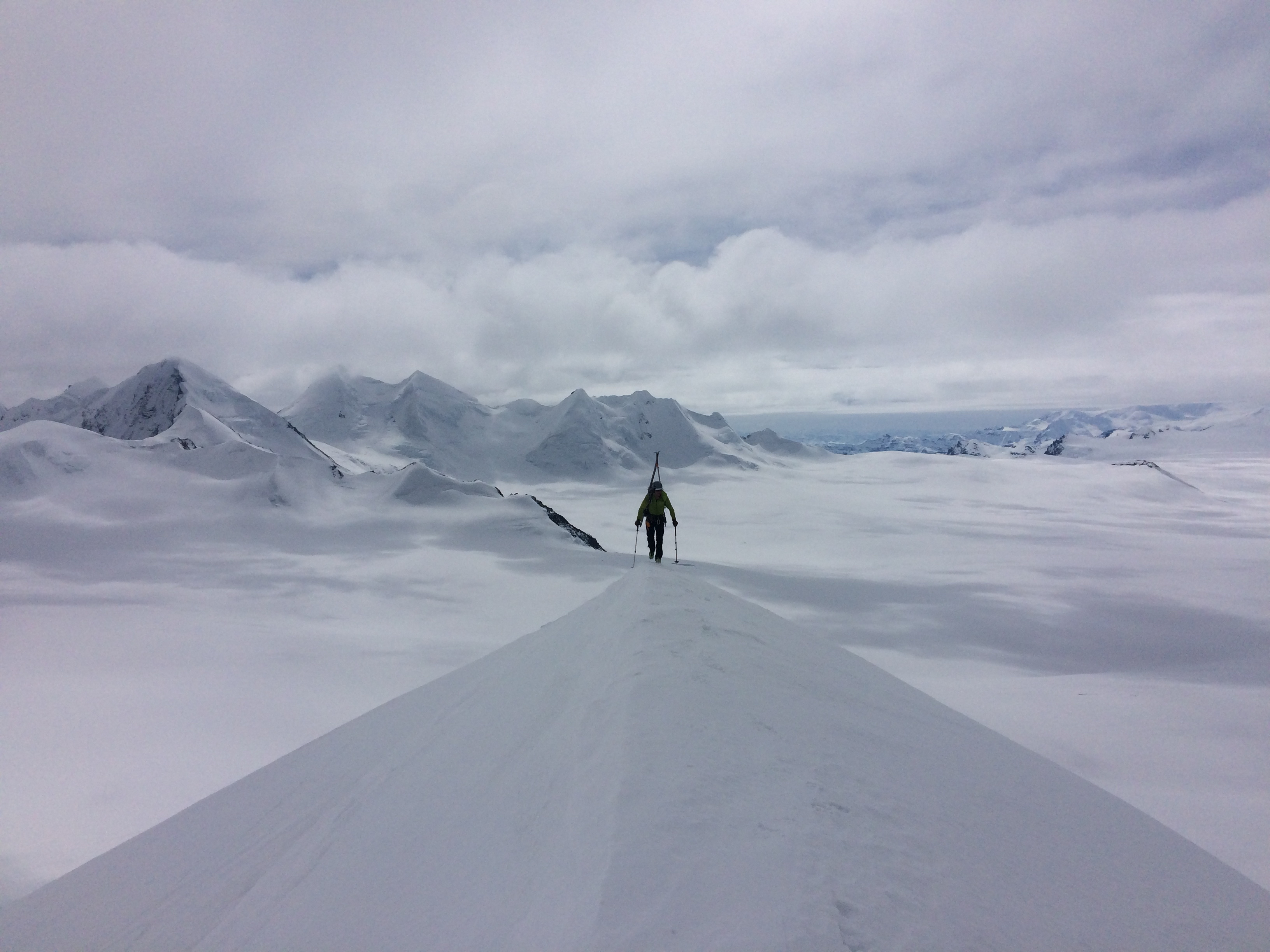
We continued our southerly trajectory from here and headed up the prominent 9400+’ peak that forms the SW corner of this basin. We climbed the N-NE ridge to the summit. This feature was one of the funnest and most aesthetic climbing and skiing features of the trip: a sharp, knife ridge from the summit that turned into a giant Wrangell spine on the descent as it turned NE toward the glacier basin. The upper ~500′ was 50+ degree slide-for-life off the west side of the sharp north ridge with big exposure down the gnarly NW side of the mountain. It then bends skier’s right (NE) into that giant, aesthetic spine feature which held softer and very pleasant snow back to the basin. From the basin we made a long downhill push back to camp with considerable double-poling and a bit of skating.
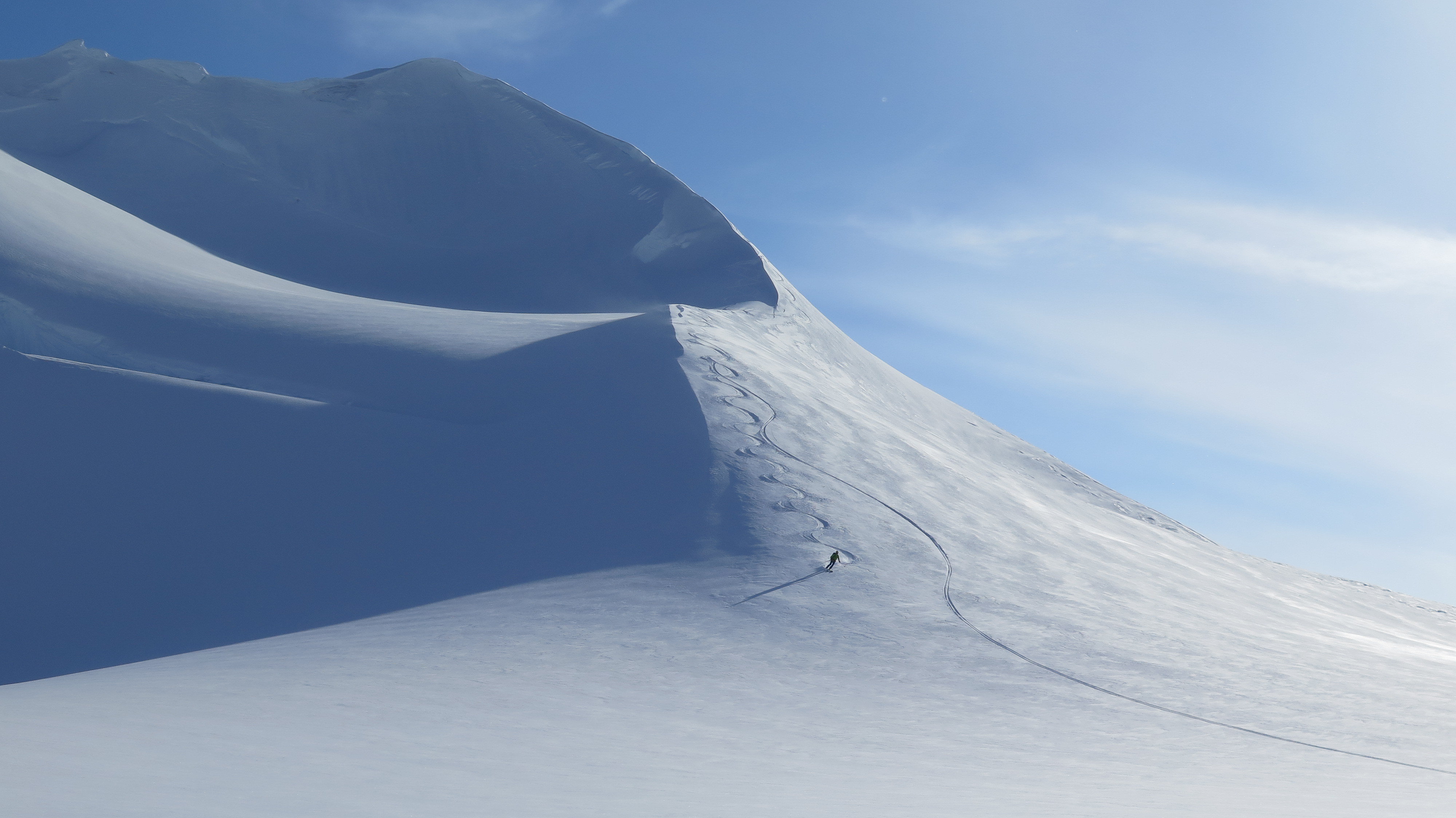
Mat skiing Peak 9400+ (pc Taylor Brown)
Thursday, May 17 we found ourselves camp-bound due to 30+ mph winds that continued through the day after raging through much of the late night and early morning. Taylor remarked about the “Mat Brunton Cross-Fit” of spending the day fortifying our camp. We had fun getting lifted by “burning fingers”, and lifting snow blocks, as we worked on our Chisana glacier engineering project.
Taylor climbing a steep, icy east facing chute to gain the peak-laden ridgeline east of camp (pc Mat Brunton)
On Friday we awoke to calm winds, but questionable visibility. We decided to head due east from our camp to bag peaks along the ridgeline leading up to the 9500′ high point in the center of quad 24 on the map. We climbed a steep, icy, easterly chute to gain the ridge that runs to the SE. Gaining the second prominent bump required some technical climbing on a strip of snice and alpine-glacier ice. We even got to grab some Wrangell rock jugging up a large horn on climber’s right. We climbed the two prominent peaks on the map leading to the 9500′ high point. While climbing the second peak (fourth bump) we noticed a very appealing ski lane on the first peak (third bump), and decided to return to ski it after a descent of the second peak – rather than continuing along the broadening ridge to the third peak (sixth bump) and high point of the ridge. We skied steep, northerly faces off these two peaks (both of which now have much more relief from glacier melt-out than the map suggests).
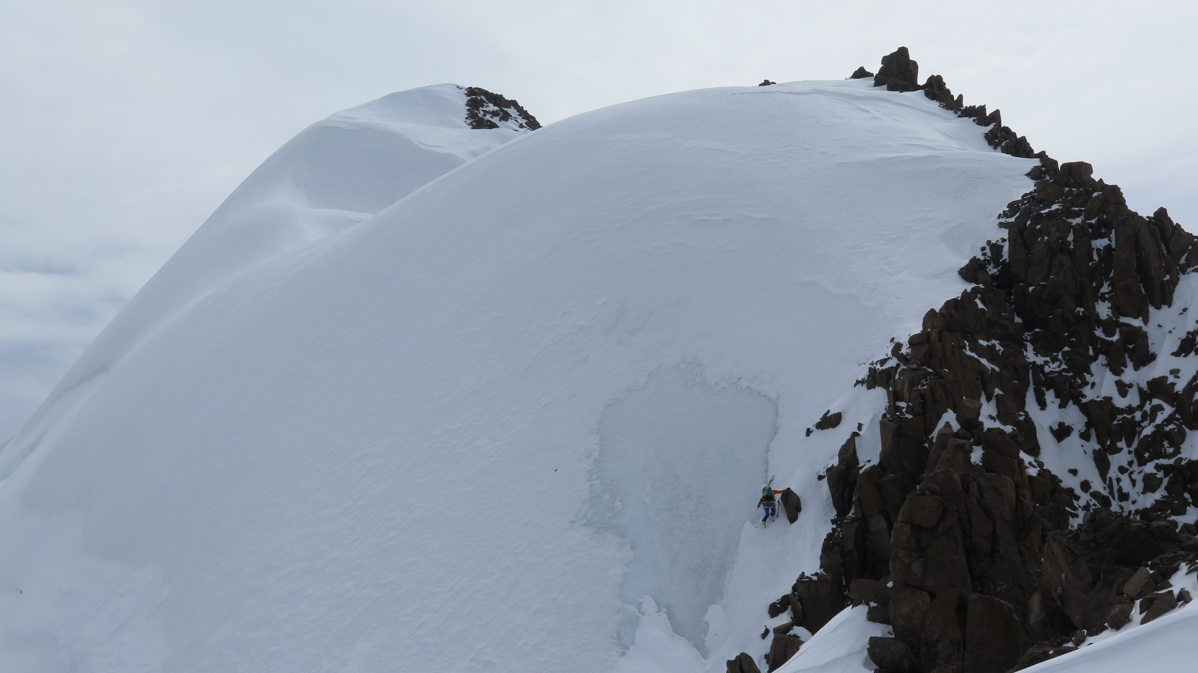
Mat climbing “Bump 2” (pc Taylor Brown)
Mat climbing “Bump 3” (pc Taylor Brown)
Peak 10630 area from Bump 3/First Peak (pc Mat Brunton)
Mat on Bump 3/First Peak (pc Taylor Brown)
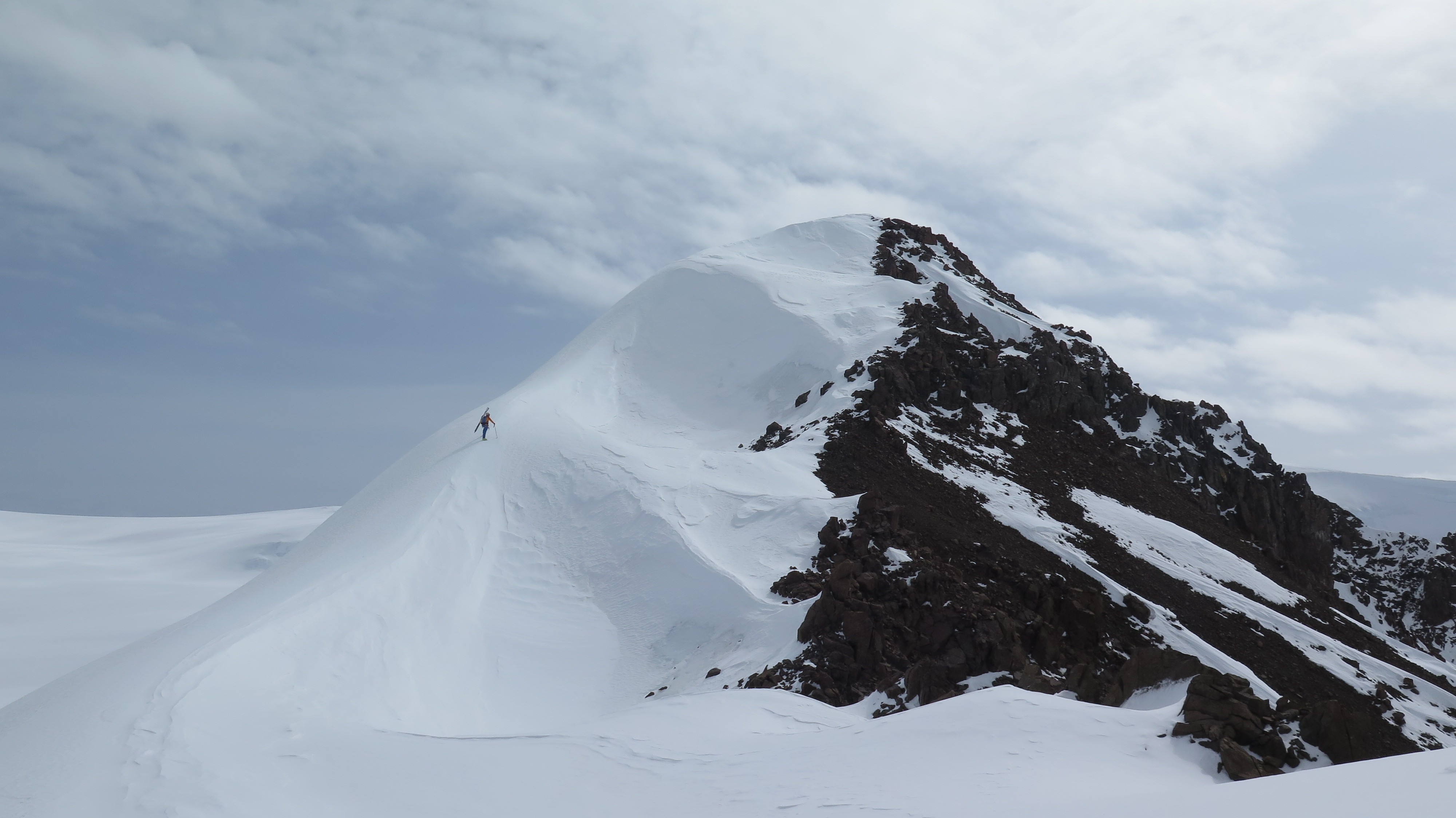
After these ski descents we headed about two miles NNE to the prominent 9605′ peak, which we dubbed Megamid peak due to its resemblance of the classic glacier cook tent. We gained the sharp south ridge at ~8700′ and took it direct to the summit. We then descended the south ridge from the summit on skis avoiding the extensive exposed alpine-glacier ice.
Taylor on the south ridge of Megamid Peak near the summit (pc Mat Brunton)
From the base we headed about a mile west to climb a beautiful, long, steep face up to another 9400+’ peak, which we then descended. This peak and its SE face provided some of the most consistently steep turns of the trip. We rallied a couple miles south back to camp making it all the way there in downhill mode with extensive double-poling and some skating after a detour to avoid crevasses. Of note, cloud cover and warm temps this day contributed to a greenhouse effect that really warmed the snow on most aspects. Snow conditions changed from wintry to melt-freeze that night.
Another 9400+’ peak we climbed and skied (Peak 9400+ is behind and left) (pc Mat Brunton)
Saturday we were again camp-bound due to snow, wind, and visibility. We had ample time for sleep, lounging, and wilderness meditation.
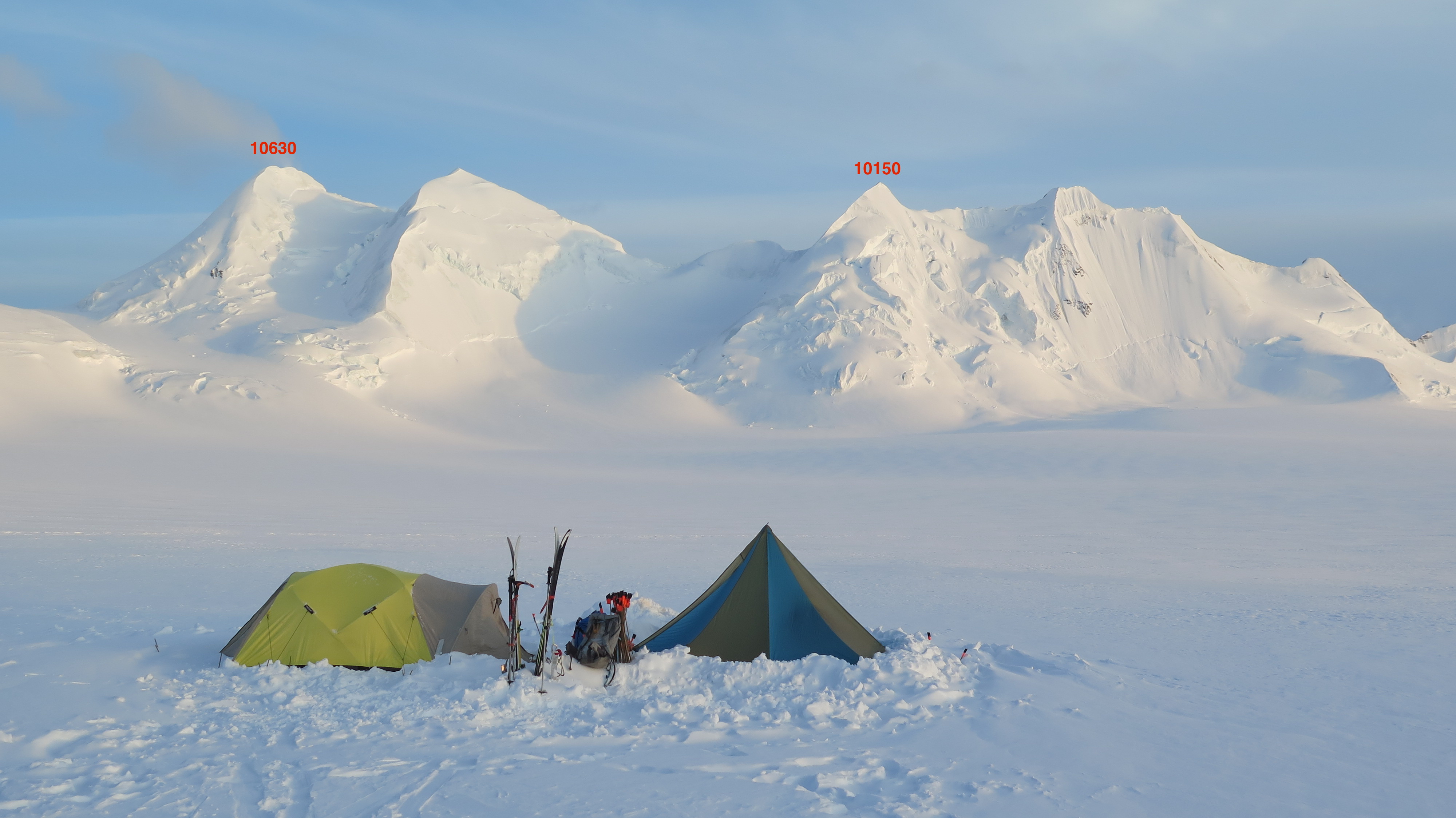
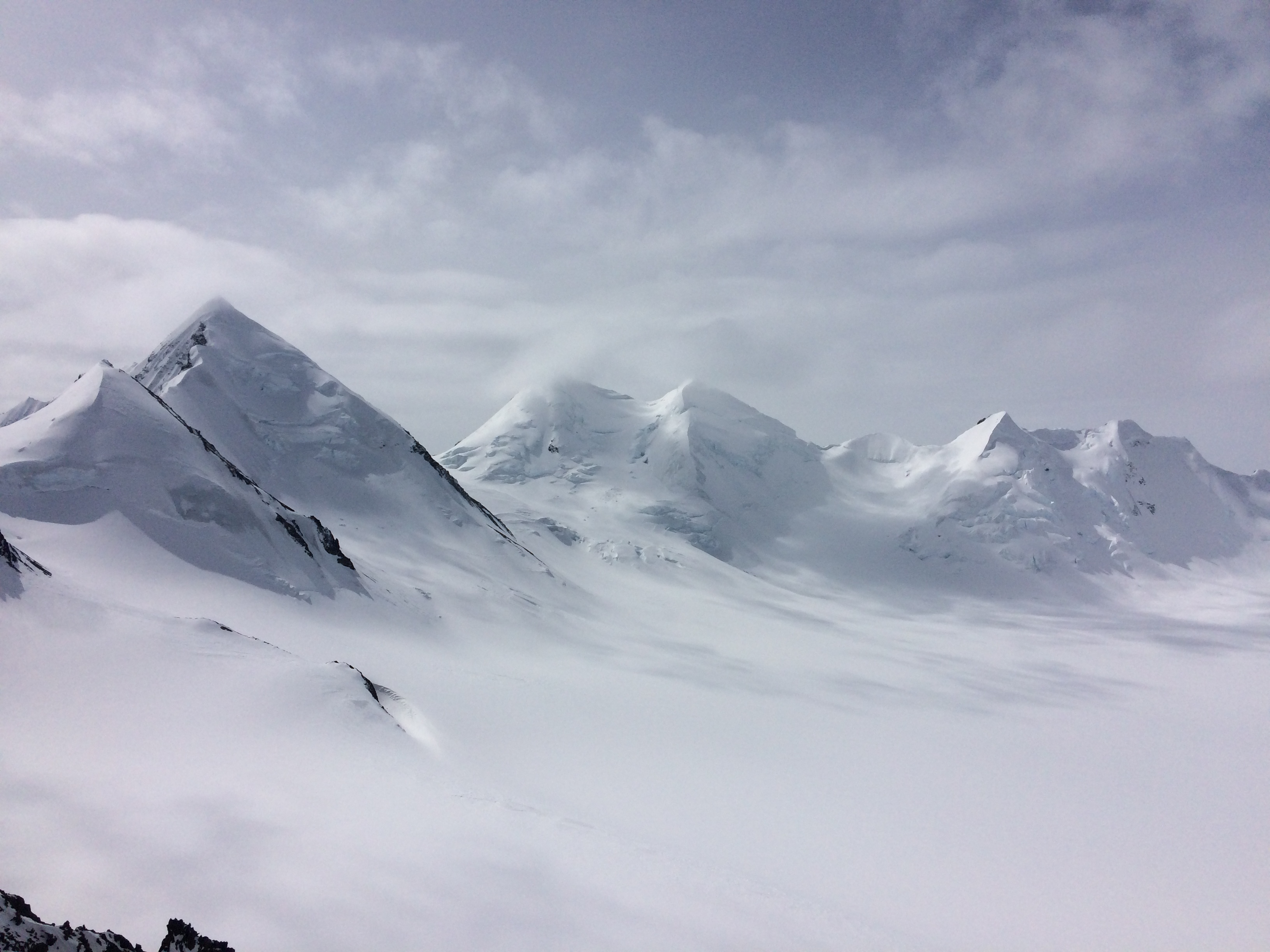
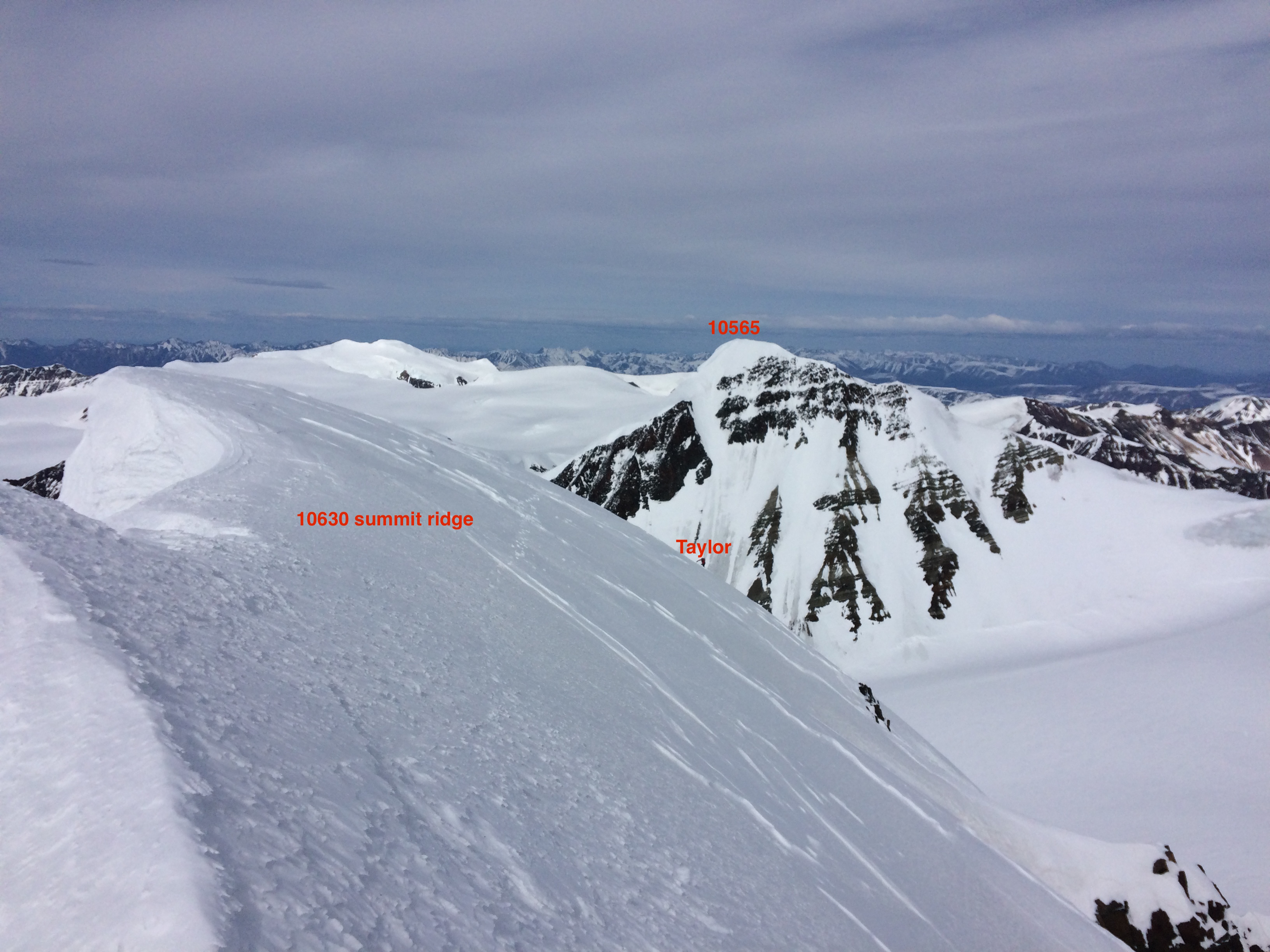
Sunday began questionable with some wind and poor visibility in the zones we had not yet ventured to. We enjoyed a very leisurely start to the day, which included a long nap after breakfast. Awakening from the nap, the visibility had improved and winds abated. We suited up and decided to head to the prominent 9500′ pass above a modest icefall between two of the gnarlier peaks in the area (10630 and 10565). We also wanted to recon and witness the stunning east face of peak 10150 which we noticed the day before and had dubbed “The Face of God.” It turned out to be ~1200′ of STEEP slide-for-life snice with some serac fall exposure to access (midday Monday after overnight snow, daytime warming, and increasing solar radiation a large serac fall occurred in the approach path).
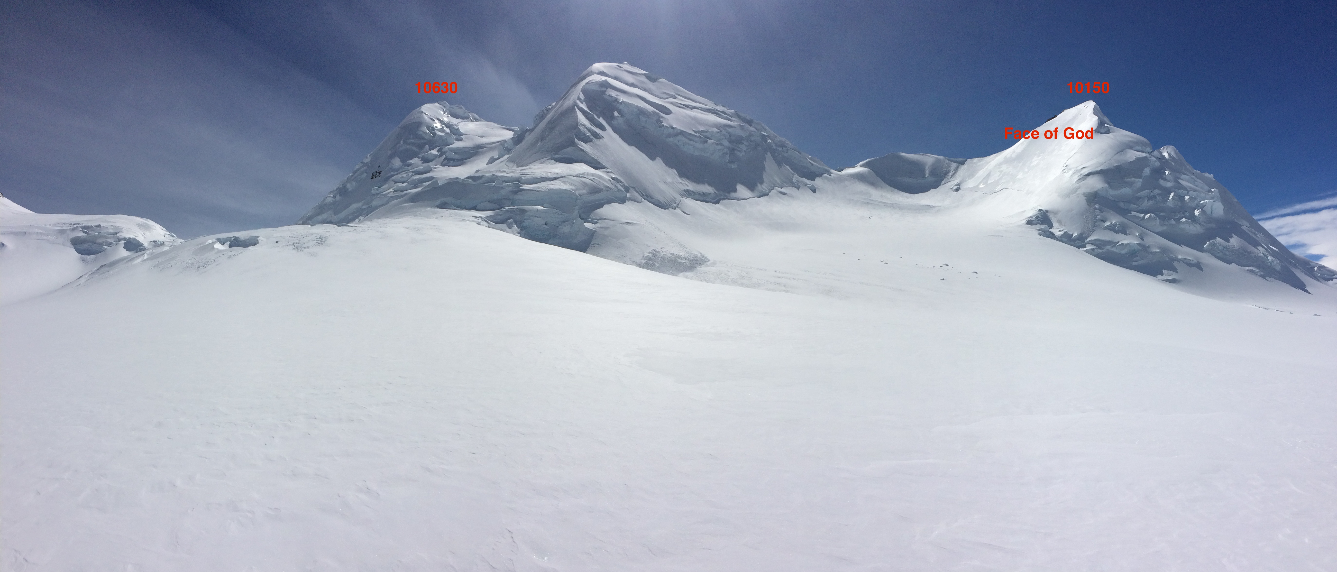
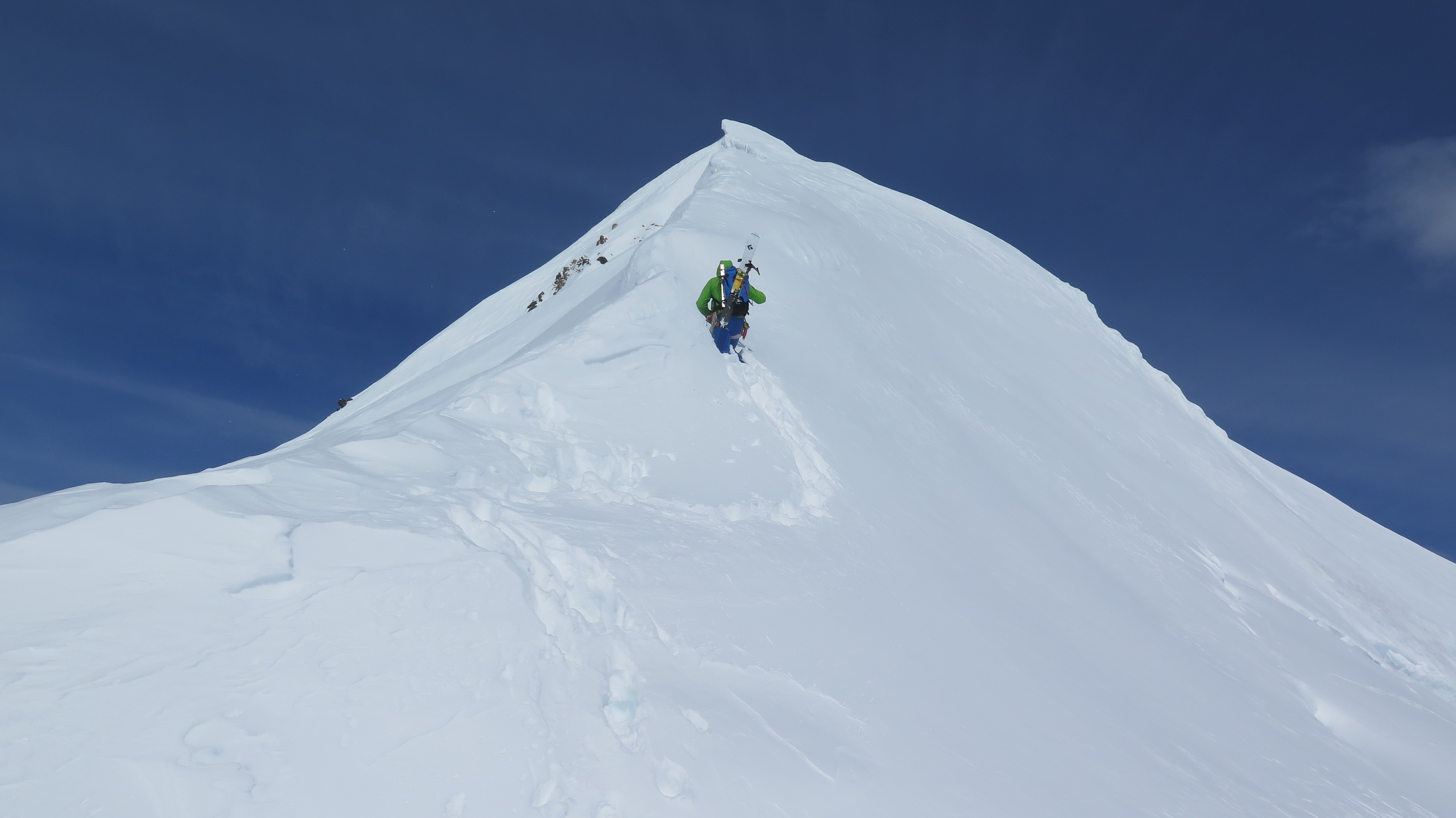
After scoping The Face of God, we made it to the pass and were directly below the large east face-ridge of peak 10630, which is the highest peak in the area and for many miles. We soloed up ~1200′ of steep snice and, for a couple hundred foot stretch nearly impenetrable, alpine-glacier ice. A short, but very exposed, walk along the corniced summit ridge took us to the top. We then soloed back down the 1200′ of toe-banging goodness alternating between full swings with the ice tools where there was harder ice, and more casual mid-upper shaft sticks in the snice. We descended severely wind-affected snow from the pass back to camp with the by-now-typical Chisana glacier skating and double-poling along the flats.
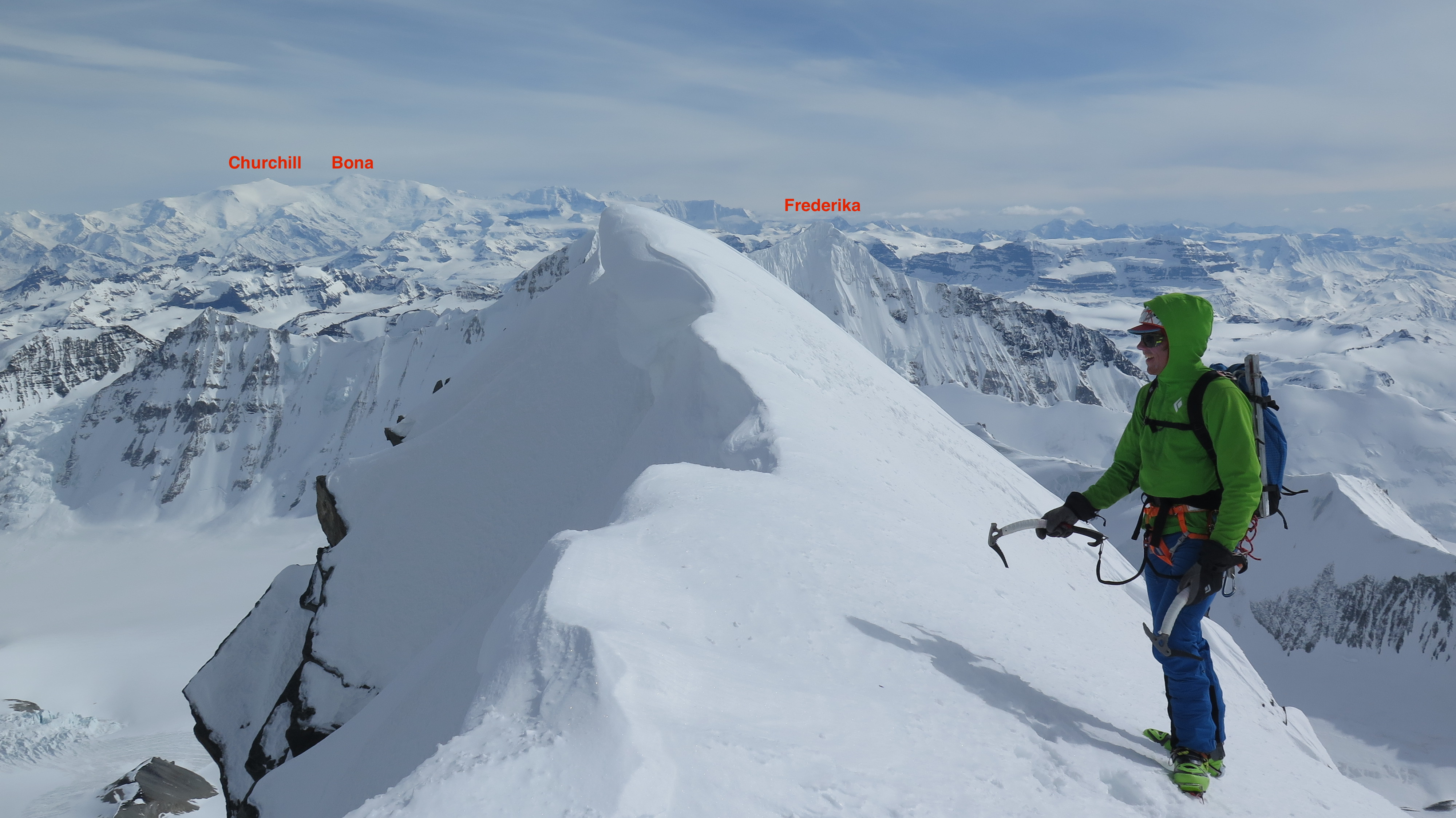
Mat on the summit of 10630 (pc Taylor Brown)
 (pc Taylor Brown)
Sunday night provided the biggest snow event of the trip with a few more inches (we received 1-2” Saturday night), which greatly improved snow conditions from the nasty, variable melt-freeze and wind-affected mank of Saturday. As it had now become clear that the basin south of Little Deborah provided the most consistent sucker hole of good weather on questionable visibility days, we headed back to that zone for unfinished business.
The day began with a mellow, but heavily crevassed ascent of the prominent 9500′ peak west of Megamid peak. We climbed it via its northerly ridge from a saddle NW of the summit and descended its west face. We then headed back NE to the saddle and ascended the other 9500′ peak NW of the first one and just east of point 9371 on the map. We dubbed this peak “Ancient Cornice” as millennia of southerly winds have created a seemingly soon-to-fail serac-cornice along the leeward north side. We weaved through numerous ridge crevasses, and then descended a steep and aesthetic southerly ramp-couloir feature from the summit back into the basin.
We beelined west back to Peak 9310 for another attempt at its summit – this time via the south ridge. This route proved much more reasonable than the north ridge, and a whippet and crampons put us on top. We descended SE from the summit on skis, and then headed back to camp for lunch and hopefully an afternoon session back to the higher peaks south of camp. Decreasing visibility and increasing winds nixed this pm session.
We awoke Tuesday to more of the persistent southerly winds, but they were moderate and only annoying rather than outright uncomfortable and stifling. Vis was also questionable: more of the same. We decided to inReach Zack for a weather update. After doing his weather research (which he told us later took 1.5 hr), he pinged us back with disheartening news: the weather looked to be getting nastier for the next couple days and he did not expect a reliable window to get us out before Saturday, and maybe not until the following Monday.
With our camp significantly melted out from a week’s worth of living, our sleeping spots feeling less like beds and more like lazy-boy recliners, and the daunting thought of having to chisel out a new camp in the increasingly firm spring snow and refortify it for more potentially stormy weather; we decided to see if Zack could sneak in that day for the pull out. Thermal troughs throughout the state, rain and poor visibility in Tok, southerly flow, and nothing promising from his pre-flight assessment; Zack was very skeptical. We assured him we were under a big blue hole with at least 15 miles of good visibility in all directions. He told us not to lie to him. After reiterating, giving him our estimate of wind speeds, and suggesting the Chisana river-glacier route looked promising for his access; he told us to be ready for pickup in 1.5 hr.
We were skeptical too, especially as the weather definitely did not seem to be improving, and neither of us expected Zack to put himself (or more of our hard-earned money than necessary) at risk to get us out. We made plans to break camp in a way that could easily be reset up if Zack didn’t show – basically packing everything up and preparing the tent and mid for ripping out but leaving it in place until we had a visual on the Sky Wagon.
After those preparations we had about a half hour to spare, so we went to work on a runway for Zack given the decreasing vis and potential for a flat light landing. He provided us with a few large, black contractor bags to fill with snow to mark a LZ which we developed further with our wands and a skin track grid (that was rapidly being erased by the increasing winds).
As the 1.5 hour mark approached we had become very doubtful about our prospects of getting out that day given the deteriorating weather in our zone, crap conditions near Tok, and ominous clouds outside our 15 mile blue hole radius. After 1 hour 38 minutes, and at perhaps the peak of our doubt, Taylor saw-heard the Sky Wagon in the distance. Approaching threshold wind speeds for flying, we crossed our fingers that Zack would have a successful landing. We packed the tent and mid in short order, Zack made his landing, and we rallied the gear on sleds over to the plane. Zack loaded while we deconstructed our makeshift LZ, and we were airborne.
Given our luck, Taylor convinced Zack to give us a recon fly by of Mt. Allen on the way back to Tok. Although Zack said “we might get our ass kicked,” he obliged and made a few circles. We then flew over Tetlin National Wildlife Refuge and the eastern Mentasta Mountains in good vis, before descending into the rain as we neared Tok. From past experience, I figured Tok was always a bag of sunshine. However, it poured rain that night (and the following day) but Zack’s cabin was serene. He grilled up salmon and we provided some leftover basecamp tortillas and cheese with fresh fixings from Three Bears for a big dinner.
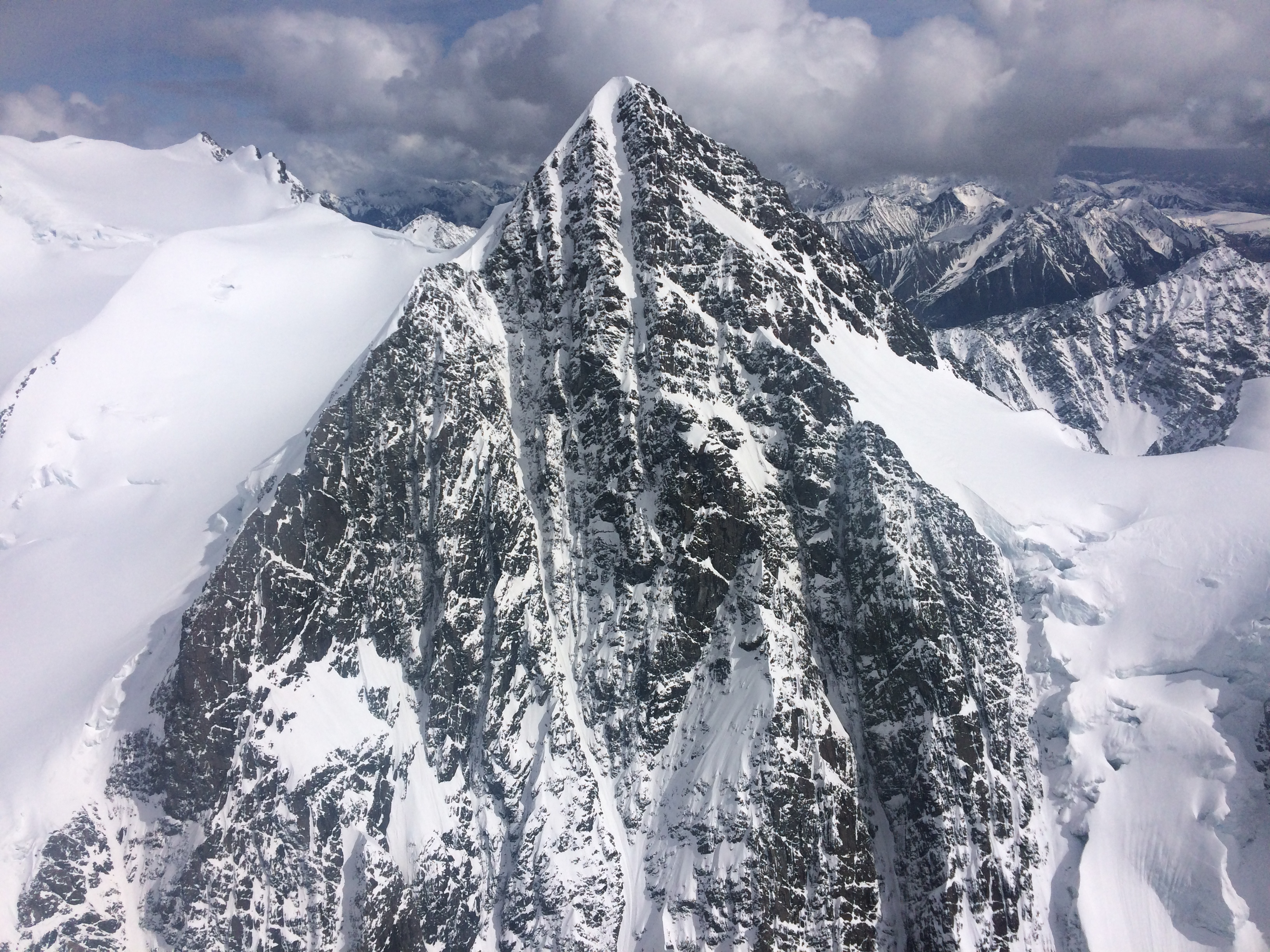
Allen and its striking west face (pc Mat Brunton)
It would be impossible to speak highly enough about the friendliness, hospitality, and wonderful service provided by Zack Knaebel: owner and operator of Tok Air Service. Likewise in regard to the knowledge, planning, and friendship of FarFarGnarGnar guru: Taylor Brown. We also can’t go without mentioning the pioneer of the upper Chisana glacier region: Danny Kost. He made a few excursions into the area in the late 90s and early 2000s, climbing numerous (likely first ascent) peaks including Little Deborah, 10150, 10630, and the two 9500′ peaks we climbed and skied in the basin on the south side of Little Deborah.
~Mat Brunton