
Avalanche Danger Forecast
Issued Monday, February 1, 2021 at noon for the greater Anchorage area Western Chugach Mountains (i.e. Chugach State Park). View map of primary forecast area here.
Monday-Thursday:
Avalanche danger will remain at moderate through this forecast period.
Small, fresh wind slabs on leeward terrain in the upper elevations will be the primary avalanche problem. These are generally not expected to be large enough to bury a person (in the absence of terrain traps), but could cause a fall or loss of control with associated dangers.
Small to medium sized persistent slabs are a twofold lower probability but higher consequence avalanche concern. First, and most likely to be human triggered, moderate to strong northerly winds in exposed upper elevation areas over the weekend may have created wind slabs that are still reactive to human triggers. Second, and while unlikely, diverse and widespread persistent weak layers deeper in the snowpack may still be reactive to human triggers if one is unlucky enough to find a “sweet spot” trigger point similar to that found by a party in the South Fork Eagle River area on Tuesday, January 26 (more details here):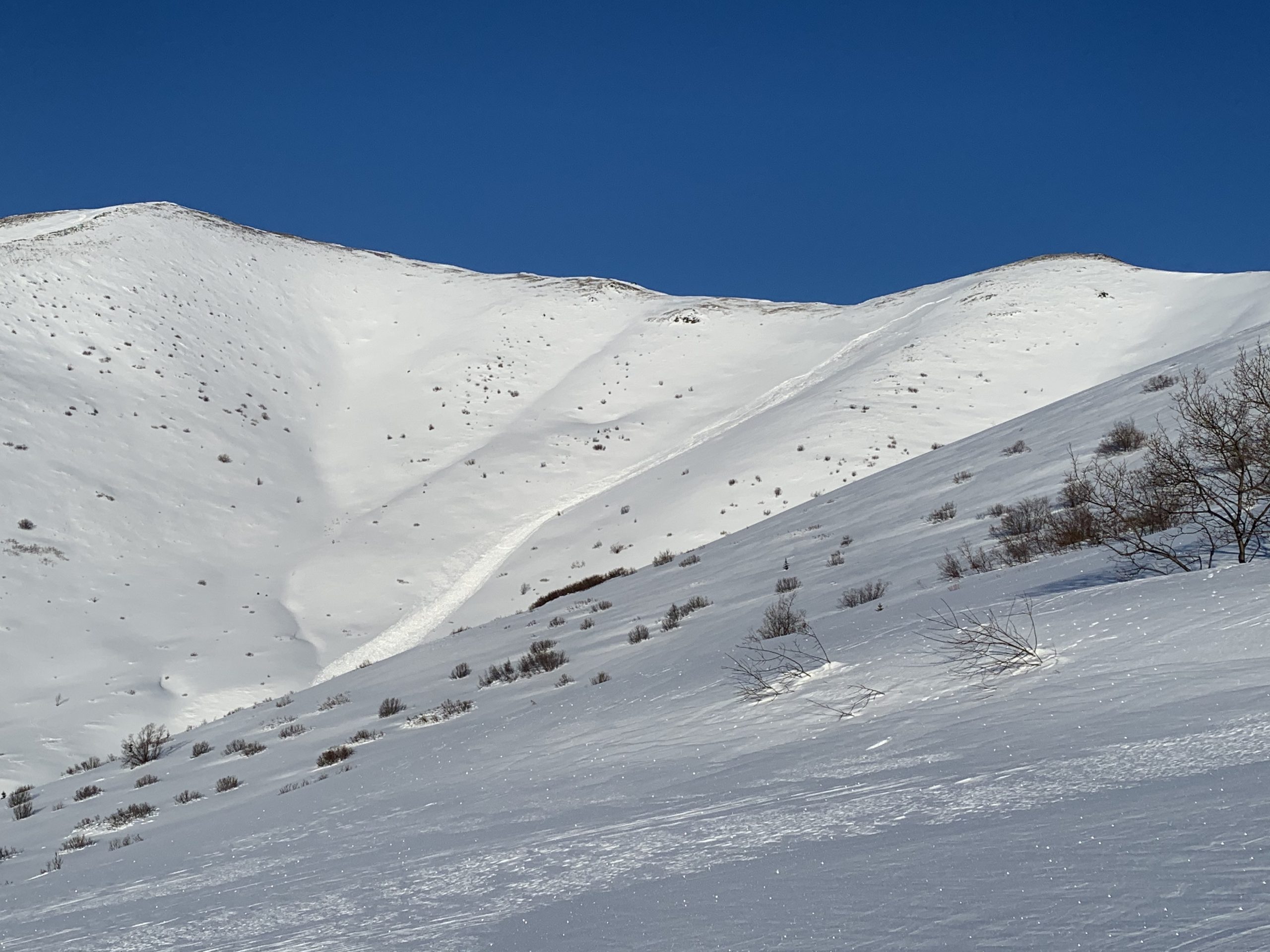
Mountain Weather:
Monday: sunny, alpine temps in the single digits, light to strong northerly winds
Tuesday: increasing clouds with a chance of light snow later in the day, alpine temps in the single digits to teens, light to moderate easterly to southerly winds
Wednesday: a chance of light snow early with potential clearing later in the day, alpine temps in the teens, light to moderate wind (easterly-southerly early, possibly northerly later)
Thursday: potential clearing, alpine temps in the teens, light to moderate wind (northerly with clearing skies)
Discussion:
The past forecast period provided a lot of sunshine (more than initially expected). Many people were out enjoying the Western Chugach snow and sunshine over the weekend with no red flags or avalanches reported or observed. While the most recent significant snowfall from the prior weekend (January 23-24) became wind-affected in many areas last Wednesday-Thursday (January 27-28), a lot of terrain was relatively unaffected and surface conditions remained quite nice.
In the South Fork Eagle River area, the Rendezvous Ridge (SW) side of the valley was heavily wind-affected and decent surface conditions could only be found in the most sheltered areas of the mid elevations and below treeline. While on the other (NE) side of the valley (Harp massif), great powder was not hard to find.
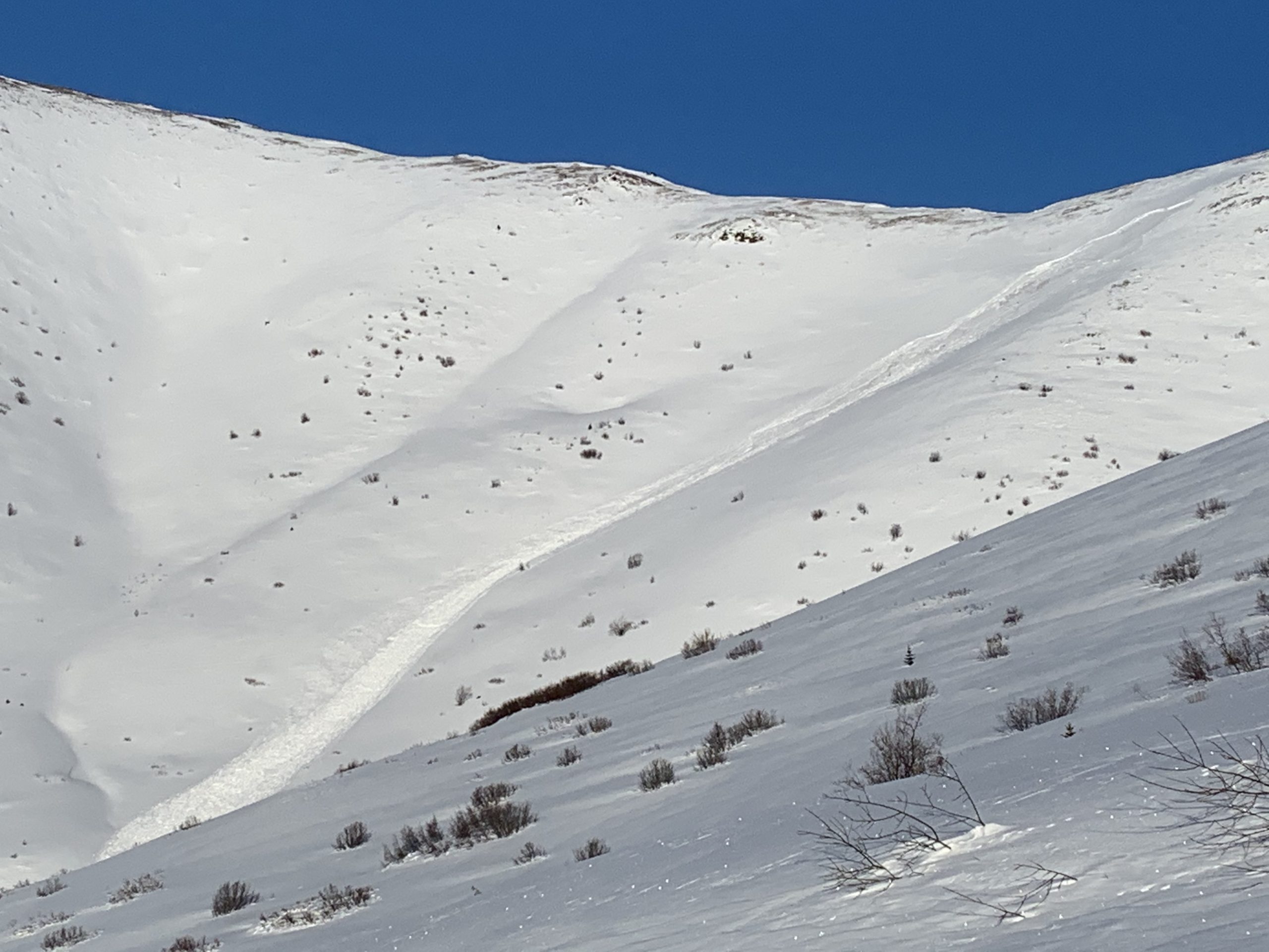
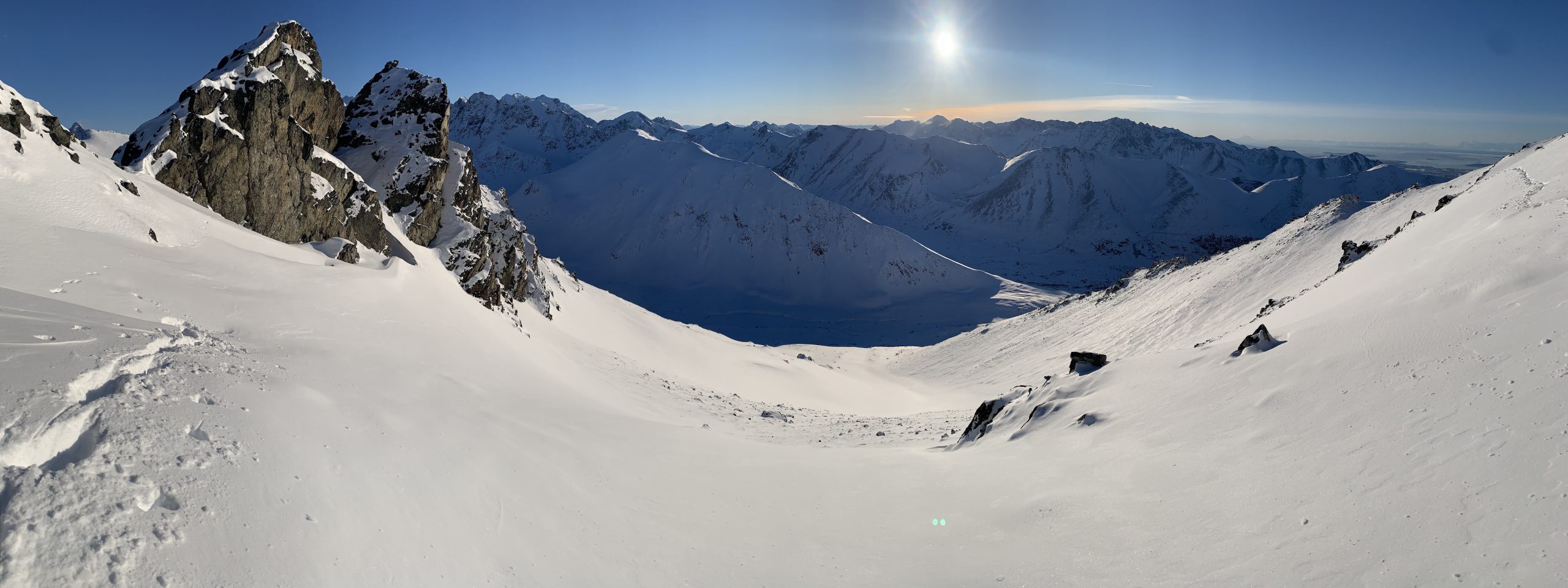
Dropping into the Ship Creek from South Fork on Saturday, decent turns could only be found in the most sheltered mid-elevation areas and below treeline: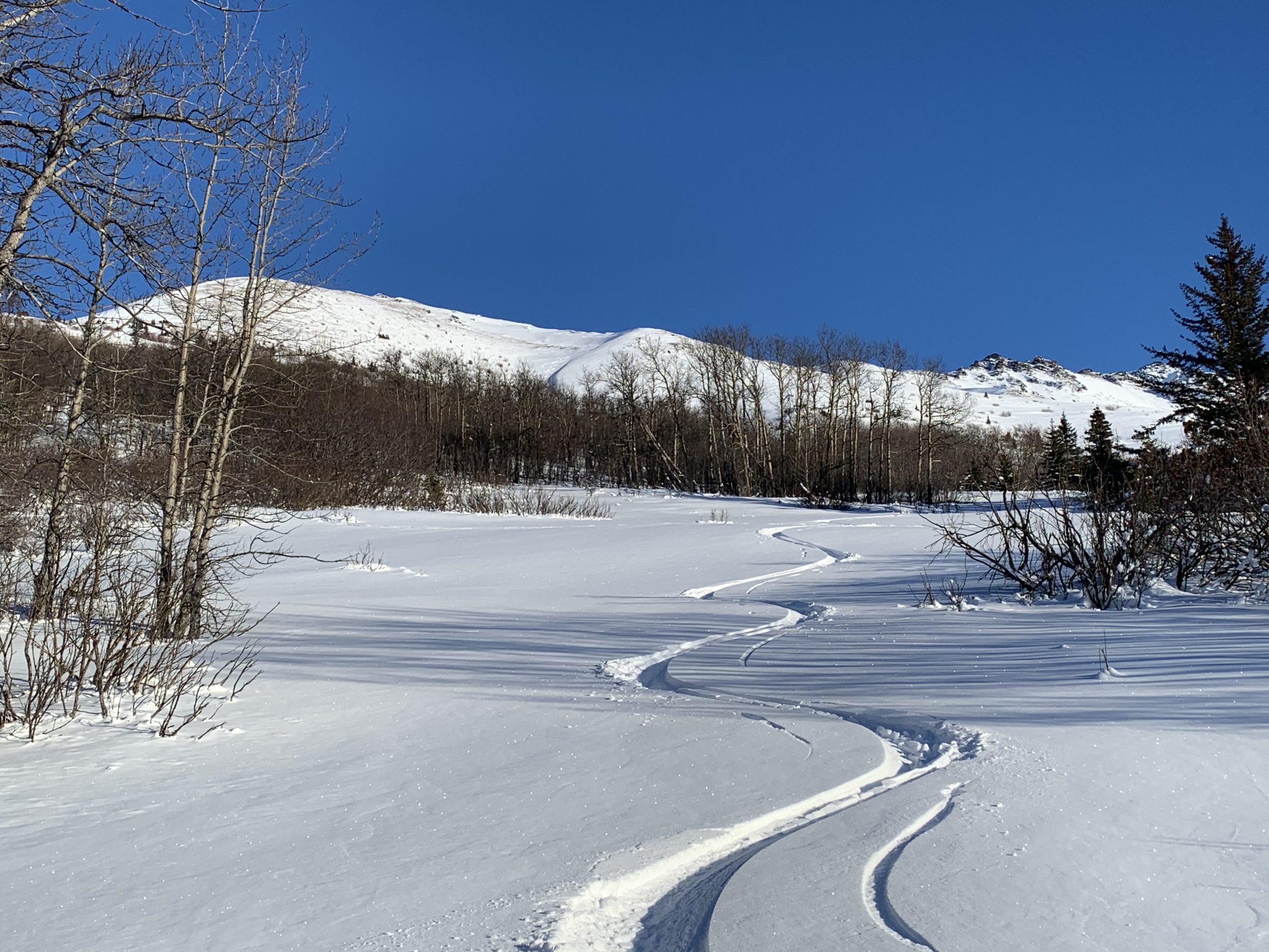
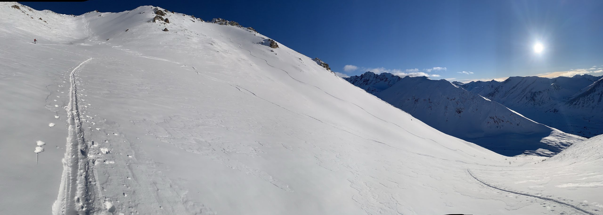
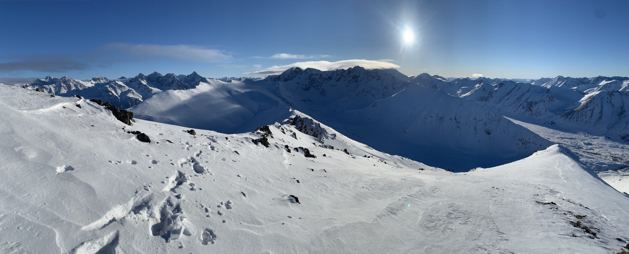
On Sunday, great skiing was found on the other side of the South Fork valley at all elevations and on multiple aspects: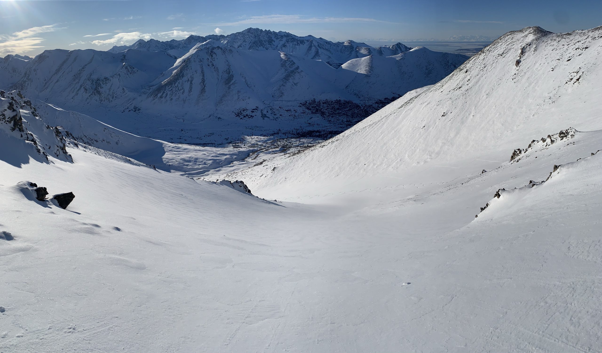
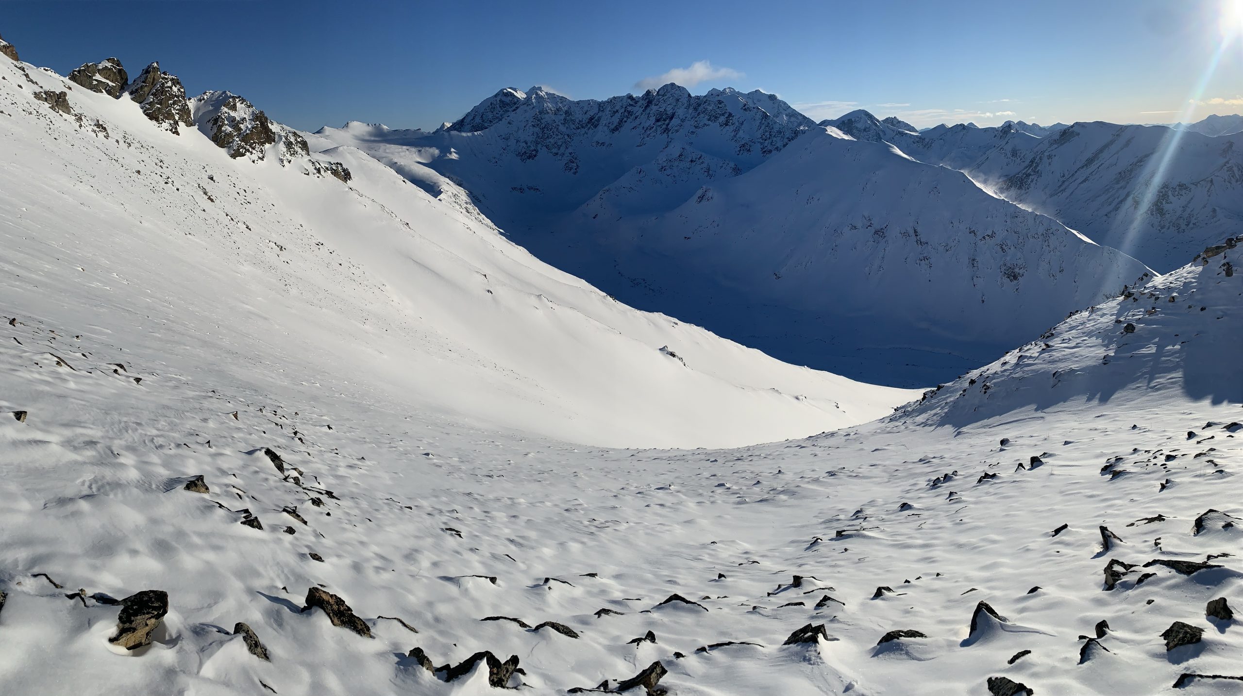
In this photo, the wind-affected snow on the Rendezvous Ridge (SW) side of the South Fork valley is evident: 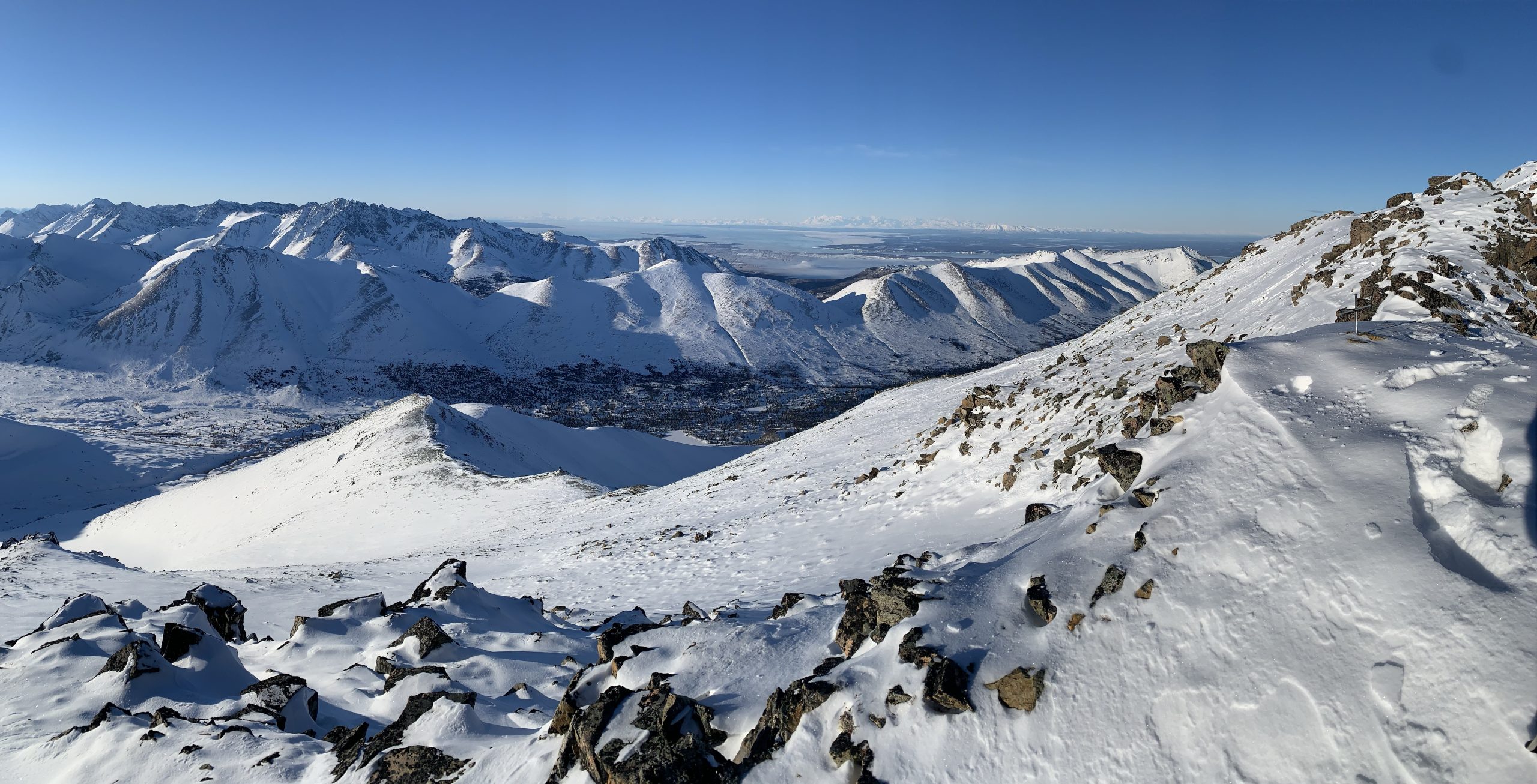
Avalanche Problems:
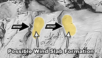
 Human triggered wind slabs up to D2 in size are possible above 2500′ on leeward terrain steeper than 35º.
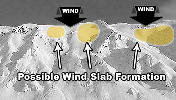
Strong northerly winds, that picked up Sunday afternoon and will continue through Monday, are affecting exposed upper elevation terrain (primarily the higher peaks and most western terrain in the forecast area). Fresh wind slabs have likely developed in such areas.
As winds will shift through this forecast period, and considering that the terrain of the forecast area channels winds in varying directions, it will be important to pay close attention to wind scouring and loading patterns in the upper elevations in order to better understand where potentially reactive wind slabs may exist.
A couple inches of new snow are possible this forecast period (most likely late Tuesday into Wednesday morning) and, if it materializes, is expected to be very light and low density – making it easy for any wind later this forecast period to create fresh wind slabs from it.
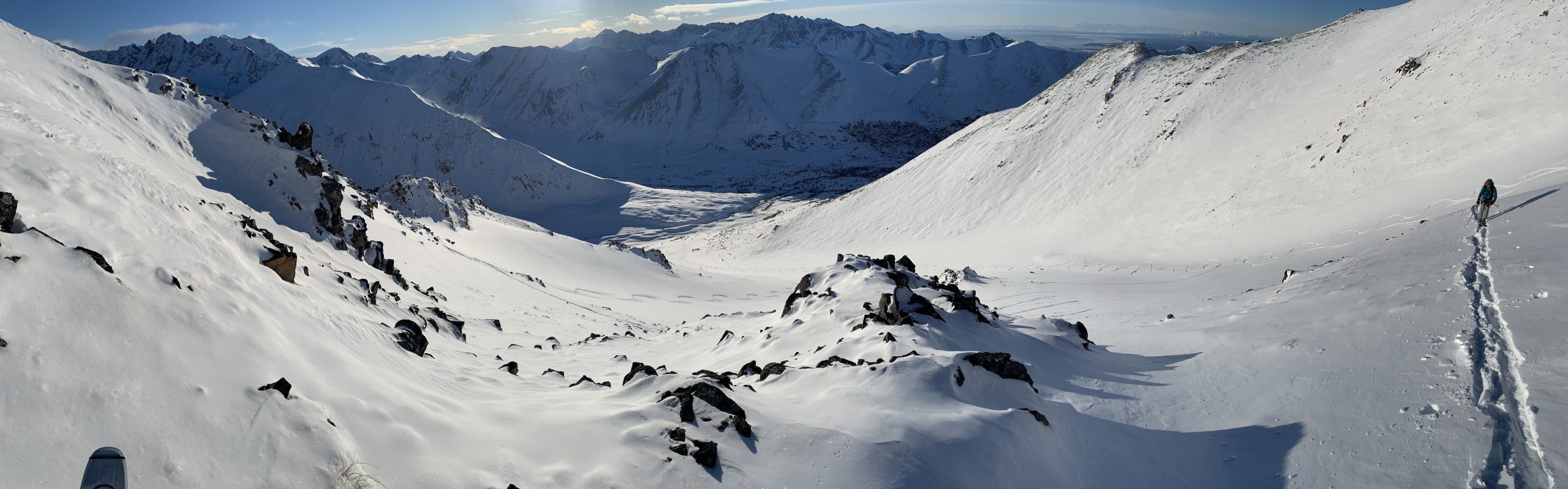
Wind slabs are most likely to exist below corniced areas and along the lee sides of ridges and cross-loaded features like gullies:
Active wind loading, recent avalanches, and shooting cracks are red flag indicators of wind slab danger. However, red flags like recent avalanches and shooting cracks may not be present through this forecast period.
Relatively densely-packed (firm and “punchier” feeling) snow and pockets of deeper snow (especially with a bulbous or fat appearance) are expected to be the most reliable indicators of wind slabs this forecast period. If you look closely at the snow surface, you may be able to distinguish areas where wind slabs exist due to the snow having a more textured, densely-packed, consolidated, and/or cohesive appearance.
Pole probing and hand pits are a quick and effective means of assessing this problem as you travel. Use pole probing to quickly feel out areas of denser, wind-packed snow overlying looser and weaker snow. Use hand pits to quickly assess how near-surface layers of snow are bonded.
Digging a snowpit and conducting a compression test and/or extended column test will provide an even better assessment of bonding and instability before you travel on terrain of consequence.
You can also assess wind slab instability via safer “test slopes” that are representative of higher consequence terrain.

Human triggered persistent slabs up to D2.5 in size are possible on all aspects above 2500′ where the terrain is steeper than 35º.
This is a low probability but potentially high consequence avalanche problem. While predominantly dormant, these persistent slabs are unpredictable. Review the discussion above and from the past forecast for an example of this.
Such hard slabs (these avalanches are likely to break deeper down in the snowpack where layers are much denser than near the surface) have a tendency to release above and around a human trigger, rather than at the trigger’s feet, which can make escape difficult. In addition, hard slab avalanche debris is more likely to cause trauma than debris from soft snow.
Diverse and widespread persistent weak layers exist in the snowpack. Faceted snow exists above and below crusts in some areas, sandwiched between wind packed layers in many areas, and a basal weak layer of advanced facets and depth hoar is widespread.
While they aren’t expected to be present this forecast period, always be on the lookout for red flag warnings of persistent slab danger: recent avalanches, collapsing (aka “whumphing“), and shooting cracks. Understanding this avalanche problem where you intend to travel will require in-depth analysis: digging snowpits, conducting instability tests, and analyzing snowpack stratigraphy (layering).
Terrain management is simply the best way to avoid tricky avalanche problems: don’t expose yourself to terrain capable of producing a large and dangerous persistent slab.
 Both natural and human triggered dry loose snow avalanches are possible above 3000′ on all aspects where the terrain is steeper than 38º.
While wind-sheltered loose snow around Chugach State Park has been steadily decreasing, some still remains and was sluffing readily on steep terrain as recently as Sunday evening.
There’s a chance for a couple inches of new snow (most likely late Tuesday to early Wednesday) this forecast period and, as it’s expected to come in cold and dry, it will likely be very low density and sluff easily off steep terrain.
While these relatively small avalanches (D1) aren’t much of a concern in regard to burial, they do have the potential to cause a fall or loss of control. While not likely, it’s possible that a loose snow avalanche could trigger a larger wind or persistent slab as it descends a slope and gains mass.
Don’t let a loose snow avalanche catch you off guard. Manage your sluff if descending steep terrain via ski or snowboard. If it happens to be windy and you’re climbing steep and/or exposed terrain, be mindful of the potential for heavy spindrift.
Before traveling on or under terrain that has the potential to avalanche think about the consequences, and have a plan (to escape the avalanche, for re-grouping, and rescue).
Always be mindful of terrain traps that can make even a small avalanche deadly.
Click the hyperlinks and icons to learn more.