Avalanche danger for Wednesday, February 26 through Thursday, February 27:
 Click here to see the complete danger scale
Avalanche danger may reach considerable Wednesday-Thursday in the mid to upper elevations for wind slabs and wet avalanches, especially if rain manifests.
Concerns:
Click here to learn more about this type of problem and how to manage it
Wind slabs began developing in the Front Range as early as last Friday (2/21/14) and in the Eagle River area by Sunday (2/23/14). There was some small D1 (click here to see avalanche size scale), natural activity observed both Friday in the Front Range (click here to see Phil’s observations) and Sunday in the Eagle River area.
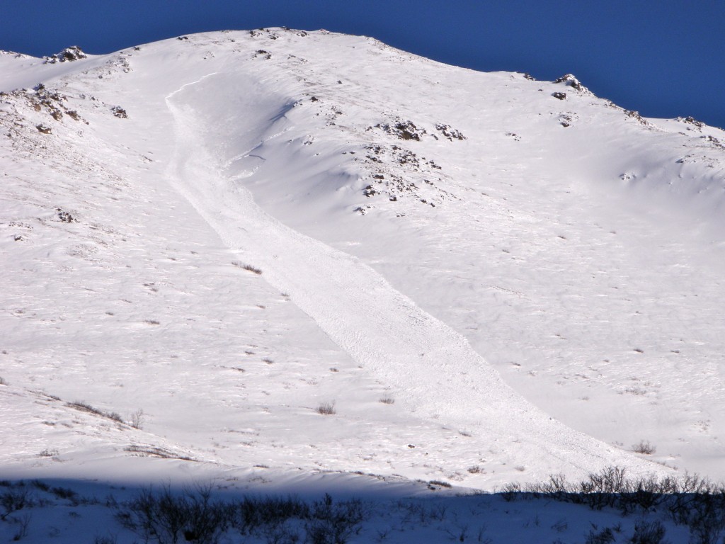
One larger wind slab (SS-N-D2-R3 starting at ~4000′ and running ~1000’…could bury, injure, or kill a person) was observed on a steep, cross-loaded gully sidewall in the Eagle River area Sunday (presumably occurred late Saturday – early Sunday…look closely at photo for smaller sympathetic release below upper avalanche’s skier’s left flank):
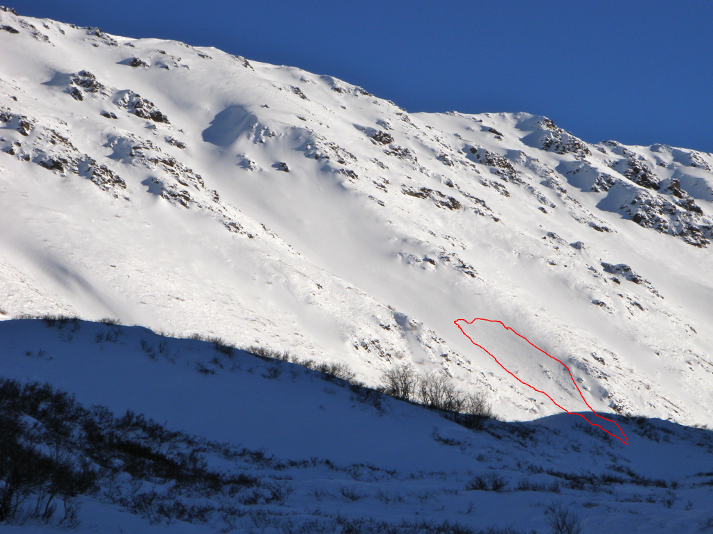
Several other smaller naturally occurring wind slabs (SS-N-D1-R1 starting ~3500-3000′ and running up to 500′ also presumably occurring late Saturday – early Sunday), like the one pictured below, were observed on similar terrain features (cross-loaded gully sidewalls) in the same area Sunday:
This terrain harbored obvious clues (even from a distance) like the fat, bulbous and heavily loaded appearance of these skier’s left gully sidewalls on which all such wind slabs occurred. Other red flags would likely have presented themselves if one had exposed themselves to this terrain – namely, shooting cracks and denser snow on top of softer snow with a hollow, punchy feel.
While such wind-affect with associated hazards wasn’t widespread this weekend, it has become increasingly so since. More widespread wind-affect and wind slab development was observed in the Arctic Valley backcountry Tuesday. Surface/near-surface conditions ranged from relatively unmolested, faceting, soft, recycled powder to wind-affected snow from supportable, to breakable and grabby, to still quite soft and easily carve-able; the riding conditions are now quite variable.
Wind slabs Tuesday, while with the potential to fail up to a foot deep in places, seemed well bonded and relatively stable. However, with more wind, ample loose snow still available for transport, and warm temperatures rising to above freezing even in the upper elevations (to 4000′ in some areas as of 11am Wednesday), wind slabs are expected to become more widespread, increase in size, and destabilize.
Click here to learn more about loose wet avalanches
Click here to learn more about wet slab avalanches
With above freezing alpine temperatures expected to stick around for the short term, wet avalanches (both wet slab and wet loose) have the potential to become an additional concern. Despite warm temperatures in the alpine, cooling from strong winds may keep the problem at bay to some degree. Nevertheless, even without a full-fledged wet avalanche problem (which will remain a possibility), the above freezing temperatures will likely have a destabilizing effect on the snowpack amplified by how high and how long temperatures are above freezing.
Mountain Weather:
Cloudy skies with moderate to strong winds (predominantly E to SE), alpine temperatures in the 30s to low 40s, and possibly light rain are expected.
Forecaster’s note:
With skiing/riding in the Front Range and Eagle River areas having been SO GOOD for at least a week before Wednesday, February 26, please do your part to manifest a quick return to winter and powder-filled days of fun for Anchorage’s backyard mountain playground. Think, pray, dance SNOW!


