Advisory based on observational knowledge and weather forecast available at the time of posting. Accuracy is subject to temporal and spatial variability. Read the disclaimer and conduct your own assessment of conditions accordingly. Accuracy expiration is less than 24 hours.
Monday:
What you need to know:
Two avalanche concerns, discussed in more detail below, are supporting a moderate danger rating that is trending towards low except for the probability of both natural and human triggered wet avalanches. Wind slab avalanches may still be possible in isolated areas and on specific features in steep terrain. While these wind slabs won’t likely be large, take heed on steep and exposed terrain with inherent consequences related to loss of control due to even a very small slide. Wet avalanches will be possible and more likely considering the warm spring temperatures and sun that are in the short term forecast. The wet avalanche problem will be more widespread and with a much higher probability of occurrence than the wind slab problem.
Danger trend:
Decreasing for wind slabs. Steady or increasing for wet avalanches.
Avalanche Concerns:
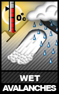
If the short term forecast holds, wet avalanches will be the most widespread and likely occurring avalanche problem. Wet avalanches could be a problem on all aspects but northerlies and especially south to west facing slopes. Be wary of slopes receiving direct sun, especially if mountain temperatures are warm and winds light enough so as to not have much of a cooling effect on moistening and sun-exposed slopes.
Strong winds from the southeast loaded leeward slopes mid-late last week. The channeling effects of terrain have created the possibility of wind slabs on various aspects, but especially west to north. The sensitivity and reactivity of these wind slabs are definitely on the decline, but wind slab avalanches can’t be ruled out. In order to identify terrain where more caution is warranted, be on the lookout for some of the characteristics of wind slabs such as a rounded or “pillowy” look and hollow or “slabby” feel. Also, pay attention to cornices and similar features in the snow to help you identify where snow has been redistributed to and from by the wind. Cracking and collapsing (“whoomphing”) are red flags that you’re in the vicinity of or on a reactive wind slab, but as substantial time has passed since new snow or significant wind red flag indicators will continue to provide less of a warning.
Travel Advice:
We’ve reached that time of the season when planning tours with aspect and time of day in mind is all the more prudent in order to avoid wet avalanches. Be on the lookout for point releases and wet sluffs from rocky and thin areas of the snowpack. Watch for rollerballs, pinwheels, and other signs that the snow has warmed and moistened substantially. Small point releases and wet sluffs will have the potential to pull out bigger wet slab avalanches as they descend.
As mentioned above, wind slabs can’t be ruled out. Pole probe, dig, and investigate further in suspect terrain.
Mountain Weather:
Expect partly cloudy skies, moderate winds from the northwest, and mountain temperatures in the upper 20s to mid 30s.
Avalanche Outlook:
Tuesday, April 2
With even sunnier skies and lighter winds in the forecast, wet avalanches will be the primary concern. Wind slabs will continue to be less of an issue.
Wednesday, April 3
The forecast is calling for another day of sunny skies and light winds meaning wet avalanches will continue to be the primary concern. Wind slabs will continue to be even less of an issue.


