Friday:
The danger rating and information provided below is only intended to be valid for 4/11/14
Click here to view the complete danger scale
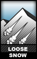
The avalanche danger is generally low, with two important considerations:
Click here to learn more about this type of problem and how to manage it
Numerous natural dry sluffs have occurred on steep terrain since Tuesday’s deposit of a widespread ~6″ of snow above ~3000′ across the Front Range and Eagle River area Chugach.
Dry sluffs will continue to be readily human triggered, primarily on steep northerly terrain. On Thursday in the southern Front Range these human triggered sluffs were of moderate volume – not enough to cause a burial but definitely enough to push a rider around. Keep terrain consequences in mind. Mind the sluff. Click here for tips on “sluff management” from two guys that would really know.
While substantial crusts (sun, radiation recrystallization, melt-freeze) had not yet formed as of Thursday the sun, warmth, and solar radiation had been significant enough to create nominal crusts capable of keeping most dry sluffing on the more solar aspects in check. However, it’s expected that on sufficiently steep slopes still somewhat loose and slightly crusted snow will sluff in a frozen, flaky, “dry” state earlier in the day (very low volume). As these areas receive more sun, the sluffs will transition to wet loose avalanches (much more volume).
Click here to learn more about this type of problem and how to manage it
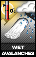
Numerous small, natural wet loose avalanches occurred Wednesday and Thursday after the sun first hit the fresh snow in earnest. Most of this activity initiated in thin and/or rocky areas of the snowpack as “point releases.” Considering forecast cold temperatures (at least overnight) for the short term, wet sluffs should only be a problem later in the day on primarily south and west aspects.
Be mindful of moistening snow becoming wet, heavy, and “gloppy” as well as the aforementioned point releases occurring naturally – all signs of increasing instability in sun exposed areas.
Temperatures are expected to rise through the weekend with increasing cloud cover – weather factors which will contribute to an increasing danger for wet avalanches.
Mountain Weather:
Sunny with light winds and mid to upper elevation temperatures in the mid 30s to mid 20s.


