Saturday & Sunday:
Click here to view the complete danger scale
Avalanche danger is expected to be moderate through the weekend – lower earlier in the day, increasing later due to warming and solar radiation.
Concerns:
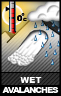
Click the above icon for a general overview of wet avalanches
Click here to learn more about loose wet avalanche problems and how to manage them
Click here to learn more about wet slab avalanche problems and how to manage them
This weekend’s sun and warm temperatures may provide for the first day this spring of significant wet avalanche activity. While the melt-freeze process has been underway for some time now, at least on the more solar aspects, the snowpack has yet to be exposed to as warm and sunny days as are expected this weekend. If this is the case, wet avalanche activity will primarily be human triggered wet loose (sluff) avalanches later in the day predominantly on south and west aspects. However, the snowpack still harbors persistent weak layers deeper within it which may again become reactive and produce larger wet slab avalanches as meltwater percolates through and the snowpack loses strength.
Such wet slab avalanches can be human triggered (likely breaking at or below the trigger), but may occur naturally as well. Be mindful of how wet the snowpack is becoming. As ski penetration increases and the snow becomes increasingly wet and unsupportable, so will the likelihood and danger of wet avalanches increase.
Click here to learn more about this type of problem and how to manage it
Southeasterly winds picked up Friday afternoon, but the loose snow required for building wind slabs on leeward aspects is limited. Small, thin wind slabs may be possible in the uppermost elevations. They are expected to bond relatively quickly.
Click here to learn more about this type of problem and how to manage it
As temperatures warm, and the effect is further magnified by intense sun this weekend, large and looming cornices will become less stable. Cornice falls pose an inherent hazard as well as their ability to trigger subsequent avalanches.
Click here to learn more about this type of problem and how to manage it
This problem, in part, goes hand-in-hand with the wet avalanche problem. As mentioned above, deeper persistent weak layers within the snowpack will lose strength as meltwater percolates through which would weaken existing bonds between snow grains and could produce wet slab avalanches.
Additionally, on drier northerly aspects Thursday some subtle collapsing (groaning whumphs) and cracking was observed in the Hiland Road area. These areas had received up to a few inches of fresh, moist, and relatively heavy snow as well as recent windloading. As slope angles were mellow in the areas where these red flags occurred, there was no avalanche activity. However, such obvious clues to instability shouldn’t be ignored and highlight the fact that vigilance is still required for safe travel and complacency has no place in the backcountry.
Mountain Weather:
Sunny with light winds and temperatures as low as the 20s early in the day possibly reaching into the upper 40s later in the day.


