Midweek Avalanche Outlook (December 17-18, 2013)
Issued Tuesday, December 17, 2013 at 9:00am (information provided below expires in 24 hours):
Anticipated danger for December 17-18:
Click here to view the complete danger scale
Primary concern:
Northerly winds appear to have ramped up across the Front Range and Eagle River area late last night and are currently, and have been for over 12 hours, blowing strong enough in the upper elevations to provide for rapid loading of the easily transportable new snow. Wind slabs well over a foot deep, formed on leeward aspects and in other deposition areas, could be sensitive and reactive Tuesday and Wednesday.
Peripheral concern:
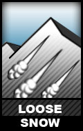
These are expected to be low volume, but long running and under certain circumstances could still prove dangerous.
If you’re out and about in Chugach State Park please submit your observations to the Anchorage Avalanche Center; they’re one of our most valuable resources!
We will update as soon as we’re able to get out and assess conditions further.


