The avalanche danger in Chugach State Park has increased due to new snow (primarily from Thursday) and moderate to strong winds (expected to persist through the weekend).
Avalanche Problems:
Click here to learn more about wind slab avalanches
Touchy to stubborn wind slabs up to D2 in size will be possible in specific areas: above 2500′ on leeward (primarily NW) aspects and cross-loaded terrain (e.g. gully sidewalls) steeper than 35 degrees.
Mountain snow showers through the week, steady and light precipitation that began early Thursday, and the chance for continued mountain snow showers through the weekend has provided ample snow available for transport into dangerous wind slabs by moderate to strong winds that are expected through the weekend.
Wind slab avalanche danger is expected to be steady through the weekend. Be on the lookout for red flags and obvious signs of instability such as recent avalanches, shooting cracks, bulbous areas of wind deposited snow, and hollow feeling snow where a denser wind slab overlies looser and weaker snow. Pole probing, hand pits, ski cuts, cornice drops, and snowpits with stability tests are all effective means of better understanding the wind slab danger.
Fresh wind slabs should be relatively easy to manage, if you’re able to effectively identify areas of concern, but may become more difficult to manage over time as they become more stubborn and less likely but with the potential to release above the trigger (rather than at or beneath it) making escape more difficult. As always, practice safe travel protocols!
Click here to learn more about persistent slab avalanches
Stubborn persistent slabs up to D2.5 in size will be possible in isolated areas: above 2500′ on terrain steeper than 35 degrees where the snowpack is relatively deep and more consistent, especially leeward upper elevation terrain where persistent slabs have been stressed due to recent loading from snow and wind.
Numerous persistent weak layers exist in the Chugach State Park snowpack, primarily crust-facet combos and depth hoar (or advanced facets). In isolated areas these persistent weak layers are overlain by a hard slab and have the potential to be triggered, especially from sweet spots like thinner and weaker areas of the slab or areas that have been stressed due to recent wind loading, which could create a large and inherently dangerous avalanche.
While this avalanche problem is relatively unlikely it is, true to its name, expected to persist and remain steady through the weekend. The persistent slab problem is relatively difficult to predict, but obvious clues will include recent avalanches, collapsing or whumphing of the snowpack, and areas with hollow feeling snow where a denser hard slab overlies looser and weaker snow. Snowpits with stability tests (like an ECT) and layer analysis will help you identify areas of concern; a more in-depth stability assessment is required to get a better handle on the persistent slab danger.
Be vigilant with your assessment and safe travel protocols, as persistent slab avalanches are relatively difficult to manage. Associated hard slabs are likely to release above the trigger and propagate widely, making escape difficult.
Click here to learn more about loose wet avalanches
Click here to learn more about wet slab avalanches
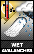
Wet avalanches will be possible, and likely if the sun comes out, on solar aspects above 2500′ where the terrain is steeper than 35 degrees. Point releases and loose wet avalanches (sluffs) may occur naturally, especially from steep, rocky, and/or thin areas of the snowpack. Additionally, wet slabs are possibly with continued warm temperatures as meltwater percolates through the snowpack and lubricates weak layers or weak interfaces underlying slabs.
Warm and moist southerly flow is expected through the weekend, with warm temperatures expected to continue indefinitely (it’s mid-April, after all). Thus, the wet avalanche danger will be a problem through the remainder of the season.
Assessment of wet avalanche danger is different than for dry snow avalanches. Loose wet avalanches are more easily predicted and managed than wet slabs. Watch for the snow becoming increasingly wet, gloppy, and unsupportable. Once ski penetration, of what was formerly a hard crust, becomes more than a few inches deep the danger for wet avalanches increases dramatically. Fresh snow that receives initial warmth and sun will also be very susceptible to avalanching. Follow the links above to learn more about wet avalanches.
Click here to learn more about cornice falls
Cornices are likely reaching their peak size for the season. They’re extra sensitive this time of year due to being at peak size and from warm temperatures and solar radiation. It will be especially important to give them a wide berth this weekend due to recent snow and wind that has likely increased their size and susceptibility to failing both naturally and from human triggers.


