Weekend Avalanche Outlook
Avalanche danger will increase due to daytime warming and sun exposure. Expect low danger and generally safe conditions in the morning. Dangerous conditions may develop by afternoon, with natural and human triggered avalanches likely, relative to warming and sun exposure. Keep in mind that even if you’re on flat, dry ground; you still may be exposed to large avalanches from snowy slopes above.
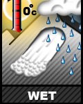
 Wet avalanches are likely to be both naturally and human triggered during the later afternoon hours this weekend, primarily in the form of wet loose avalanches (aka sluffs, point releases) on steep (35*+) south to west aspects. Wet slabs are lower probability, but higher consequence. Clues to danger will include gloppy, wet, and heavy snow; less supportable snowpack; and naturally occurring small, wet loose avalanches.
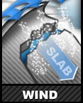
 Small (D1) wind slabs sensitive to human triggers may exist on steep (35*+) terrain in isolated upper elevation areas (3500’+), primarily along leeward ridgelines and cross-loaded features (west to north aspects). Keep terrain traps and exposure in mind.
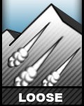
 Small (D1) loose snow avalanches are possible on steep (35*+), upper elevation northerly aspects. Practice good sluff management.
![]() Cornice falls are possible. If you’re in an area with larger cornices, give them a wide berth. Don’t approach the edge of snowy and potentially corniced ridgelines. While a cornice fall is inherently dangerous, it could also trigger a subsequent avalanche.
Cornice falls are possible. If you’re in an area with larger cornices, give them a wide berth. Don’t approach the edge of snowy and potentially corniced ridgelines. While a cornice fall is inherently dangerous, it could also trigger a subsequent avalanche.
