Weekend Avalanche Outlook
click here for the complete danger scale
Avalanche problems:
 Fresh, small D1-D2 wind slabs are possible on steep (35*+) leeward (primarily W to N aspects) upper elevation (3000’+) terrain. Persistent strong winds have affected the Chugach State Park snowpack recently, but there has been limited snow available for transport. Expect wind slabs to be most problematic along leeward ridge lines and cross-loaded features. Suspect snow will likely be relatively fat, bulbous, or pillowy in appearance.
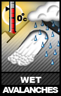
 D1-D2 wet loose and wet slab avalanche problems could develop by late afternoon this weekend, especially on solar aspects. Watch for the snow becoming heavy, gloppy, and less supportable: signs of increasing danger. Wet avalanche problems will likely first manifest as point releases from steep (35*+) terrain that’s thin and/or rocky. While temperatures should now be cooling enough at night to initiate a melt-freeze (corn) cycle, the snowpack recently experienced consecutive days of above freezing temperatures and became isothermal (very wet and unsupportable) in many areas.
 D2-D3 persistent slabs are again a low probability, but high consequence, problem. Expect them to be most problematic on steep (35*+) upper elevation (3000’+) terrain, especially near likely trigger points like steep rollovers or steep rocky and/or thin areas where persistent weak layers might be more exposed to human triggering. Persistent slabs may be more likely to fail in areas where they’re stressed from solar radiation and warming temperatures.
![]() Cornices in the upper elevations have likely grown to near peak size from recent snow and wind. They’ve also been stressed by recent warm temperatures, and may become stressed to the point of failure from daytime warming in some areas this weekend. Give cornices a wide berth; don’t approach the snowy edge of a ridge unless you know it’s supported. Cornice falls are inherently dangerous, but can also trigger subsequent avalanches.
Cornices in the upper elevations have likely grown to near peak size from recent snow and wind. They’ve also been stressed by recent warm temperatures, and may become stressed to the point of failure from daytime warming in some areas this weekend. Give cornices a wide berth; don’t approach the snowy edge of a ridge unless you know it’s supported. Cornice falls are inherently dangerous, but can also trigger subsequent avalanches.

