Weekend Avalanche Outlook
click here for the complete danger scale
Warm, wet, and windy conditions are expected in Chugach State Park this weekend. Avalanche danger is increasing, and unpleasant weather will make mountain travel more difficult and hazardous.
It’s also that time of year when you need to be especially cautious of overhead avalanche danger; even if you’re on flat, dry ground there may be large avalanche paths above you. Warm temperatures, new snow and/or rain, and strong winds this weekend have the potential to naturally trigger large avalanches in the upper elevations that descend into snow-free and relatively flat lower elevation terrain.
Avalanche Problems:
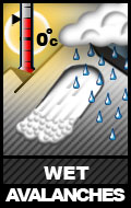
 Natural and human triggered wet loose and wet slab avalanches up to D3 in size are possible on steep (35*+) solar aspects (primarily south to west) at all elevations later in the day due to daytime warming, and will be likely if the sun comes out. Watch for the snow becoming wet, heavy, gloppy, and less supportable. Watch for point releases and natural sluffs from steep solar terrain, especially initiating from rocky areas. These are signs of increasing danger.
Cloud cover this weekend is expected to trap heat from daytime warming and prevent as much of a stabilizing overnight re-freeze. While the sun isn’t expected to be out in force, the lack of a solid melt-freeze cycle is expected to contribute to the wet avalanche danger. Loading from new snow and wind may also stress upper elevation persistent slabs that fail near the ground and bring down a lot of wet debris with them.
 Persistent slabs up to D3 in size are possible in isolated areas on steep (35*+), leeward (primarily north to west aspects) or solar (primarily south to west aspects) upper elevation (3500’+) terrain. Loading from new snow and wind this weekend may stress persistent slabs on leeward terrain. Warmth from daytime warming, especially is the sun comes out, may stress persistent slabs on solar aspects. These are lower probability, but very high consequence avalanches. Be especially cautious around terrain that might have multiple contributing factors: wind loaded, warm and moist-wet snow, steep, convex, etc.
 Wind slabs up to D2 in size are possible in isolated areas on steep (35*+), leeward (primarily north to west aspects) upper elevation (3500’+) terrain. These are generally expected to be small, but keep exposure and terrain traps in mind. Watch for areas of firmer, denser snow. Watch for steep terrain with bulbous and/or pillowy looking deposits of wind loaded snow.
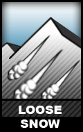
D1 low volume, medium paced sluffing is to be expected on steep (35*+), sheltered northerly terrain. Practice good sluff management techniques. Keep exposure and terrain traps in mind.
Cornices aren’t expected to be especially problematic this weekend, but do practice general caution: don’t approach leeward edges of ridge lines and give corniced areas a wide berth. Be especially cautious this weekend due to potential new snow and wind. Be even more cautious if it really warms up, and/or cornices are exposed to solar radiation.


