Weekend Avalanche Outlook
Heightened avalanche conditions in Chugach State Park this weekend: evaluate snow and terrain carefully; identify features of concern.
Avalanche concerns:
 Winds slabs up to D2 in size are possible above 2500′ on terrain steeper than 35 degrees. Steep, leeward (primarily west to north) terrain especially along ridges and cross-loaded gully sidewalls is expected to be the most problematic. Clues to identify include areas of deeper snow especially if bulbous in appearance, snow surface texure (etched, or sastrugi), denser/firmer snow that has been wind-packed (especially if hollow sounding-feeling), and cracks radiating from your feet. Pole probing and quick handpits will be an effective way to get a handle on the wind slab problem. Moderate to strong winds and a steady trickle of new snow recently has lead to wind slab development.
 Persistent slabs up to D3 in size are possible (low probability, high consequence) above 3000′ on terrain steeper than 35 degrees. Steep, leeward (primarily west to north) terrain in the upper elevations is expected to be the most problematic. Be especially wary of large slopes with a deeper and more continuous snowpack; in thinner areas of a large slab the weight of a person may more easily penetrate down to persistent weak layers (facets, depth hoar, surface hoar all identified in the Chugach State Park snowpack recently) initiating a fracture that is still showing some propagation propensity. Digging a full-on snowpit, examining the stratigraphy, and conducting Extended Column Tests (ECT) and Compression Tests (CT) are good means of better understanding the relatively elusive persistent slab problem this weekend. Please share with us what you find!
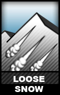
 Loose dry avalanches, or “sluffs”, are likely on relatively sheltered leeward terrain steeper than 35 degrees. On Friday, low volume and relatively slow moving sluff was observed above 3500′ on sheltered leeward terrain steeper than 35 degrees where there was up to 8″ new snow.
The avalanche danger is expected to remain steady, or increase, through the weekend with the possibility for more snow showers and winds capable of further wind slab development.
