Weekend Avalanche Outlook
 click here for the complete danger scale
Avalanche concerns:
 Moderate to strong winds (primarily from the SE) have affected some parts of Chugach State Park recently. Isolated wind slabs up to D2 in size are possible on steep (>35*), leeward (primarily W to N aspects), upper elevation (3000’+) terrain. Watch for wind slabs along the lee side ridges, cross-loaded features, and near peaks. Look for fatter pockets of snow that might be denser or hollow feeling. Use hand pits and pole probing as a quick means of assessing for wind slabs (denser, firmer snow overlying looser, weaker snow).
 Persistent weak layers are widespread throughout the Chugach State Park snowpack, and distribution varies greatly from area to area and slope to slope. Persistent weak layers seem to be relatively dormant and are a low probability problem, but a high consequence one. Isolated persistent slabs up to D3 in size are an unlikely, but still possible, problem – primarily on steep (>35*), upper elevation (3000’+) terrain where’s there’s enough snowpack for a large slab, but trigger points like protruding rocks or steep rollovers.
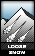
 Small (D1) dry loose avalanches will be possible on steep (>35*), sheltered, leeward (primarily northerly since it’s also sheltered from sun), upper elevation (3000’+) terrain. These “sluffs” will be low volume and are not expected to be particularly fast moving. Watch your exposure and keep the consequences of a loss of control in mind!
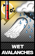
 D1-D2 loose wet avalanches are possible in the afternoon on steep (>35*) solar aspects. Watch for snow that is becoming wet, gloppy, and unsupportable. Watch for small “point releases” coming from steep, rocky terrain. Keep exposure in mind and be aware that while a wet loose avalanche may start small and be slow moving, it can pick up a lot of volume as it descends.
Cornices![]() are a possible problem overhanging leeward (primarily west to north aspects) in isolated areas of Chugach State Park, primarily terrain deeper in the park and closer to Turnagain Arm, where’s there’s been more snowfall this season. Give cornices a wide berth; they have the potential to fail and break off much further back than might be expected. Not only are cornice falls inherently dangerous, but they may trigger a subsequent avalanche.
are a possible problem overhanging leeward (primarily west to north aspects) in isolated areas of Chugach State Park, primarily terrain deeper in the park and closer to Turnagain Arm, where’s there’s been more snowfall this season. Give cornices a wide berth; they have the potential to fail and break off much further back than might be expected. Not only are cornice falls inherently dangerous, but they may trigger a subsequent avalanche.
The avalanche danger is expected to decrease through the weekend.
