Weekend Avalanche Outlook
 Click here for the complete danger scale
 Persistent slabs up to D3 in size are possible on steep (35*+) terrain above ~2500′ (low probability, but high consequence). Expected to be most problematic on leeward, upper elevation terrain features near peaks and ridge lines. Watch for possible trigger points: areas where the snowpack is thinner and/or weaker and steep rollovers. Keep terrain traps and exposure in mind. Digging a snowpit, looking at layers, and doing an ECT is a means of assessing suspect terrain…but don’t dig dangerously.
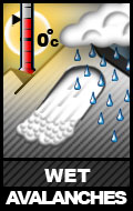
 Wet avalanches up to D2 in size are possible below ~4000′ on steep (35*+) solar aspects.. These are likely to be smaller, and in the form of point releases and sluffs from steep rocky terrain on south to west aspects. Watch for the snow becoming wet, heavy, and gloppy later in the day. If you’re seeing rollerballs and the snow is becoming unsupportable, the danger is increasing.
 Wind slabs up to D2 in size are possible above 2500′ on steep (35*+terrain). These are expected to be smaller, and problematic in isolated upper elevation areas: leeward terrain near peaks, ridge lines, and cross-loaded features. Watch for possible trigger points, like a steep rollover on a fat pocket of snow.
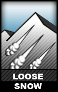
 Small, D1 sluffs are possible on steep (35*+) terrain above 3000′ from recent light snowfall. These are expected to be small and not particularly fast moving. Keep terrain traps and exposure in mind.
![]() Cornices may be weak and susceptible to fail from recent warm temperatures and bit of recent loading. While small in most areas, be mindful of cornice exposure from above and be cautious approaching corniced ridges. Where large cornices have been observed, they appeared on the brink of failure. A large cornice fall could cause a subsequent avalanche.
Cornices may be weak and susceptible to fail from recent warm temperatures and bit of recent loading. While small in most areas, be mindful of cornice exposure from above and be cautious approaching corniced ridges. Where large cornices have been observed, they appeared on the brink of failure. A large cornice fall could cause a subsequent avalanche.
Expect cloudy weather and light winds with a chance of alpine snow showers, becoming sunnier Sunday.
The avalanche danger is expected to increase next week with unusually warm and wet weather.
