Issued 1/26/14 @ 7:15am (expires in 24hrs)
Click here to see the complete danger scale
The avalanche danger is expected to be at considerable today, due to above freezing temperatures up to ~4000′ in areas with a lack of overnight freeze. Because of the anomalous nature of such weather conditions for January, this still isn’t expected to contribute to a wet avalanche specific problem. It is more of a concern for exacerbating existing problems such as the persistent slab issue, but wet avalanches can’t be ruled out considering such temperatures. Approach the backcountry with caution today. As was the case Saturday, considering the strange weather, it’s hard to know until you go.
Concerns:
Click here to learn more about this type of problem and how to manage it
Persistent slab problems still linger above ~3000. Weather factors can reactivate, or increase the sensitivity, of such problems. In this case, rain and above freezing temperatures having reached up to at least ~3500′ recently have stressed the problem and changed its nature, to some degree. Persistent weak layers, such as large and loose facets at the ground or surrounding old buried melt freeze crusts (initially much like what are our surface snow is now), still exist within the snowpack and may be more susceptible to human triggering due to anomalously warm, windy, and wet January weather.
Persistent slab avalanches could propagate widely, fail deep within the snowpack, and create large and dangerous avalanches. Pay close attention to the snow you’re traveling on for clues, and this problem requires relatively more in depth assessment to understand than more recently formed instabilities closer to the surface. Learn more about this type of problem by following the link above.
Click here to learn more about this type of problem and how to manage it
The rain we experienced in town Friday night into Saturday morning fell as snow above ~3500′. Moderate to strong winds (predominantly SE) in the upper elevations (above ~4000′) Saturday were able to redistribute this snow, as evidenced by pluming along higher peaks and ridges in the Front Range and Eagle River area Saturday.
Wind slabs, sensitive to human triggers, are possible in upper elevation terrain – especially in leeward deposition areas along ridgelines and near peaks. Pay close attention to the snow you’re traveling on for clues. Learn more about this type of problem by following the link above.
Click the following links to learn more about the two types of wet avalanche problems and how to manage them: wet slab avalanche, loose wet avalanche
Wet avalanches aren’t expected but still remain a possibility for Sunday considering forecast temperatures. The problem was kept in check Saturday by lack of solar radiation (it’s only January despite the late April temps), wind cooling at mid to upper elevations, and cooler air sinking to lower elevation slopes (there seems to have been a modest inversion in some areas Saturday).
Click here to learn more about this type of problem and how to manage it
Relentless winds (primarily from the southeast) for over a week have built cornices into large, hard, and looming masses. Warm temperatures and more wind has the potential to weaken and further stress these masses – making them more likely to fail. A cornice can pose a hazard in and of itself; it also has the potential to create an avalanche as it fall on and “bombs” a slope below.
Mountain Weather:
Partly sunny skies with moderate to strong E to SE winds. There seems to be an atypical temperature profile (not really an inversion) with the highest temperatures at the mid elevations (~2000-3000′) where they may reach into the lower 50s, upper elevation (above ~3000′) temps possibly reaching the lower 40s, and lower elevation (below ~2000′) temps in the lower to mid 40s.
Climate change carnage!?
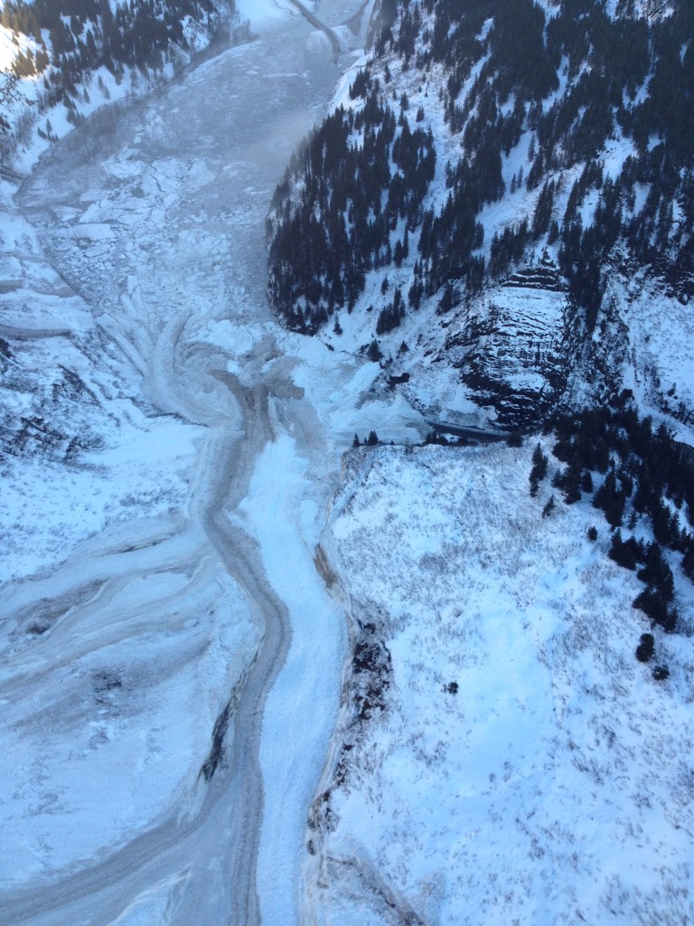
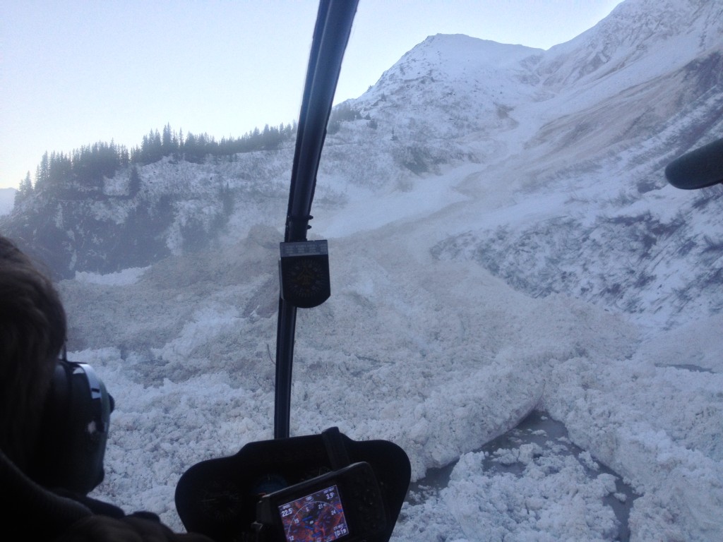
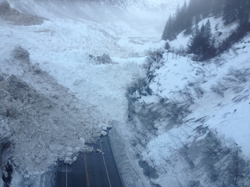
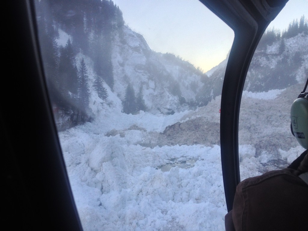
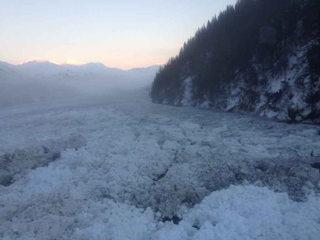
Renowned AK Avalanche Specialist Pete Carter shared these photos from his avalanche control work for the DOT in the Valdez-Thompson Pass area Saturday.
The report from the Keystone Canyon area is that the debris over the road is 70-100′ deep, burying 500-800′ of road. The lake is over a mile long and quarter mile across with a depth of 40′ and rising.
View from above of avalanche debris dam and lake (see the Richardson Hwy becoming submerged top center): 