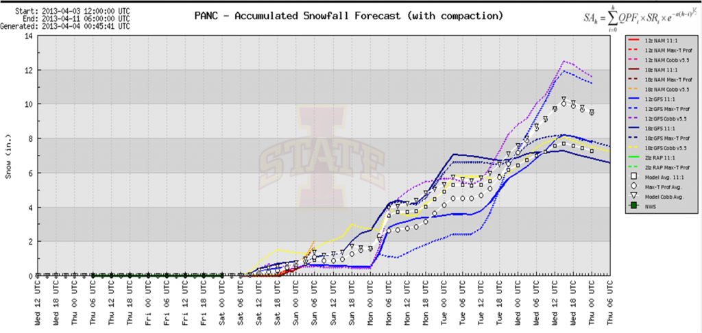
Professional observation from Kyle Van Peursem:
Wanted to shift everyone’s attention to what looks to be a major change in the weather pattern beginning this weekend. A low dropping out of NW Canada and into the Western Gulf of Alaska will set up Southwesterly flow over the local area as well as bringing in much colder temperatures. Right now, the long range models are hinting at a pretty decent snow event beginning late Sunday through Tuesday night, with total accumulations in the Anchorage bowl between 7-12 inches. I don’t have much confidence in the snow totals at this point as they can be over done this far out. But, nevertheless, it does seem certain that we will be seeing a pretty decent snow event early next week.
One thing to remember is that snowpacks don’t like rapid, intense change; so we can be confident that there will be an increase in avalanche activity with this storm. With the recent clear, cold weather we’ve been experiencing, I was not surprised that I noticed lots of 3-4mm surface hoar growing on most aspects, especially NW-NE, yesterday up on Peak 3. It will be important to monitor the persistence of the SH and see if it stays intact before being buried this weekend. This could be a major player in our avalanche danger next week.

