Observations
Turnagain Arm: West Penguin
Obvious signs of instability (red flags):
- None immediately observed (although pluming snow and active wind loading observed in the area earlier in the day from town)
Weather:
- Sunny, clear skies
- Alpine temps barely above 0*F
- Light northerly wind
Surface conditions:
- A few inches of soft, settled powder below treeline and in sheltered upper elevation areas
- A couple inches of wind-buffed powder (relatively soft and carve-able) in most upper elevation areas
Snowpack:
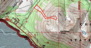
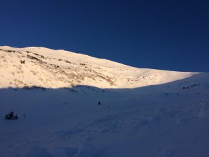
This avalanche path (in red) is what basically makes the entirety of the first 2000 vertical feet of the Penguin Ridge summer trail a terrain trap (note the white, non-forested areas below 1000′ on the map indicating the historicity of this and other paths). During most snow seasons this path runs all the way to the summer ATV trail in the Penguin Creek valley with a very impressive debris pile. Currently the debris only extends down to about 1000′ (as shown further below):
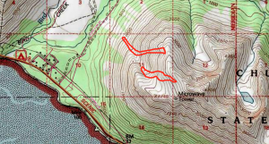
The map below shows the extent of debris from semi-recent natural avalanches in the Penguin West bowl. The upper elevation avalanche is very anomalous, at least in regard to the extent of propagation. Small (D1-D2), discontinuous avalanches have been observed in the area of the upper avalanche in seasons past but never as a contiguous path sending debris almost connecting to the lower elevation path that runs more predictably:
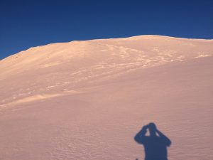
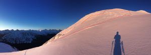
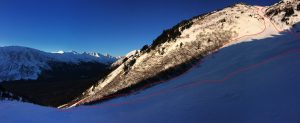
This is the upper elevation path (D2.5-3), with the second photo showing how propagation wrapped around from the upper west bowl in to the lower west bowl:
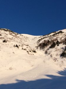
The upper elevation path’s debris in the lower bowl:
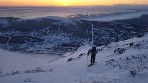
The is the lower, more typical avalanche path on West Penguin that can send debris all the way down to the motorized trail on the Penguin Creek valley flats:
Front Range: Bear Valley – McHugh Peak area
Route:
Toured west aspect slopes up to 3100′ on McHugh Peak north ridgeline and summer trail.
Red Flags/Signs of Instability:
Ridge top pluming observed in morning due to northerly winds. Fresh, soft and touchy windslabs encountered on leeward aspects. Shooting cracks observed in these wind slabs on test slopes and able to easily trigger D-0.5 windslabs on these small test slopes on southerly aspects.
Weather:
Clear skies. Temps in mid teens. N wind estimated at 20+mph (based on arctic valley weather station) and large wind pluming noted along ridgelines in morning. By 5 pm, wind was calm to light out of the north.
Snowpack:
Variable conditions along W aspect uptrack. Below alderline, 6″ of soft, wind deposited snow sat on a supportable melt freeze crust with basal facets and depth hoar sitting below. Isolated pockets of fresh windslabs on leeward aspects from morning winds were present. HS along up track and below 2300′ (alder line) varied from 1′-3 deep with basal facets comprising roughly 40% of snow pack. Above 2300′, most west aspects were wind scoured down the stout crust/ground with intermittent pockets of wind deposited snow.
Tests:
Pole probes consistently showed upside down snowpack with denser wind deposited snow and crusts sitting on basal facets. Hand pits varied from unreactive to failure upon isolation on slab/basal facet interface. Wind loaded test slopes proved touchy, with both shooting cracks and small slides when stomped on (see photo). No formal pits were dug.
Wind scoured conditions above alder line on west aspects:
Small, D-0.5 wind slab triggered upon stomping on southerly aspect test slope:
Front Range: Hidden Lake – Hidden Peak area
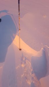
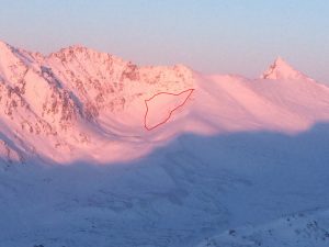
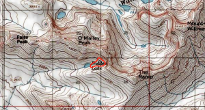
Sizable D2+ natural or human (likely snowmachine if human) triggered avalanche in the Hidden Lake-Hidden Peak area.

