
Issued 1/4/14 at 10:00pm (information provided below expires in 24hrs):
Sunday & Monday:
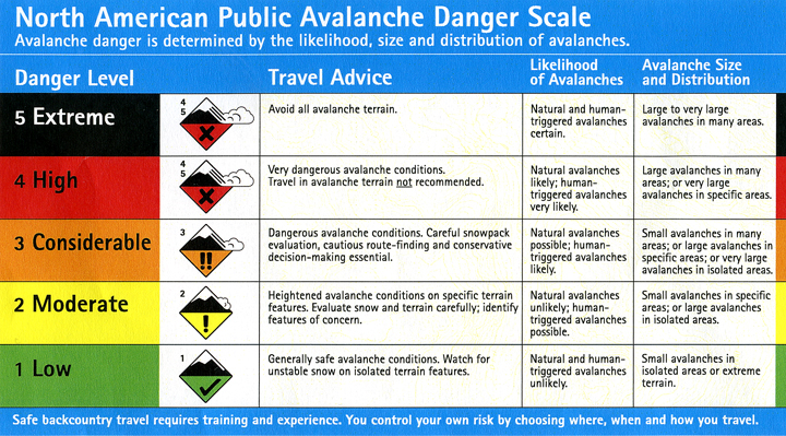
Click here to see the complete danger scale
The lowdown:
Sunday’s avalanche danger is expected to be at the more dangerous end of moderate for fresh wind slabs and loading of existing slabs (wind slabs formed Friday and Saturday and persistent slabs buried deeper within the snowpack). Additional loading from wind will push these slabs closer to the brink of failure, causing them to be more susceptible to human triggering.
With decreasing winds and not much loose snow available for transport by Monday, avalanche danger is expected to decrease but remain moderate.
Primary Concerns:
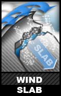
Click here to learn more about wind slabs and management of this type of danger
Expect the wind slab problem to be the most pronounced and suspect on West to North aspects and cross-loaded terrain.
There was more loose snow available for building fresh wind slabs in the southern Front Range than Eagle River area before winds picked up Friday. Winds also seem like they may have been stronger in the Eagle River area than southern Front Range Friday and Saturday. Freshly formed wind slabs were already reactive by Friday evening in the Eagle River area, but were thin and patchy. Despite increasing wind speeds expected through Sunday, there isn’t much loose snow available for further development of these wind slabs in the Eagle River area.
The southern Front Range may be a different story. There is more fresh, loose snow and winds don’t seem to have redistributed and packed in existing loose snow Friday and Saturday like they did in the Eagle River area. With increasing wind speeds through Sunday and more snow available for transport, expect the fresh wind slab problem to be most pronounced in the southern Front Range Sunday and Monday.
Snowpit stability test results from Thursday and Friday showed repeated failures between previously formed layers of wind slab of different hardnesses. While instabilities between such layers are expected to bond relatively rapidly, becoming less of a problem, there is potential for additional loading to make failure between such layers a possibility.

Click here to learn more about persistent slabs and management of this type of danger
Persistent slab problems; primarily consisting of melt-freeze crusts (bed surface), faceting grains on top of the melt-freeze crusts (weak interface/layer – part of slabs decomposing above the crust or already completely decomposed and distinctly separate faceted layers), and wind-packed hard slabs above; are widespread throughout the Front Range and Eagle River area Chugach.
Snowpit stability tests from Thursday and Friday showed continued failure potential of such persistent instabilities. Tests from Thursday off Peak 2 showed continued propagation potential; while hard to initiate these failures still had pop and energy.
Persistent slabs are relatively elusive and will be more difficult to detect and assess than younger wind slabs which will fail closer to the surface. If existing persistent slabs receive additional stress from wind loading, they will be more susceptible to human triggering.
———-
Be on the lookout for red flags of instabilities: wind loading, recent avalanches, whumphing (collapsing), shooting cracks, hollow sounding snow (denser snow on top of less consolidated snow), and specifically for the wind slab problem: snow that looks fat, pillowy, or loaded.
As always, if you are in avalanche terrain assess the snowpack and consequences for yourself. Click here for a list of local educational opportunities through which you can learn how.
Here’s a couple online tutorials:
Online Avalanche Course provided by the Canadian Avalanche Centre
Avalanche Awareness provided by the Forest Service National Avalanche Center
Mountain weather:
Sunday: Cloudy with isolated snow showers, strong southeast winds, and temperatures in the 20s.
Monday: Cloudy with scattered snow showers, light-moderate southeast winds, and temperatures in the 20s.